Storm Highway by Dan Robinson
Storm chasing, photography and the open roadClick for an important message
Storm Highway by Dan RobinsonClick for an important message
Home | Blog Index | Blog Archives | Christianity & Faith Essays | Storm Chasing Essays

                   Thursday, June 6, 2019

Mississippi River flood of 2019 photos: Alton, Illinois

By DAN ROBINSON
Editor/Photographer
Important Message 30 Years of Storm Chasing & Photography Dan's YouTube Video Channel Dan's Twitter feed Dan's RSS/XML feed

From Dan: How the crime of copyright infringement took $1 million from me and shut down my operation.

In September of 2025, my work is generating the most income it ever has in my career. Yet, I'm being forced to shut down my successul operation, against my will, due to one cause alone: 95% of that revenue is being stolen by piracy and copyright infringement. I've lost more than $1 million to copyright infringement in the last 15 years, and it's finally brought an end to my professional storm chasing operation. Do not be misled by the lies of infringers, anti-copyright activists and organized piracy cartels. This page is a detailed, evidenced account of my battle I had to undertake to just barely stay in business, and eventually could not overcome. It's a problem faced by all of my colleagues and most other creators in the field.

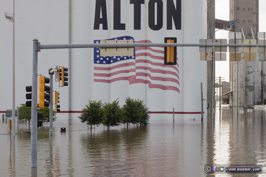
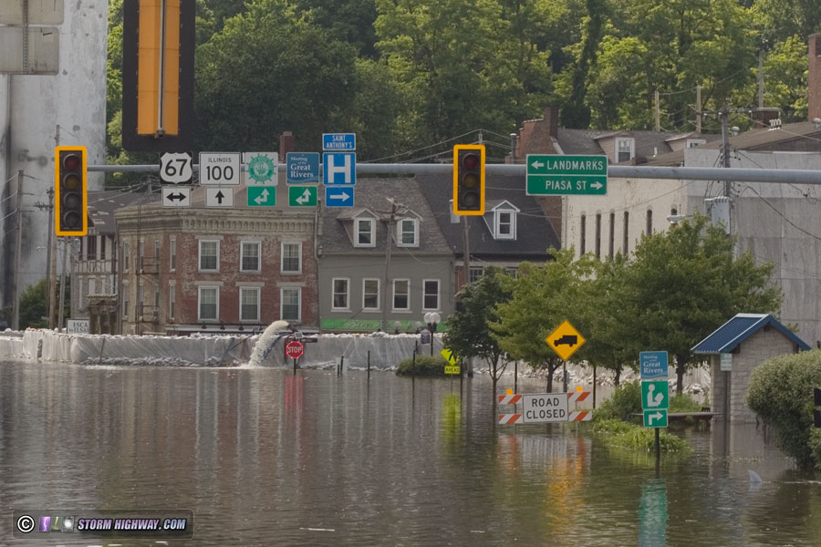
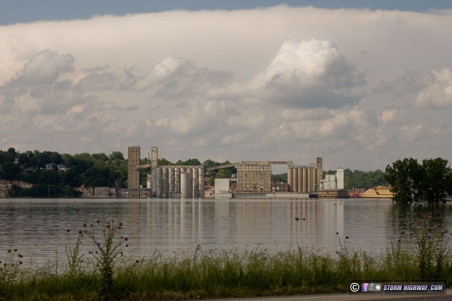
The Mississippi River crested this week at Alton, Illinois, just below the record set in 1993.

The line of red paint on the downtown grain elevator marks the 1993 high water line, showing how close the 2019 flood came to matching that record.

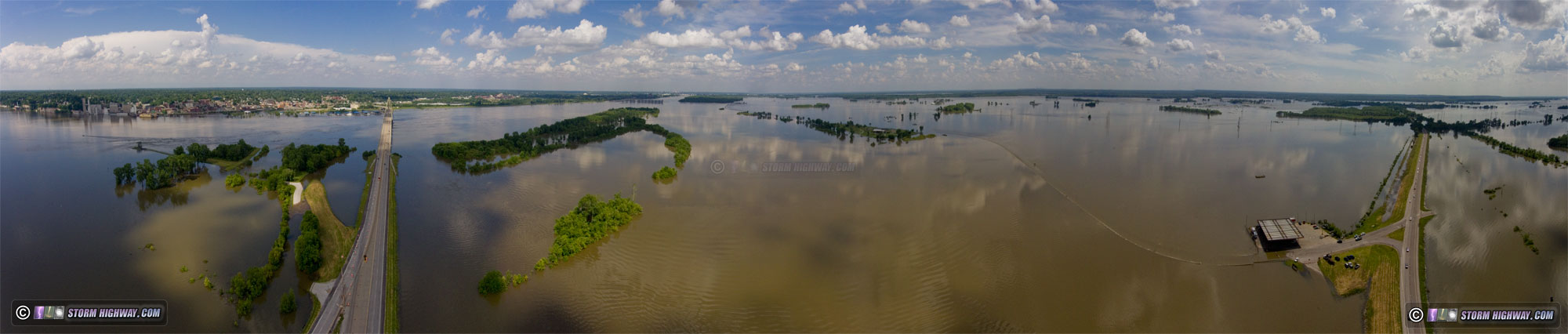
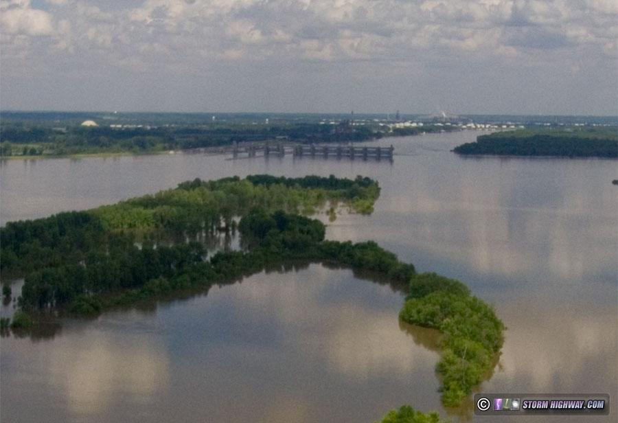
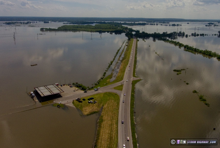
This drone panorama gives a birds-eye view of the downtown Alton area during the river crest:

Alton, IL flood 2019

A temporary floodwall protects downtown shops and buildings, with water seepage continually being pumped back into the river:

Viewed from across the river, the water's encroachment into the town is dramatic:

This drone panorama from the Missouri side provides a sense of scale:

Alton, IL flood 2019

The Audubon Center at Riverlands barely stays dry atop a small island of high ground:

The water has reached the top of the guide walls at the Melvin Price Locks and Dam:

The southbound lanes of Highway 67 lie underwater, with the Phillips 66 gas station only feet from being part of the flood:

30 Years of Storm Chasing & Photography
Important Message
Dan's YouTube Video Channel
Dan's Twitter feed
Dan's RSS/XML feed

GO: Home | Storm Chase Logs | Photography | Extreme Weather Library | Stock Footage | Blog

Featured Weather Library Article:

Ipods & lightning
Will wearing headphones attract lightning to you?
More Library Articles

All content © Dan Robinson. All usage requires a paid license - please contact Dan for inquiries.

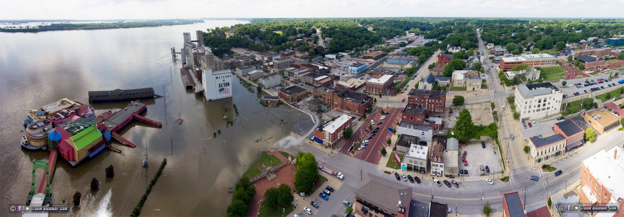
Web Site Design and Internet Marketing by CIS Internet