| Home | Blog Index | Blog Archives | Christianity & Faith Essays | Storm Chasing Essays
Clearing line at sunset, weather update
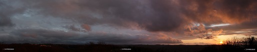
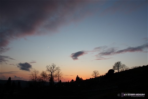
I've said before that one of my favorite non-storm weather phenomena is a sharp 'clearing line', which is an abrupt end to extensive, thick cloud decks at all layers of the atmosphere. They are especially refreshing after days of overcast and rain, and even better at sunset. Charleston was blessed with just that this evening.
Here is a panorama showing the transition from cloudy and overcast to clear skies in the west. The view is looking south from the cemetery ridge behind the house:
click to enlarge

click to enlarge
click to enlarge
Forecast update
Lots of stuff going on to talk about weather-wise. I don't have as much time for my daily blog post today, so I won't post illustrative model imagery this time (if you're interested, you can access the GFS, NAM and WRF models on my data page).
Plains/Front Range/Midwest snowstorm: I am thankful that we're going to miss out on what is shaping up to be the biggest continental US snowstorm this entire winter season. Models have been in remarkable agreement in Colorado, Kansas, Oklahoma and the Texas panhandle seeing up to 30 inches of snow in places through Saturday. The Denver area has already seen upwards of a foot of snow already today. This storm is forecast to turn sharply to the north and dump around a foot of snow in a swath from Kansas City, through Northern Missouri, eastern Iowa and northern Illinois.
As for us, the models seem to have settled on a solution of West Virginia flirting with the freezing mark on Monday morning (as I've expected for some time now), however no upslope precip is shown falling except at the highest elevations. After that, things begin a gradual warmup into what I think will be a largely permanent goodbye to winter weather for the state (aside from a few morning frosts). Don't hold me to that, though!
Saturday severe weather: We have gone remarkably thunderstorm-free this March here in West Virginia, but that will change on Saturday as the strong trough to our west (responsible for the big snows out there) will swing through. There is some potential for tornadoes in Kentucky on Saturday afternoon/evening, however most likely we'll see a more typical strong wind event across the KY/OH/WV/TN region. At any rate, this looks like a good storm chase day nonetheless that I'll probably be out for. SPC may go Moderate Risk for Kentucky and Tennessee in later updates.
Building 82 update
I have not been able to get in touch with the demolition crew to finalize needed clearances for Saturday's implosion, so I'm not sure what to say about what is happening there. I am swamped with other high-priority projects at the moment and don't have much time to pursue this. All I can say is stay tuned, as soon as I hear from the people who are in control of the site (if at all) I'll know if this is going to actually happen as planned. Rain is also a good bet for Saturday morning, which may or may not be a game-changer.
Nice job man! Couldn't agree more about sharp clearing lines as that is what drew me out the other day. Hope the weekend pans out for you. Also praying you get the demo assignment! There's NO ONE better than you and to quote a little gangsta... homies need ta recognize!
- Posted by Paul | |
|


