|
Home | Blog Index | Blog Archives | Christianity & Faith Essays | Storm Chasing Essays
Storm chasing forecast update 11, for May 12
Peak tornado season is upon us, and accordingly an active period of severe weather in the Plains and Midwest looks to be on our doorstep. In the next week, western US troughing will bring general southwesterly flow aloft over the central part of the country. For the Wednesday-Friday period, not much has changed since my last post: A potential event in the Plains on Wednesday still appears to be capped (no storms forming in the best areas of instability/shear), then two potent-looking events in the Midwest look likely on Thursday and Friday. So at least for those three days, a Plains trip seems unlikely as the action area will be solely here in the Midwest.
For Saturday and beyond, a complex and difficult-to-forecast pattern is shown. This is because both the northern stream and southern stream jets are shown either partially or fully merging together right over the Plains and Midwest this weekend, with numerous embedded jet maxes and shortwaves each bringing severe storm potential to the entire central USA. The basic ingredients for supercells and tornadoes will almost certainly be present in abundance between Saturday and next Wednesday, meaning that potentially big events are possible across a vast area from the Rockies to the Appalachians. The whens and wheres will depend mostly on those smaller features of the upper jet, and as such, they will be very difficult to forecast much more than a day or so in advance.
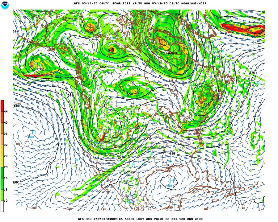
GFS 500mb forecast for Sunday evening, May 18
What we do know is that the Plains dryline will be an active player during that period, with some classic-looking setups shown mostly south of the Kansas-Oklahoma border. But also shown is for many of those days to simultaneously have open warm sector and/or warm front components in the Midwest. Generally speaking, the dryline in the Great Plains is where you want to be as a chaser in nearly every circumstance this time of year. Dryline supercells and tornadoes are always more reliable in producing photogenic tornadoes and storm structure. But as I've said many times, if a tornado risk exists here at home in the Midwest at the same time, I lean heavily toward that option even though the chances of a big score are much less here. These secondary or even tertiary target areas will have fewer chasers, will involve a tenth or less of the mileage of a Plains chase and won't require overnight stays. I'm at the point in my chase career where I've seen and done everything there is to see and do, and so I like the challenge of targeting these less-covered events close to home that I might end up being one of few who catch them.
At any rate, whether you're a Plains or a Midwest chaser, the weather is saying it's "go time" starting on Thursday. "When it's May, you chase" as Tim Marshall says. If the Midwest setups on Saturday and beyond trend far downward in their potential, then the second Plains trip of the year would be likely. Right now though, my focus might very well be entirely in the Midwest as an "at-home" multi-day chase expedition!
The following table charts the probabilities for a Plains storm chase expedition taking place for the date ranges shown:
| 2025 Plains Chase Expeditions - Probabilities as of May 12 |
| May 12-16 | 30% | |
| May 17-21 | 50% | |
|
GO: Home | Storm Chase Logs | Photography | Extreme Weather Library | Stock Footage | Blog
Featured Weather Library Article:
|


