|
Home | Blog Index | Blog Archives | Christianity & Faith Essays | Storm Chasing Essays
Storm chasing forecast update 13, for May 27
Since our most recent active period ended (with the last chase in the sequence being May 20), some periodic supercell and tornado action has continued, albiet well south and west of traditional "chase alley" into central Texas and eastern New Mexico. These are areas that are generally too far for me to consider in most years, as they are within more challenging road networks and terrain, not to mention being 12-15 hours away from St. Louis (not much different than going on traditional chase trips from West Virginia)!
As a consequence, I've been completely sidelined here in the Midwest since May 20. There hasn't been so much as a rumble of thunder here since then, nor anything within my travel range worth pursuing. It's just been a period of PTO building while waiting for deep moisture in the Plains to return with dryline opportunities within my normal travel range.
As it's shown now, this downtime will continue until at least early next week. Models are indicating some slow moisture return from the Gulf ahead of a developing western upper trough taking shape. A prominient shortwave within this trough is shown ejecting out over the central/northern Plains during the June 3-5 timeframe, with potent-looking supercell/tornado wind profiles from South Dakota through Kansas and Colorado.
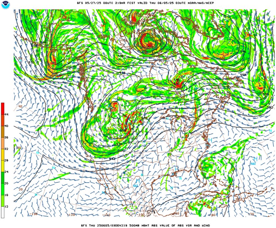
GFS 500mb forecast for Wednesday evening, June 4
The main question for this system will be moisture. Again, the better moisture has been confined mainly south of Interstate 20 in Texas this past week. That will make several attempts to move northward over the next 5-7 days, but models don't currently show this as being very robust. It's got a long way to go to get to the South Dakota border in time for the upper wave's arrival. And we're still far anough away from that indicated upper wave that there is still a lot of time for the orientation/timing of the wave to be significantly different from what is shown now.
On top of that, I have prior obligations on June 3 that will place my earliest possible departure time to that afternoon. So, if the wave comes in early, it will be out of play for me. After the wave departs, most models show a summerlike pattern trying to get established, with the jet curving around a Plains ridge with nightly severe storm complexes in the Midwest. That's all much too far out in time to speak about with any confidence, however. If the June 3-5 wave timing is as currently shown and moisture overperforms in its trek northward, the June 4-6 time period may prompt Plains trip #3. Stay tuned!
The following table charts the probabilities for a Plains storm chase expedition taking place for the date ranges shown:
| 2025 Plains Chase Expeditions - Probabilities as of May 27 |
| May 27-June 3 | 0% | |
| June 4-7 | 50% | |
|
GO: Home | Storm Chase Logs | Photography | Extreme Weather Library | Stock Footage | Blog
Featured Weather Library Article:
|


