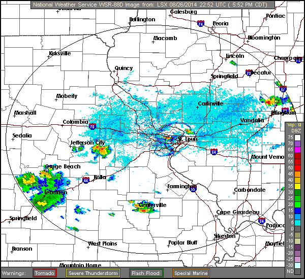
Circular outflow boundaries around St. Louis - August 26
National Weather Service radar image from 6:18PM CDT on Tuesday, August 26, 2014. These outflow boundaries are caused by rain-cooled air in a thunderstorm falling to the ground and spreading out, like pouring water on a table:
GO: Home | Storm Chase Logs | Photography | Extreme Weather Library | Stock Footage | Blog
Featured Weather Library Article:
|
|


