 Severe storms in north central Missouri: April 23, 2010 Severe storms in north central Missouri: April 23, 2010
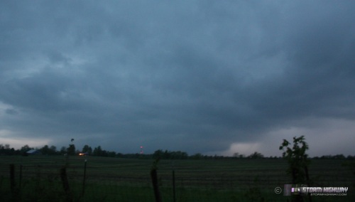
ABOVE: A weakening severe storm south of Columbia, MO on April 23, 2010.
Click any thumbnail on this page to view a larger version.
COLUMBIA, MO - I woke up early on Friday morning in Tulsa after a short night's sleep following the previous day's chase in Texas. The forecast for Friday (April 23) in the days leading up to it looked promising, but as the day dawned, I wasn't that impressed with the setup. Models had been showing the typical three target areas seen with Plains/Midwest events - the dryline, the triple point, and the warm front. The warm front had looked like the better play for several days, and so I was eager to get on the road early for that possibility. Since I was a long distance from the northern and eastern targets, I decided to give the closer dryline in eastern Kansas a chance (it was more of a cool front than a dryline by this point). I headed north from Tulsa through Nowata and onward toward Kansas City.
Convergence along the dryline/cool front in Kansas was almost non-existent, with winds on either side of it nearly due north. As a result, the meager cumulus field that developed early on faded to nothing by late afternoon. An area of numerous storms in Missouri looked like junk, but it was in a favorable environment and near the warm front - so I decided to jump on it. I hit Kansas City right at rush hour, and with numerous accidents and backups all over town, it took me a considerable time to make it through the metro area.
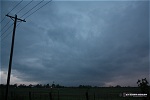
I caught the first storms on I-70 south of Marshall. Very little lightning and some small hail were characteristic of these and other storms I'd see through the evening. This storm crossed I-70 west of Boonville - this view is looking southeast at the north side of the storm as it approached:
The warm front was hanging around the general area along I-70, so I moved east to catch up with storms near Jefferson City as they neared the boundary near Columbia. About this time, the tornado warnings came out for the Warrenton storm farther east - the one that produced at least two confirmed tornadoes. I was too far away to catch this storm before dark, so I decided not to try it. I made it to Columbia and dropped southward to where I could watch the Jefferson City cells approach.
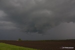
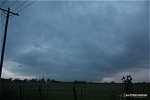
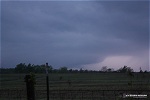
The cells tried in vain to get organized as they moved north. The surface winds were very backed into the storm, but the inflow was just too cold - not enough instability. The storm barely mustered lightning strikes. With darkness quickly ending visibility, I called off the chase and headed back to St. Louis. Here are some images of the storm about 15 miles south of Columbia:
NEXT EVENT: Severe storms in southern IL >
GO: Home | Storm Chase Logs | Photography | Extreme Weather Library | Stock Footage | Blog
Featured Weather Library Article:
|


