|
Home | Blog Index | Blog Archives | Christianity & Faith Essays | Storm Chasing Essays
Here it comes
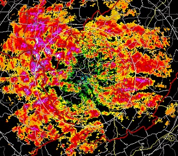
Some destabilizing sunshine today has contributed to some potent snow showers firing early this afternoon. Here is Charleston's radar image from 5:40PM EDT:

RLX NEXRAD radar image - Charleston is in the center
The weird red-orange-purple-white color scheme here is a result of the radar being in 'clear-air mode', as opposed to 'precipitation mode'. When the radar is in clear-air mode, it is more sensitive, and shows stronger-looking returns for clouds and precip. Heavier and more widespread precipitation will trigger the radar to automatically switch to precip mode, which is the classic green-yellow-orange-red color scheme for rain showers and storms. Snow tends to have a weaker radar signature than rain of similar intensity, so many times the radar will stay in clear-air mode throughout an entire snow event.
It's going to be a long night.
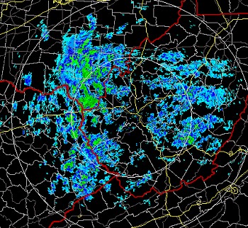
UPDATE: Not minutes after I finished this post, the radar switched to 'precipitation mode' due to the coverage and intensity of the precip echoes around Charleston. So, here you get a rare glimpse of the moment the radar changes over from clear-air to precip mode.

RLX NEXRAD radar image - precip mode
| View 1,609 storm chases: |
| by year: |
|
| by type: |
|
|
|
GO: Home | Storm Chase Logs | Photography | Extreme Weather Library | Stock Footage | Blog
Featured Weather Library Article:
|