| Home | Blog Index | Blog Archives | Christianity & Faith Essays | Storm Chasing Essays
Hurricane Bill on course to top Category 3
Update 3:25PM Tuesday, (Posted from Charleston, WV):
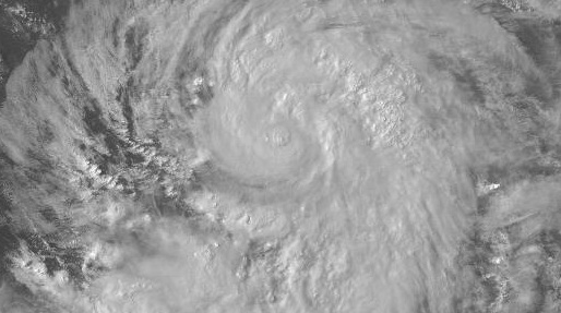
Dramatic satellite image of Bill from this morning, showing an unusually large eye:
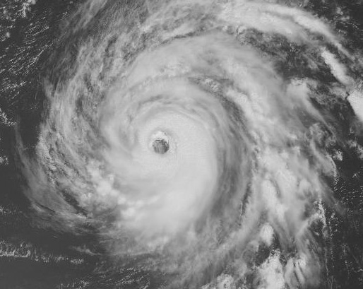
Visible satellite of Hurricane Bill at 10:45AM EDT Tuesday
Update 4:32PM Monday, (Posted from Charleston, WV):
Hurricane Bill continues to intensify in the Atlantic:
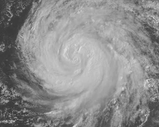
Visible satellite of Hurricane Bill at 4:32PM EDT Monday
Bill is forecast to strengthen beyond major hurricane intensity (Category 3 or higher) in the next couple of days.
Update 7:31AM Monday, (Posted from Charleston, WV):
Shortly after Claudette moved inland, Bill has become the first hurricane of 2009:
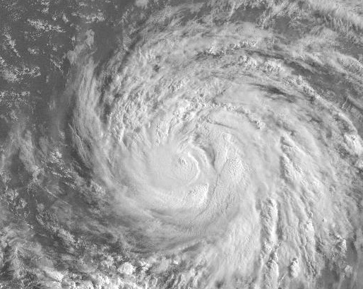
Visible satellite of Hurricane Bill at 7:31AM EDT Monday
Bill is expected to curve northeastward away from the US Atlantic coast, but a shift in this course could place it close to the Outer Banks of North Carolina and/or the Massachusetts Cape. The remnants of Claudette will impact the Appalachians - including West Virginia - with clouds, rain and thunderstorms during the next few days. Meanwhile, Ana has weakened below tropical storm strength in the Caribbean, and is not expected to regain intensity before racing across the Gulf into the southern US.
Update 7:56PM Sunday, (Posted from Charleston, WV):
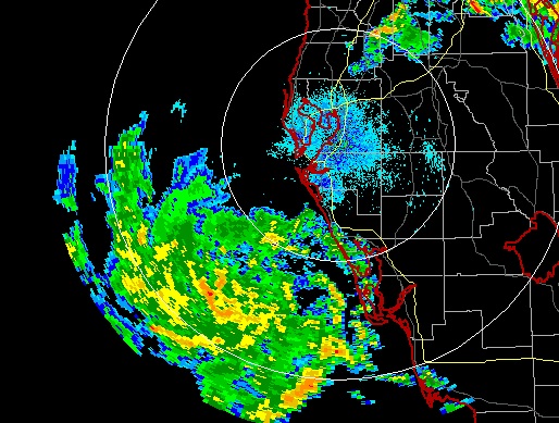
Tropical Storm Claudette is slowly coming ashore in the northwest Florida panhandle as the first landfalling tropical system of the 2009 season:
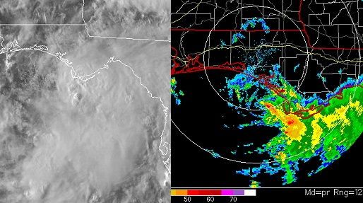
Satellite and Pensacola, FL radar at 7:56PM EDT Sunday
TS Ana has weakened in recent hours, while TS Bill is expected to reach hurricane status tonight:
TS Bill on satellite on Sunday evening
Update 10:45PM Saturday, (Posted from Charleston, WV):
Tampa, FL radar at 10:45PM EDT Saturday
It took it long enough this season, but the tropics are finally starting to show some activity. Right off the bat, we have three systems of note - recently-named tropical storms Ana and Bill in the Atlantic, and a developing system near the Gulf coast of Florida. All three have the potential to make landfalls in the US as either tropical storms or hurricanes, with Bill being a remote candidate for a Carolinas event.
You can follow these systems along with me by visiting the Tropical Weather Data links on my data page. For reference, I'll copy-and-paste them here - these are the main sources I use during hurricane season:
Tropical Weather Data
National Hurricane Center
FSU Tropical Model Data
CSU Tropical Model Track Plots
Satellite: Atlantic VIS | IR | Gulf VIS | IR
Floater 1: Visible | Loop | IR | IR Loop
Floater 2: Visible | Loop | IR | IR Loop
Floater 3: Visible | Loop | IR | IR Loop
Floater 4: Visible | Loop | IR | IR Loop
I have scraped together a budget for a Carolinas hurricane intercept, so if something moves in that direction I'll be going into an 'intercept standby' mode.
If Bill hits the cape...are you gonna come up here?
- Posted by Katie from Melrose, MA | |
Actually would not be a bad idea - would love to see Gloucester Point with a hurricane just offshore!
- Posted by Dan R. from Charleston, WV | |
|


