|
Home | Blog Index | Blog Archives | Christianity & Faith Essays | Storm Chasing Essays
December 5 snow event: Tuesday 10:14AM update
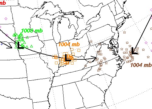
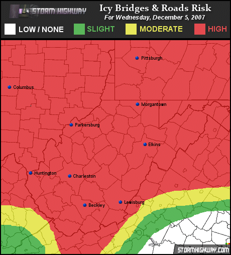
The forecast track of the clipper system has shifted slightly to the south, putting West Virginia deeper into the cold sector of the storm. This not only means a better chance for snow, but a better chance for the snow to stick and accumulate. Adding to the snow prospects is that the clipper is progged to arrive in the middle of the night, just after midnight tonight when temperatures have had a chance to fall below freezing. Charleston could see from one to three inches out of this storm before temperatures rise again on Wednesday morning. However, I'm not confident that temps will rise above freezing on Wednesday if the snowfall rates maintain themselves through the morning. Snow has a cooling effect that often counters any warming from the diurnal cycle (daytime solar heating). If the air can stay below 32F, I would not be surprised to see 4 or 5 inches of snow on the ground in Charleston by midday Wednesday. At any rate, school closings look like a good bet for tomorrow along with a very messy morning commute.

Clipper low forecast track

I'll keep this blog updated until I have to run out the door to cover the storm, then post pictures and video after it's over - so stay tuned!
| View 1,609 storm chases: |
| by year: |
|
| by type: |
|
|
|
GO: Home | Storm Chase Logs | Photography | Extreme Weather Library | Stock Footage | Blog
Featured Weather Library Article:
|