|
Home | Blog Index | Blog Archives | Christianity & Faith Essays | Storm Chasing Essays
Tuesday/Wednesday forecast and chase plans
Update 5:15AM Tuesday: It is interesting to note that the RUC model is forecasting that the line of storms currently in Indiana, Illinois and Ohio will drop south today and end up in the Charleston area by this afternoon. The NAM/WRF and GFS keep it all well to the north and west of us. Whether the RUC is out to lunch or not remains to be seen, but part of that line of convection heading for Cincinnati is a little farther east and south than I expected it to be by now - and some eastward progression is apparent on radar. If the RUC is right, things are going to be interesting today.
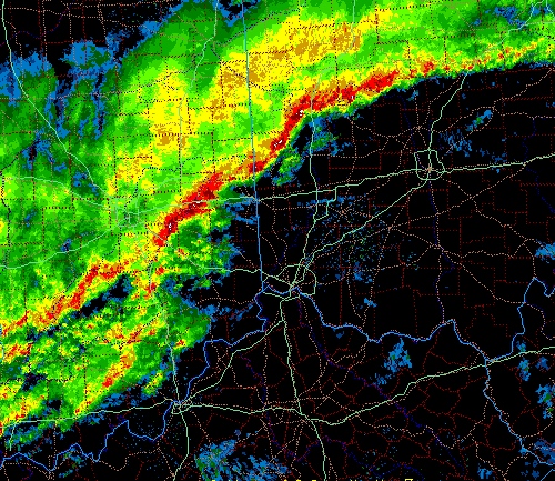
5:15AM radar image
4:56AM Tuesday: The timing on today's event has really slowed down, resulting on Tuesday's threat area moving significantly westward from earlier forecasts. This makes a chase for me today even more unlikely. However, West Virginia and points east may even have another partial or full day in the warm sector ahead of the front tomorrow, which means that the eastern Appalachians, Piedmont and coastal areas are going to get their own shot at an outbreak on Wednesday! So now, the closer chaseable risk for me is to the east of Charleston rather than the west. I have some clients in Raleigh I need to meet with, so this may be a convenient way for me to combine two objectives into one trip. The caveat is the chances for snow here in Charleston on Friday morning and Saturday, which I will need to be here for either way. If snow looks likely on Thursday morning, I'll have to turn around and head back home even if I travel all the way to Raleigh tomorrow.
Since I was focusing earlier on Tuesday's forecast only, one thing I didn't notice at all on the 00Z NAM/WRF and GFS is that the squall line is shown to not arrive in Charleston until mid-afternoon/evening tomorrow. That could mean that the best target for a chase might end up being right here at home - how'd that be for a convenient outcome? I haven't had time to look at Wednesday's forecast in much detail, other than the fact that a slower frontal passage will allow the Carolinas and Virginia to be in the warm sector during peak heating before the system arrives. Here is the SPC's Day 2 outlook for Wednesday:
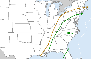
SPC severe storm risk for Wednesday
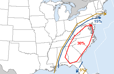
SPC tornado/wind/hail risk for Wednesday
|


