| Home | Blog Index | Blog Archives | Christianity & Faith Essays | Storm Chasing Essays
CASE STUDY: Bridge frost creates icy road hazard under clear skies
click to enlarge
This is the first case of pure frost (ice entirely of non-precipitation and non-terrestrial origin) covering a road that I've observed, so I wanted to do as thorough of a documentation as I could. It is amazing to think that icy roads can develop literally out of thin air under clear skies.
Upon the discovery of the South Side Bridge's condition, I checked the condition of several other bridges in Charleston. I found frost only on one other bridge, the Spring Street Bridge over the Elk River.
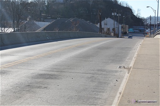
- Spring Street bridge over the Elk River: It appeared that a light band of frost had formed in the southbound lanes (photo). The band was not slick in either walking or driving tests.
- Washington Street Bridge over the Elk River - no frost observed
- Lee Street Bridge over the Elk River - no frost observed
- I-64 Bridge over the Kanawha River (Carter/Oakwood/Fort Hill) - no frost observed
- Patrick Street Bridge over the Kanawha River - no frost observed
South Side Bridge frost observations
Time: Frost was first observed on the bridge at 8:00AM EST, and had nearly completely melted/evaporated by 9:30AM EST due to direct sunlight warming the road surface.
Weather Conditions:
I recorded the valley temperature at the bridge at 8:00AM at 16°F under clear skies. The hilltop temperature at the CRW ASOS site (at Yeager Airport) was recorded at 14°F. It is worth noting that valley and hilltop conditions in Charleston can differ by several degrees in both temperature and dewpoint. The following is a chart of the obs at the CRW ASOS around the time of the bridge frost event:
| Time (EST) |
Temp (°F) |
Dewpoint (°F) |
Sky |
Wind |
| 5:54AM |
15 |
11 |
Clear |
Calm |
| 6:54AM |
14 |
11 |
Clear |
Calm |
| 7:54AM |
14 |
11 |
Clear |
Calm |
| 8:54AM |
17 |
12 |
Clear |
Calm |
| 9:54AM |
23 |
12 |
Clear |
SE 7 |
| 10:54AM |
27 |
12 |
Clear |
S 3 |
|
Thick frost was also present on vehicles, grass and ground vegetation in the Kanawha Valley.
Appearance:
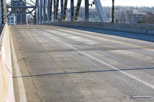
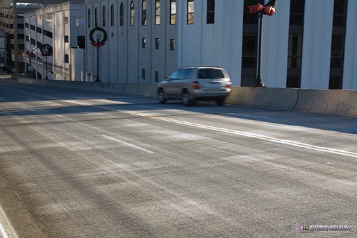
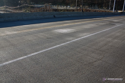
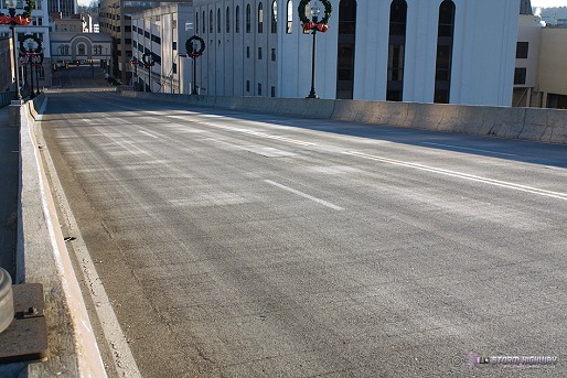
The frost layer was similar in appearance to a light snow covering. Tire tracks had formed from passing vehicles.
Slickness hazard:
The light coating was about a 4 on a slickness scale of 1 to 10 - my wheels would slide on it only during hard braking. My shoes, however, slid easily as I walked across. It appeared that if the frost would have had another hour or two to accrete, the bridge surface would have become hazarous enough to pose a significant accident threat, on par with a normal snowfall event.
Coverage:
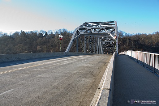
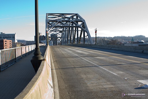
The frost covered the full width of the bridge pavement plus the top of the Jersey barrier railings, mainly on either end of the bridge. No frost was present on the pedestrian walkway on the west side of the bridge. Frost was not present in the center of the bridge underneath the steel truss superstructure.
No frost on bridge center:
I have two theories about the frost only being on either end of the bridge and not in the center. One is that the 'frost accretion zone' could have been confined to a shallow layer of air above the river. In that case, the high arching center of the bridge would be situated above this layer, while the lower approaches would have been down inside the layer. This may explain why other bridges over the Kanawha (like the much higher-elevated I-64 bridge) had no frost at all. My second theory is that the steel truss superstructure somehow (thermally or otherwise) shielded the road surface from radiational cooling effects.
Moisture source:
Since the surface layer was not at saturation (not at or near 100% humidity) and no fog was observed anywhere in the region, my theory is that the bridge frost was fed by moisture from the Kanawha River below. This photo taken close to the time of the above observations shows a shallow layer of mist/steam rising just above the water surface.
Photos:
These images were taken at approximately 8:00AM EST (click each image to enlarge):
click to enlarge
click to enlarge
click to enlarge
click to enlarge
click to enlarge
Spring Street bridge:
click to enlarge
Conclusions: Although I wasn't able to chase enough bridge sites to draw a certain conclusion, it appears that this morning's bridge frost event likely was caused by just the right combination of 1.) subfreezing temps, 2.) good radiational cooling conditions, and 3.) river moisture in a shallow layer of air above the Kanawha River. While this event proves that pure frost is capable of posing a hazard to motorists, it appears that its formation is dependent on a delicate balance of ambient weather conditions, and is therefore not a significant risk factor in terms of frequency.
|


