| Home | Blog Index | Blog Archives | Christianity & Faith Essays | Storm Chasing Essays
Tuesday-Wednesday winter storm updates
Update 7:17PM Tuesday: We are approaching ice storm criteria in many parts of the Charleston area, with 1/4" of ice evident on some power lines and trees. I observed a power flash about 30 minutes ago over South Charleston. Trees are sagging in South Hills. Freezing rain has been in progress since about 11:00AM this morning. Most roads are still in good shape. Photos to come later.
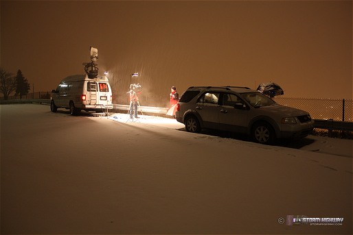
Update 7:46AM Tuesday: 3 inches on the ground now after a brief start as sleet/freezing rain. I spent a few hours on Fort Hill, again this time with a WOWK crew (photo below). Not many road problems, despite the widespread packed snow. A few vehicles were getting stuck on the westbound Oakwood offramp, but other than that, there was not much to report. I left the spot around 7AM and went home - at this point in a winter storm like this, road problems typically peak at the onset of the precip, and taper off as public awareness levels increase. Accidents still happen, but not at rates that make being out covering them worth the effort. I'm not sure if I'll need to go back out today, but as always, I'll need to keep a watch on things.
click to enlarge
Update 12:14AM Tuesday: Temps at the higher elevations above freezing (37°F at Beckley) indicates we have some warm air aloft at or very close to us, so I'm inclined to think that our precip in Charleston may start as freezing rain. The 00z sounding at Wilmington, Ohio (the closest one to here) showed 700mb temps almost at 0°C, meaning a layer of air aloft is almost at the freezing mark. In theory that should be a little warmer over southern WV, which would explain the warm air in the mountains. We're at 27°F at the surface here now, and if the air above us is warm as it seems it may be, the ptype will be freezing rain. A weather balloon launch here for some upper air data would be helpful now. Looking at radar and eyeballing the speed of the main precip area, we should start seeing this event start at around 3AM in Charleston.
9:44PM Monday: The system approaching us tonight looks like the biggest storm of the season so far. Not a record-breaker by any means, but enough to shut the state down for a day or so. My head has been spinning looking at all the data leading up to this, and at this point I'm just not going to try to pin down precip types and totals - it's useless. We'll have some snow, sleet, freezing rain and a mix of those at varying times. All I can say is that the roads are going to be bad until sometime Wednesday, and I'll be out shooting video until it's over.
As with most marathon winter storm events, I'm probably going to be too tired/occupied to do much blogging on this event. But, if something interesting happens and I get a break to post it, you'll see it here first.
Right now the task at hand is to get some sleep before it's time to head out - probably sometime after midnight.
|


