|
Home | Blog Index | Blog Archives | Christianity & Faith Essays | Storm Chasing Essays
Best country road drives around Charleston
 I've said many times that the road has always been my 'unwinding' place, and probably always will be. When I can't take a long road trip, the local country roads outside of town do just fine. For more than 12 years, I've been escaping to the back roads around Charleston for a few hours at least once a week - both during the day, in the middle of the night, or whenever I get the urge. Climbing gas prices have made the cost of this activity a little more expensive lately, but not enough for me to stop doing it. It's an important part of how I keep my sanity, so I'll keep spending the money at the pump. I've explored and driven on every through-route within a 30 mile radius of town, but two regions have become my favorites: the areas to the north and to the southwest of town. These areas, in my opinion, have the best combination of scenery and lighter traffic than other parts do. I've said many times that the road has always been my 'unwinding' place, and probably always will be. When I can't take a long road trip, the local country roads outside of town do just fine. For more than 12 years, I've been escaping to the back roads around Charleston for a few hours at least once a week - both during the day, in the middle of the night, or whenever I get the urge. Climbing gas prices have made the cost of this activity a little more expensive lately, but not enough for me to stop doing it. It's an important part of how I keep my sanity, so I'll keep spending the money at the pump. I've explored and driven on every through-route within a 30 mile radius of town, but two regions have become my favorites: the areas to the north and to the southwest of town. These areas, in my opinion, have the best combination of scenery and lighter traffic than other parts do.
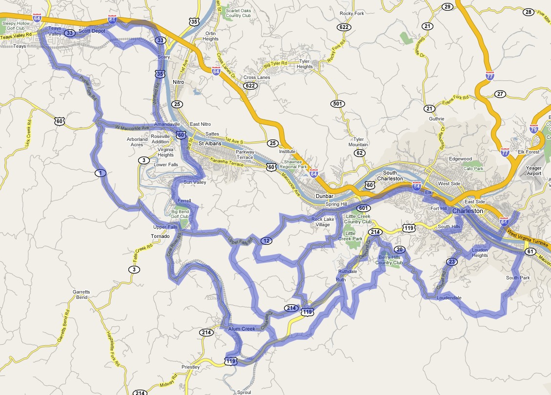
Southwestern region
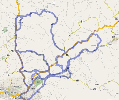
Click for larger map

These roads are the first that I frequented when I moved to Charleston. There are plenty of through roads to create a good variety of routes - and since they are mostly well south of the Kanawha Valley, you'll usually not have to deal with traffic in front of or behind you. The Coal River region is one of my favorite places in the Charleston area, with great landscapes and interesting roads. Some of the good driving routes in this area include:
 - Coal River Road - St. Albans, Tornado, Alum Creek
- Ferrell Road & Pennsylvania Avenue - Tornado to St. Albans
- Lincoln Drive & Upper Falls Road - Spring Hill to Tornado
- Rabel Mountain Road - Alum Creek to Ruthdale
- Poplar Fork Road - Scott Depot to Coal Mountain
- Browns Creek Road - Coal Mountain to Tornado
- Chestnut Road - Spring Hill to Ruthdale
- Davis Creek Road - Southridge to Loudondale
- Loudon Heights Road - Loudondale to Charleston
- South Park Road - Loudondale to Kanawha City
- Greenview Road - Alum Creek to Upper Falls Road
- Scary Creek Road & Hedrick Road - Scary to Scott Depot
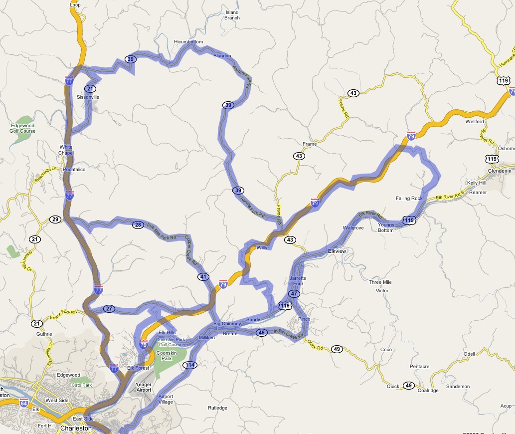
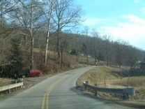
Northern region
Click for larger map
In the past few years, I've been spending a lot of time on the back roads north of town. The through roads and variety of routes are a little lesser in number, but are longer than in the southwestern areas. Traffic is also very light on these routes, allowing you to have the roads all to yourself. Most of these routes intersect I-77 and I-79, allowing for a quick return trip if time is at a premium. Some of the good driving routes in this area include:
 - Cooper's Creek Road & Five Mile Fork Road - Big Chimney to Tupper's Creek/I-77
- Edens Fork Road - Big Chimney to I-77
- Crestwood Road - Elk Hills
- Little Sandy Creek Road - Big Chimney to Elkview
- Wills Creek Road & Jordan Creek Road - Elkview to Falling Rock
- Indian Creek Road & Pinch Road - Big Chimney to Elkview
- Aaron's Fork Road & Pocatalico River Road - Elkview to Sissonville/I-77
|