| Home | Blog Index | Blog Archives | Christianity & Faith Essays | Storm Chasing Essays
January 6-7 Midwest snowstorm
Update 11:57PM Wednesday, (Posted via Laptop from New Baden, IL):
About 3/4" of fine, granular snow on the ground so far. Snowfall has been steady, but accumulation rates have not been very rapid up to this point. Winds are starting to pick up a little, creating some blowing snow eddies off of rooftops - but not much in the way of reduced visibilities.
I took a short drive to the center of town to take a look at things.
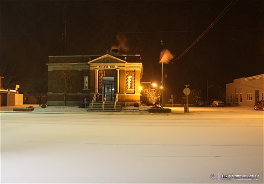
click to enlarge
* * *
Update 9:40PM Wednesday, (Posted via Laptop from New Baden, IL):
Steady light snow in New Baden currently with a coating already on the ground. Winds still light, nothing blowing around yet. * * *
Update 6:39PM Wednesday, (Posted via Laptop from New Baden, IL):
Decided to just settle here in the comfort of home for the duration of this event. Snow has not yet started in New Baden, but STL area traffic cameras show that roads are already snow-covered in the western third of the metro.
I don't plan on doing a whole lot with this storm tonight other than periodic looks outside to check on things. I think some 'blizzard-like' photo opportunities worth venturing outside for will be available in the morning. * * *
Update 2:11PM Wednesday, (Posted via Laptop from New Baden, IL):
This has been a brutal winter so far - so much so that most of us would just as soon see it end soon than pay more attention to it. However, the St. Louis region sees very few significant winter storm events each year, so I think the system set to impact the area today and tonight is worth blogging about. While the snowfall totals themselves are newsworthy, the expected high winds, very low temps and dry/powdery nature of the snow will make the event feel more like a blizzard - with low visibilities, dangerous cold and blowing and drifting snow.
I am not sure where I plan to document this event. I feel that the blowing/drifting snow will make any travel - even just down the road to downtown STL - a risky prospect. Furthermore, the flat terrain around St. Clair/Clinton counties may make any blizzard-like conditions more dramatic - which would make staying here in New Baden a better choice. Snow is set to begin within the next few hours, peaking out sometime overnight and into the morning hours tomorrow as winds increase. * * *
This is a running-updates style post, with new sub-updates appearing under the same heading. New posts are listed first.
|


