|
Home | Blog Index | Blog Archives | Christianity & Faith Essays | Storm Chasing Essays
Active week ahead, major system for end of March
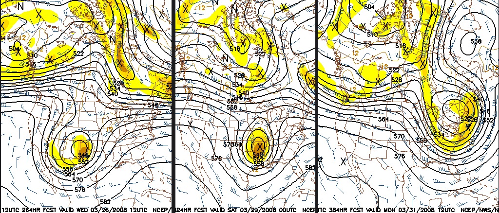
Talking about long-range forecasts at all usually means you'll have to eat your words from time to time, but when something interesting shows up it's hard not to take notice. The extended GFS shows a major upper-level trough slamming the USA toward the last few days of March. This sequence of images shows the trough's progression across the country as portrayed by the GFS model:
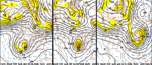
GFS 500mb forecasts for March 26, 29 and 31 (click to enlarge)
If you followed any of our storm chase expeditions in the past few years, you know that this is the type of upper-level pattern we look for to make a trip out west during the spring storm season. This trough, if it comes to pass, will produce several potent severe weather events on its leading edge from the Plains to the east coast, followed by a cold spell as its axis passes over. This image shows subfreezing 850mb level temperatures (the level a few thousand feet or so above the ground) all the way to northern Florida, which would mean cold air and maybe snow at the surface over West Virginia - totally busting my last post about winter being over!
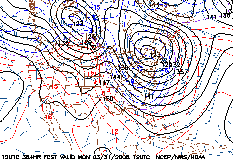
GFS 850mb forecast for March 31
Again, we're talking about the far end of the extended range, which is one of the most notorious for wildly flip-flopping. I'd put a 10% chance of this scenario actually happening, and I wouldn't be surprised for that trough to be completely gone from the model output in a week. But, it's been showing up for the past few runs, so there is at least a little reason to keep watch. The ensembles (groups of similar models run separately) for the extended period are somewhat in disarray, not showing much agreement between their members - which reinforces the uncertainty in the long-range outlook.
So on to the short term, where we can forecast with more confidence. What does look likely is that a major trough will move across the country in the coming days, creating chances for severe storms and tornadoes from the southern Plains to the southeastern states.
As is typical this early in the season, the trough's position is a little too far south to bring much of a tornado threat to the central US. Moisture looks to be best in central and southern Texas on Monday.
And that southern trend will likely continue as the trough moves east, keeping the threat for tornadoes well to the south of us and out of any realistic intercept range for me. What interests me the most at this point is a surface low apparently getting close to us late Tuesday into Wednesday.
When you're a storm chaser, surface lows are never things to ignore when they pass overtop of or close to you. Their enhanced lift makes thunderstorms and heavy rain/flooding more likely, and if clearing/instability can develop close to their centers, 'surprise' tornado events can develop.
As the cold axis of this trough passes us during the Thursday-Saturday time frame, the GFS still hints at the possibility of upslope snow, but mainly in the mountains. I doubt we will see anything frozen to worry about here in Charleston, but as always, it's 'something to watch'.
|