|
Home | Blog Index | Blog Archives | Christianity & Faith Essays | Storm Chasing Essays
A look at the near-term & extended outlooks
There's not much in the way of major events to talk about nor chase weather-wise for the near future, which is a good thing since my next two weeks are tied up with business-running and tax related issues. Despite this fact, our weather will be somewhat active for the next two-week period. There are a few items of interest showing up that are worth a mention, so here's a look at what model output suggests.
Wednesday/Thursday - thunderstorms and possible flooding in OH/WV
Models paint healthy QPF (rainfall amounts) along a frontal boundary in the central-southern Ohio/West Virginia region from Wednesday night into Thursday. Tonight's 00z WRF/NAM puts this potential hazard more into southern Ohio than over us, though parts of central WV may see a quick inch of rain. The GFS model is in general agreement. Two rapid inches is needed to start seeing any notable flash flooding issues around here, so I don't see a lot to be concerned about at this point. The heavy precip likely indicates some lightning is possible during this event, hopefully some of which will be close enough to Charleston to take a quick 35mm photography outing on Wednesday night.
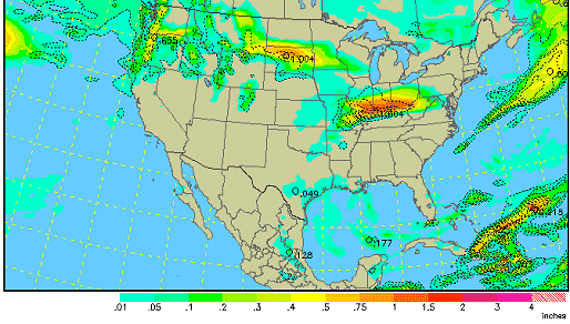
WRF/NAM precip forecast for Thursday morning
Monday/Tuesday - thunderstorms and heavy rain again
After a few light shower events over the weekend, the next system of interest shows up on the GFS for late Monday as a long, sharp cold front sinks south from the Plains to the upper Ohio Valley. While the model QPF amounts are high for Monday evening/Tuesday, most of the upper-level wind energy is shown passing well to the north of the front - limiting the severe storm potential. The apparent slow movement of this front could bring another flood hazard wherever it sets up.
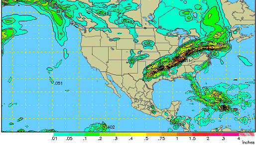
GFS precip forecast for Monday evening
Extended range
The long-range operational GFS has not been consistent in recent days about what we might be seeing during the first week of April. A large trough has been floating around on the outputs, varying in strength, duration and placement from run to run. The ensembles are not gung-ho on a big trough, though a general dip in the jet stream over the eastern US is suggested. Probably the only thing we can say from this info is that temps may be on the cooler side of normal for West Virginia during the extended period through April 10.
The latest of the indecisive operational GFS's ideas of a trough for early April gets the 850mb freezing line south of us one more time, which could spell another chance of snow showers:
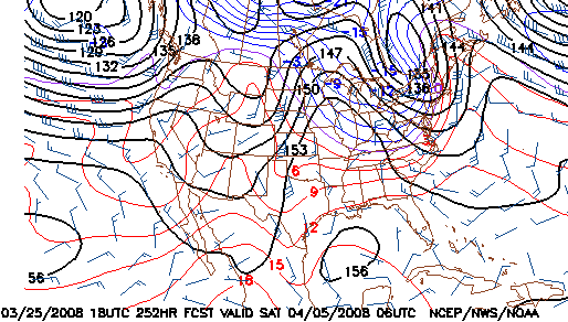
GFS 850mb forecast for April 5
While the ensemble plots show a generally less amplified configuration - implying cooler than normal temps, but less supportive of snow:
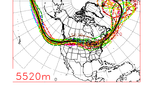
NCEP ensemble forecast for April 5
|


