| Home | Blog Index | Blog Archives | Christianity & Faith Essays | Storm Chasing Essays
2010 season - here we go
UPDATES:   stormhighway.com Facebook Page (more on this below) stormhighway.com Facebook Page (more on this below)
An unexpectedly more active pattern than anticipated is upon us. Wednesday and Thursday are looking like not only thunderstorm days, but the first 'real' storm chase days of the season for the Midwest. Models show that instability, moisture, good upper support and a surface low pressure in the vicinity may be present, all ambient ingredients for possible severe thunderstorms and tornadoes. The details are yet to be resolved, but here are just a few quick NAM model images:
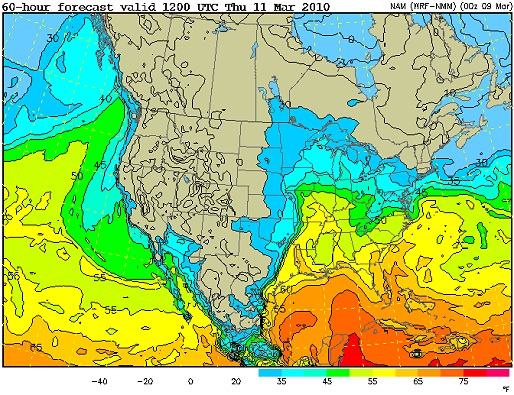
Dewpoints shown in the 50s up to St. Louis:

NAM dewpoints for Thursday
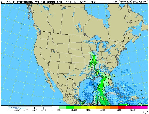
Instability:

NAM CAPE for Thursday
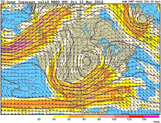
Upper support:

NAM 500mb winds for Thursday
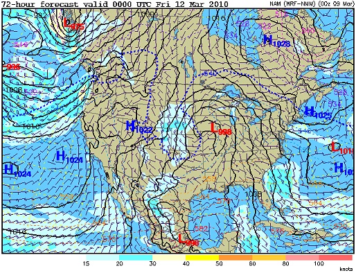
Surface low and backed winds:

NAM surface for Thursday
Wednesday looks like a potential event to the west and south of here, which could also lead to an storm chase day. The best parameters may be in eastern Oklahoma, which is a little too far to drive considering an event may take place here at home the next day. Stay tuned!
Facebook Page
UPDATES:   stormhighway.com Facebook Page stormhighway.com Facebook Page
I've had a Facebook page set up for this site for some time now, and plan to start using it with higher frequency this season. If you have a Facebook account, you can join this page without actually having to be on my private friend list. The idea behind this is to keep weather-related updates in their own area, so that (1) non-Facebook friends can interact and (2) I don't impose too much weather content on my private Facebook page for non-storm chaser friends who may not care to read it.
I also set up the Facebook page to automatically simul-post to my Twitter account, in case you're a more frequent user of that service.
hi you are my biggest storm fan
- Posted by kevin from siouxlookout .ON | |
|