| Home | Blog Index | Blog Archives | Christianity & Faith Essays | Storm Chasing Essays
Midwest chase on Wednesday?
A nice upper trough is shown by both the GFS and NAM to take shape just east of the Great Plains on Tuesday night and impact the mid-Mississippi valley and midwestern region of the country on Wednesday. Deep moisture (dewpoints in the 60s) with CAPES 2500-3000, southerly to south-southeasterly surface winds in the instability axis, diffluent 500mb/300mb flow overtop of decent low-level directional shear and a moderate capping inversion should allow for the possibility of supercells across Missouri, Illinois, Indiana and Kentucky on Wednesday afternoon/evening.
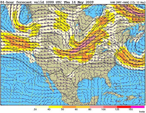
NAM 500mb pattern for Wednesday
If these parameters come to pass as shown, I will likely make this a day-chase from WV and back. If the latest model runs are correct, my premilinary starting point would be Effingham/Champaign IL to target the warm front - though that will likely change. I'm not sure if I would classify this as part of a classic spring storm chase expedition or not, I still have to think about that. It's outside of the Plains, but just outside of my normal 'home chase area'. I guess if I end up in northern Illinois or Missouri, I'll call it a 'storm chase expedition' day.
|


