|
Home | Blog Index | Blog Archives | Christianity & Faith Essays | Storm Chasing Essays
Signs of winter
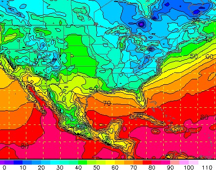
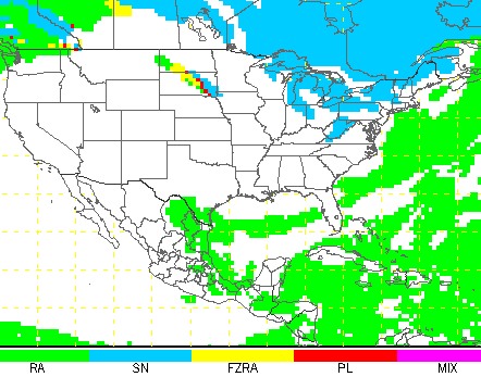
The first 'real' cold air of the year arrives on Tuesday night following a strong cold front. The GFS model paints low 20s across much of WV by Thursday morning next week, and snow is looking like a good possibility for the mountains on Tuesday night. Charleston could see a brief rain/snow mix late Tuesday. The cold air should also get the lake-effect snow machine going across PA and NY by Thursday, with thundersnow a good bet. Meanwhile, fast-moving Hurricane Noel will stay offshore of the US, but will bring high winds and big waves from the Outer Banks of North Carolina to the rocky coasts of New England. If finances and scheduling permit, I may consider a chase to Buffalo, New York if the lake-effect snow event looks significant.


The first frosts of the season have arrived across West Virginia, a little later than normal this year.
October Rainfall Notes
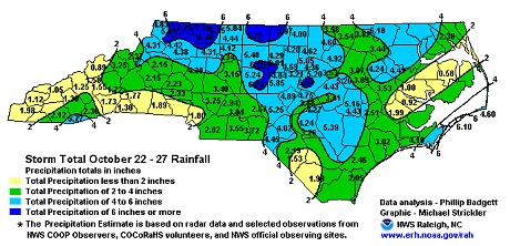
North Carolina received well-needed rainfall last week, with storm-total rainfall amounts exceeding 6 inches in many locations. In three days, the rain gauge at the house on Ten Ten Road (south of downtown Raleigh) topped its maximum 5.5" reading and overflowed! Here is an NWS map showing the measured totals across the area from the event:

Meanwhile, Charleston, WV recorded 3.64 inches of rain for the month of October. Totals for the month around West Virginia ranged from 2.39 inches at Huntington to 4.33 inches at Elkins.
| View 1,609 storm chases: |
| by year: |
|
| by type: |
|
|
|
GO: Home | Storm Chase Logs | Photography | Extreme Weather Library | Stock Footage | Blog
Featured Weather Library Article:
|