| Home | Blog Index | Blog Archives | Christianity & Faith Essays | Storm Chasing Essays
Thanksgiving snow event
A strong upper trough will swing through the eastern US this week, bringing the first significant shot of cold air of the season on its trailing end - and the first snows to the Appalachians since October 17. An upslope snowfall event in the West Virginia mountains will accompany this feature starting Thursday, as winds turn northwesterly and surface temperatures cool. Most of the state will likely see snow with this system by Friday morning.
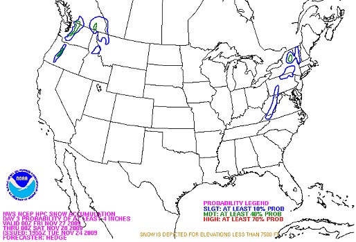
HPC +4" snowfall forecast for Thursday night
850mb temps cross the freezing mark on Thursday morning and continue to fall through Saturday, with surface temps gradually responding accordingly. Snow should begin above 3,000 feet during the day on Thursday, with the changeover slowly working its way lower in elevation. All of West Virginia's precip should be snow by Friday morning, with at least a dusting on the grass everywhere a good bet - and icy bridges possible statewide. Models are in decent agreement on precip rates and coverage, supporting as much as 6 inches above 3,000 feet, at least 1 or 2 inches in Beckley and possibly an inch in Charleston by Saturday morning. Temps are the wildcard, indications are that the mountains should easily drop below 32°F while the lowlands to the west (Charleston/Huntington etc) will hover around freezing. Icy roads in the mountains look certain, with bridges likely being a problem statewide (wherever temps hit freezing).
This storm will hopefully miss the bulk of Thanksgiving travel times in the region, but will make Black Friday a cold and snowy outing - especially in the morning, when bridge ice could be a problem. As always, I will be out and sending mobile updates to an eventual running updates post (which I'll start sometime on Thursday).
|


