|
Home | Blog Index | Blog Archives | Christianity & Faith Essays | Storm Chasing Essays
Cold air and snow next week
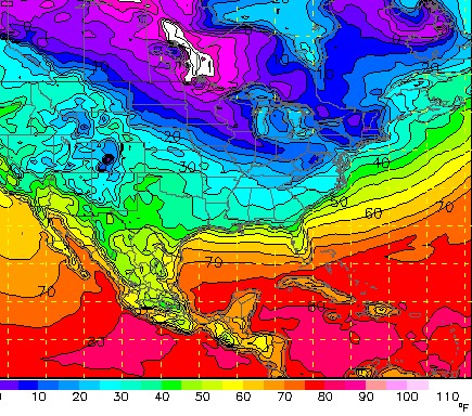
I'm not normally one to take notice of what the GFS model is advertising for 7 days away, as that far out, models are very flaky. But what the GFS is suggesting for next week bears a mention. A very cold arctic air mass is shown plowing southward, with temperatures dropping into the teens by Tuesday morning in West Virginia - and much colder air still to come. Subzero °F temps are nosing toward Chicago on Tuesday and trying to move our direction.

Surface temperature forecast for Tuesday morning
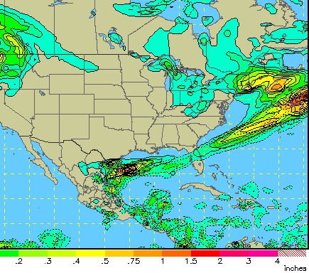
A good amount of QPF is shaded over West Virginia as this cold air arrives, which means an all-snow scenario. The QPF shading here suggests that a 2 to 4 inch snowfall from Charleston to Pittsburgh by Tuesday-Wednesday is possible if these conditions come to pass:

QPF (total precip) forecast for Tuesday morning
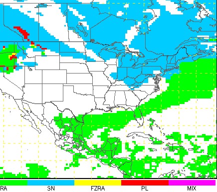
Precip type is shown as all snow for Tuesday:

Precip type forecast for Tuesday morning
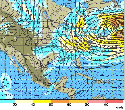
And the low-level winds (850mb and surface) are shown very strong out of the northwest, which indicates a very potent upslope snow setup for both the mountains and the lowlands of West Virginia. Note that this system is part of a massive low pressure on the Atlantic coast (a classic nor'easter), which will likely also be a big story for the Northeast if this scenario happens.

850mb wind forecast for Tuesday morning
The GFS is known for sometimes exaggerating wintertime low temperatures and QPF, but if anything close to this scenario takes place, cold and unsettled winter weather looks like a good bet next week.
| View 1,609 storm chases: |
| by year: |
|
| by type: |
|
|
|
GO: Home | Storm Chase Logs | Photography | Extreme Weather Library | Stock Footage | Blog
Featured Weather Library Article:
|