| Home | Blog Index | Blog Archives | Christianity & Faith Essays | Storm Chasing Essays
October 27-29 first snow: winding down
Update 11:42AM Tuesday: Just arrived back home. I have 5 gigs of photos to go through and edit from this morning. But for now, after an all-nighter, I need some rest. EDIT: Photos are posted here.
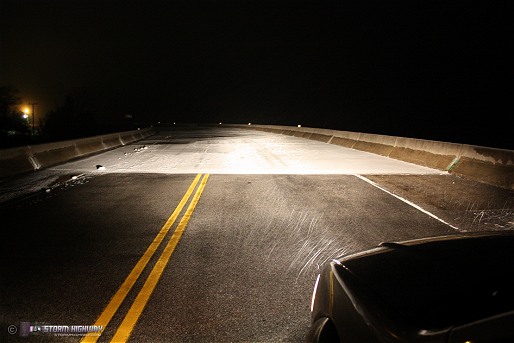
Update 4:41AM Tuesday: Drove up to Flat Top mountain (3,200 feet) where temps bottomed out at 29°F, encountering this icy bridge on Route 19 near the summit:
The landscape up here is pretty well covered, everything but the roads is white. Should be an impressive sight here shortly when the sun comes up.
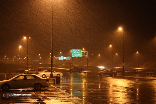
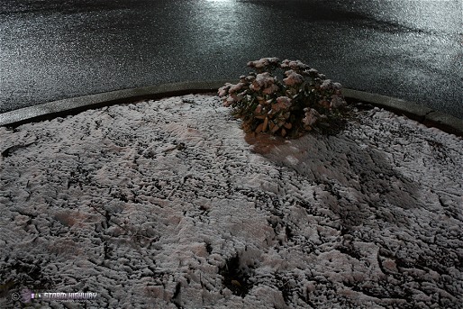
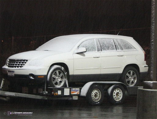
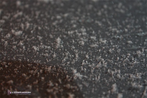
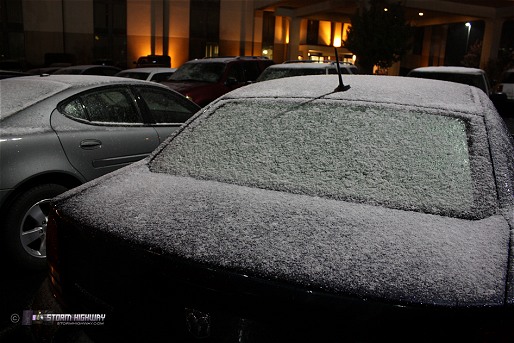
Update 2:24AM Tuesday: Currently in Beckley for the night, in the middle of a considerably potent upslope snow event. I've been here since 10PM, and it has not stopped snowing since I got here. Temps are right at freezing, limiting road impacts (I have not found any icy bridges or roads yet). Grassy surfaces, cars and roofs are covered with 1/4" so far. Through the darkness, I can see the trees are covered (and still have most of their leaves). Consequently I plan on staying here until morning for some daylight photography.

Update 2:14PM Monday: Both the NAM/WRF and GFS models are in agreement in the mountains seeing accumulating snow tonight into tomorrow morning. Temps in the lower elevations (Charleston, Huntington, Parkersburg) should remain high enough to avoid icy bridge problems, but any strong snow shower could locally lower temps quickly to at or below the freezing point. Icy roads will be a problem in the mountains tonight, particularly on I-68 east of Morgantown. The models indicate that the northern WV mountains could see as much as 8 inches of accumulation overnight, with up to 2 or 3 inches in the higher areas around Beckley/Lewisburg.
Although I-68 will be the place of highest impact, I don't think I want to go that far. Most likely I'll be out in the Beckley-Lewisburg area tonight.
A news article today quoted the NWS as recording Charleston's first flurries this morning. I don't doubt this, on account of the vigorous upslope echoes on radar last night (see the previous update below). However, I checked my CCTV cameras and didn't see anything falling at the house at the time the snow was reported.
Update 3:04AM Monday: The cold front is currently crashing across West Virginia, with upslope clouds/precip quickly forming behind it. The front shows up well on the METAR map:
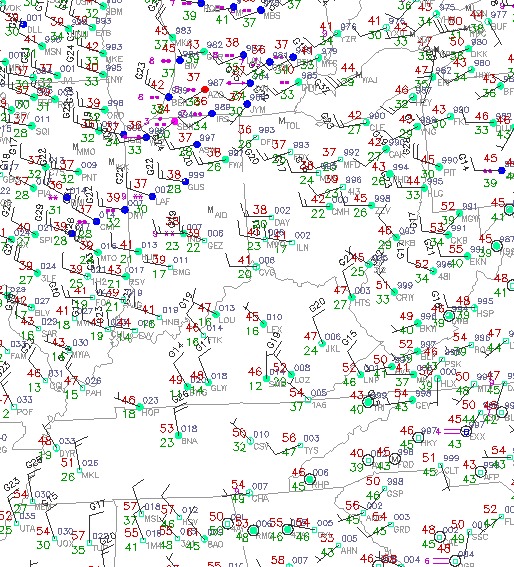
METAR obs at 3:00AM EDT Monday
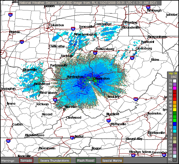
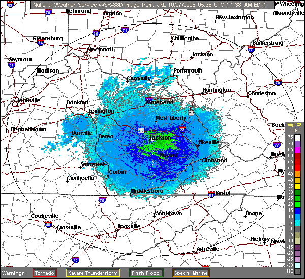
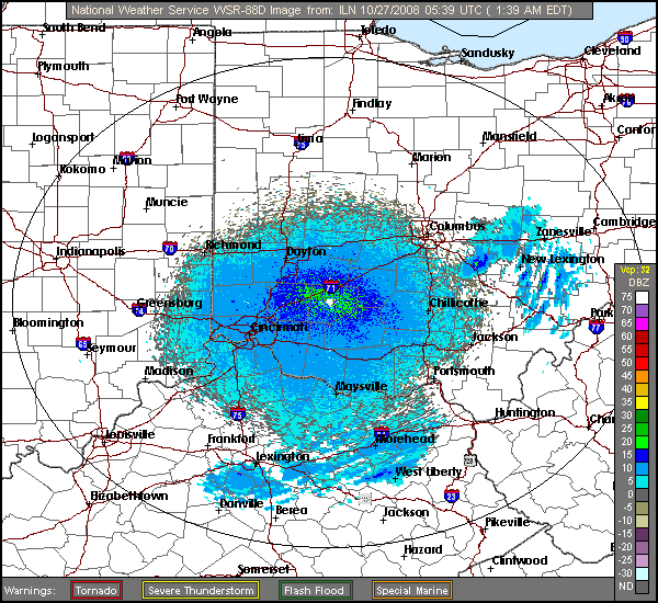
I captured these three radar animations at 3AM where you can see the frontal boundary sweeping southeast, followed quickly by the onset of upslope precip echoes forming 'out of the blue'. The upslope precip is forming as the northwest winds behind the front slam into the increasingly higher elevations of the Appalachians, squeezing out the moisture in the air:
RADAR LOOP 1: RLX - Charleston, WV radar site
RADAR LOOP 2: JKL - Jackson, KY radar site
RADAR LOOP 3: ILN - Wilmington, OH radar site
On the METAR map above, notice the snow being reported in Indiana and Illinois with surface temps in the mid to upper 30s. Snow making it to the ground with surface temps that high indicates very cold air aloft, at 850mb and higher. All of this is moving toward West Virginia. When these colder 850s infiltrate the upslope zone, snow may be flying by evening!
If you don't know what upslope precip is, I put together a brief writeup post on it last year. I'll be talking about upslope snow quite frequently on this blog over the winter, as it is a factor in many of our winter precip events here in WV.
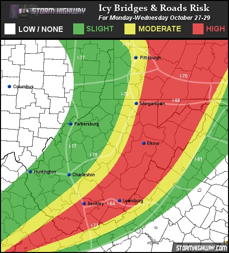
Update 8:57PM Saturday: West Virginia Icy Roads Forecast
Based on the current outlook, the greatest risk for icy roads from Sunday through Thursday will extend north and south along the higher elevations of the Appalachians, with the risk increasing and spreading farther westward into the lower elevations from south to north. Lake effect snow will be a factor during this event, bringing a risk of icy roads to areas of western Pennsylvania and northern Ohio, downwind of Lakes Michigan and Erie. Interstate danger zones will include the mountain regions of I-64, I-77, and I-68. I-70, I-80 and I-79 from Weston, WV northward will also be zones where drivers should be cautious of icy bridges and other slick spots.
12:42PM Saturday: With this event only a couple of days away now, I decided it's time to start keeping a closer eye on it. It looks like what West Virginia has in store is a borderline rain/snow upslope event from Monday through Thursday, with any small change in temperature resulting in a very different outcome. A few degrees warmer, and it will be an all-rain event in Charleston. A few degrees colder could actually cover the grass with snow. At the highest elevations, above 3000 feet, snow looks like a lock.
What the models agree on for now is that our 850mb temps (in WV, the atmospheric layer above the surface) will be solidly below freezing by Monday morning and remain that way for at least 48 hours. Subfreezing 850s mean that any precip that forms aloft will be in the form of snow. The critical factor for what will happen to those falling snowflakes is what the surface temperatures do. If the surface stays in the high 30s or low 40s, any snow aloft will melt into rain before it reaches the ground - although a brief mixture may be seen. I think that is the most likely scenario for Charleston. Any mid-30s surface temps will usually see all snow that will melt upon impact with the ground, and of course any sub-32°F surface temps will see snow making it to the ground and sticking to bridges, cars and grassy surfaces.
At this point, it looks like the typical temperature and precipitation-type gradient between the lower and higher elevations will be in play, with the lower elevations seeing mostly rain and only the highest elevations seeing accumulating snow. Again though, if temps fall farther than forecast, the accumulating snow zone may reach farther to the west into the lower foothills (including Charleston), particularly during the overnights when temps will bottom out.
The WRF/NAM model has been rather wimpy in terms of precip throughout the duration of this event, but the GFS has been more robust in the precip department. The strongest signal for snow on the GFS model is shown for Tuesday morning:
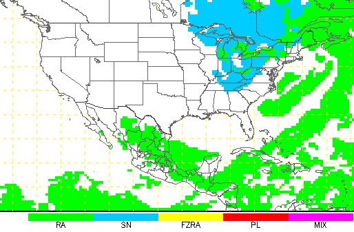
GFS ptype forecast for Tuesday morning
As for my plans, I most likely will end up in Beckley or somewhere higher up to the east, with any daylight snowfall being the priority for video. As far as icy roads go, I think that only bridges and overpasses above 2500 feet will be at risk. That risk zone could expand if temps fall more than expected.
|


