| Home | Blog Index | Blog Archives | Christianity & Faith Essays | Storm Chasing Essays
No chase today
Well, it turns out this event is a bust, except for the usual deep south regions - which have already seen some tornadoes from this system. It's not usual that I don't chase on a day when we have an upper trough like this coming in:
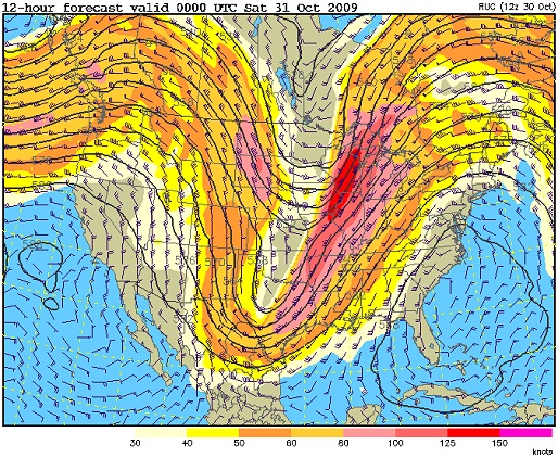
500mb pattern this afternoon
We actually have decent moisture (dewpoints in the upper 50s, good enough for this time of year), clear skies across eastern/central Kentucky and a cold front to the west:
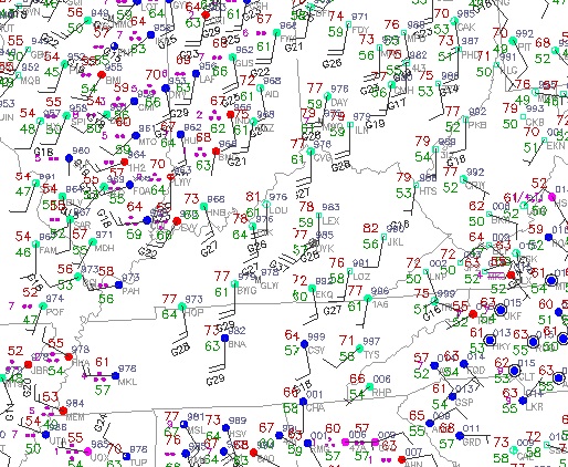
Surface obs at 3:37PM
So what went wrong with this setup? The answer lies in looking at the midlevel temperatures:
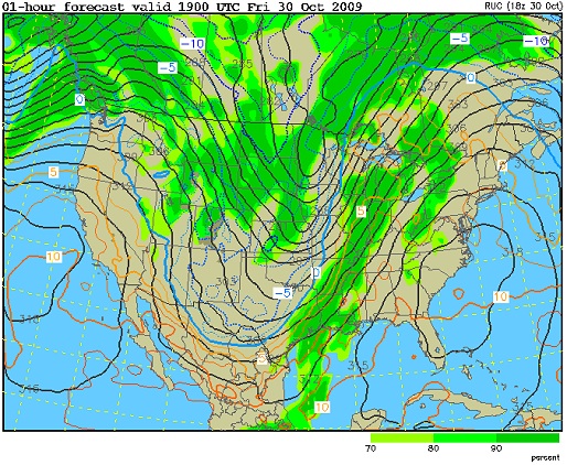
700mb temps this afternoon
(Remember that the millibar values go lower as you go higher in the atmosphere, so 700mb is lower than 500mb, but higher up than 850mb). This trough, being as strong as it is, is actually working against itself regarding the severe weather threat. The screaming winds in the midlevels and their direction/trajectory is working to not only pull warm, moist air at the surface northward, but also warm air at the midlevels from the south. Warm air overtop of warm air equals lower instability, which is what we have today. If this trough were oriented differently and/or slightly weaker, today may have turned out differently.
Looking at the surface obs above (the second map) shows another factor for the area west of the mountains - downsloping. Upslope flow moistens and cools air (encouraging fog, clouds and precipitation), while downslope warms and dries it (encouraging clearing). You can see this not only in the temp/dewpoints on either side of the mountains, but in the cloud cover obs (how much of the little circles are filled in). The satellite image below also really shows the upslope/downslope effect on cloud cover on either side of the Appalachians. So, while it is very warm around the western Appalachian slopes, it is fairly dry - canceling out any gains in instability we're getting from the clear skies.
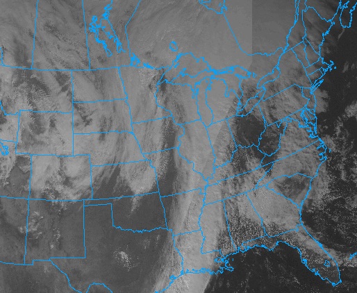
Visible satellite this afternoon
You may be asking me why I even pay attention to what the models say if they are wrong so often. The answer is simple - storm chasing is about paying attention to future possibilities and either succeeding or failing based on factors you can't see in advance. When the possibilities arise, you pay attention - because every once in a while, they end up being right about warning of something big about to happen.
|


