| Home | Blog Index | Blog Archives | Christianity & Faith Essays | Storm Chasing Essays
Rainy Labor Day weekend
Just another post to fill some space here during the quiet end-of-summer season. A low pressure circulation is spinning off of the coast of the Carolinas today. While an area of interest for tropical development, conditions are not favorable for it to become anything of note, other than a source for prolonged rainfall over the region east of the mountains. This surface ob map shows the northeasterly flow curving in from the system, you can deduce from this where the center of circulation is offshore:
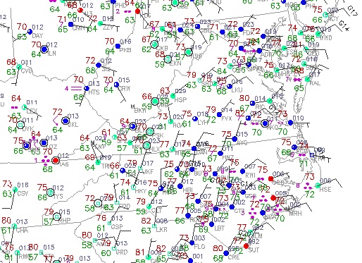
Surface obs at 1:15PM Monday
This flow may push some Atlantic moisture westward over the mountains in the next couple of days, bringing another round of steady rain to Charleston and surrounding areas. It's been uncharacteristically rainy for the last couple of days here, something I'd expect to see more with tropical remnants than with this type of pattern. September is normally a very dry month for the Appalachians.
Late in the upcoming week, models are hinting at an interesting cutoff low pattern developing in the country's midsection:
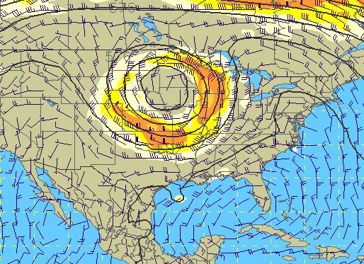
GFS 500mb forecast for next Monday
While winds across all layers in such a pattern tend to be unidirectional, some decent storm events may pop up on the leading side of this system from the Midwest on eastward. In the long range, models are showing a deep eastern troughing pattern which would mean cloudy and cool weather for the eastern half of the US. In fact, the trough shown is so deep that I would not be surprised to see some frost in the West Virginia mountains sometime in the next 2 weeks if the models are correct:
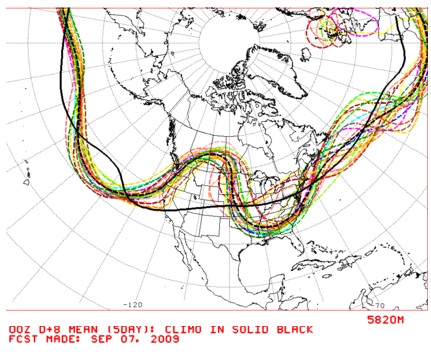
NCEP long-range model spaghetti plot
|


