| Home | Blog Index | Blog Archives | Christianity & Faith Essays | Storm Chasing Essays
July storm slowdown; learning local climate
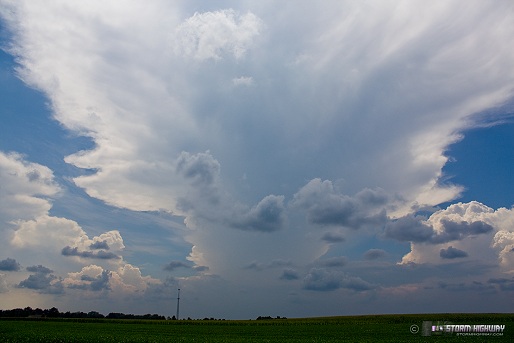
An isolated thunderstorm over south St. Louis viewed from New Baden blocks out the sun this afternoon, flanked on all sides by convection. Everything is nearly gone now (as of 6PM).
click to enlarge
click to enlarge
A slow late July pattern has taken hold in the Midwest. With the upper support far to the north and the atmosphere seasonably warm and thick (in height), storms are moving slowly, disorganized, heavy rain-laden, and generally have less of a punch. Summer in the Midwest is quite variable, with the full spectrum from downtimes to severe weather events possible at virtually any time. Whether this pattern will persist remains to be seen.
After 17 years of living in West Virginia, I had a pretty good handle on what to expect as far as the typical weather patterns throughout the year. While there are occasionally deviations from the norm, I knew what to expect, because I'd seen nearly 2 decades of it. This year, I'm having to start nearly from scratch on building my 'mental climate notes' on the Midwestern patterns. Climate data is plentiful, but there is really no substitute for 'living and chasing' the weather to get the best handle on it.
With little to no topographical or maritime features to influence our weather here, things are mostly at the whims of the upper patterns, and therefore can vary greatly from year to year. Much more so than in the Appalachians. For example, I consistently chased that the summer storm season in and around Charleston, WV is typically on its way out around the first or second week of August. That's not true here in the Midwest, where storms frequently continue much farther into the fall season. In the Appalachians, eastbound storm complexes frequently weaken/dissipate on approaching the mountains. There is no such weakening mechanism here - storms dissipate when they outrun an instability axis or upper support, which are much more variable factors in time and space than a fixed mountain range. By late September in most years, the central Appalachians have seen their last thunderstorms of the summer. A relatively quiet period lasts into late October, at which time the first upslope and mountain snows begin. No such reliable timeline can apparently be expected here in the Midwest. Winter severe weather/tornadoes are more common here (my town was hit by an F3 in December of 1982), meaning there's no chasing 'off season'. And so on.
Having spent only one spring/summer here, I can't make too many assumptions on what to expect in the future. The only thing to do is just to be ready for anything at any time. Should be an interesting ride.
|


