| Home | Blog Index | Blog Archives | Christianity & Faith Essays | Storm Chasing Essays
Upward tower lightning and Blue Ridge supercells - April 27, 2011
HD EXPEDITION VIDEO: Upward lightning at WVAH TV tower, 4/27/11
There isn't much that I can say about the tragically historic tornado outbreak that occurred on Wednesday. I think most every person involved in some way with storm chasing and severe weather is nearly speechless about it right now as the videos, pictures and casualty reports continue to roll in. As trivial as it may seem in light of the situation to our south, I'll share the following of my account covering the northern extent of this event.
The last thing I thought I'd be doing this spring is intercepting tornado-warned supercells in the Blue Ridge Mountains at night. But that's how this day's events turned out.
A Monday to Friday business trip in my old hometown of Charleston, West Virginia placed me within the threat area of Wednesday's major outbreak. My work project ended at 3PM, which initially had me worried about being too late for an early supercell/tornado event in one of two targets: the Lexington-Morehead area of central Kentucky, and the Blue Ridge Mountain region of western Virginia. However, as the day wore on, it became apparent that neither of my targets were going to produce before dark. A large area of rain was hosing the Kentucky side of the setup, and the Virginia storms of interest were initiating much farther east than I had anticipated - much too far away to realistically chase. (The Virginia storms went on to produce photogenic tornadoes near Richmond and points northeast - see video from chaser Bill Hark here.)
After work, a check of data revealed no obvious target within daytime reach of Charleston, and therefore no urgency to begin driving anywhere. Thanks to extensive cloud cover and rain, there was no surface-based instability available anywhere in the region, aside from along and east of the Blue Ridge. Mixed-layer CAPE was also meager over the entire area, giving me low confidence of storms intensifying at all in West Virginia. Short-term models suggested that the weak squall line to our west could intensify toward sunset. Furthermore, a few apparent embedded supercells were organizing in the area of heavy rain to the southwest near the Tennessee/Kentucky border, on course to pass near Beckley. I felt that if these cells could begin ingesting the surface-based CAPE to the east, that they might have a shot at tornadoing.
I started the drive down the WV Turnpike at around 5PM, a surreal thing to be doing on the way to a chase target after moving to the Midwest 1 1/2 years ago. I still have my EZ-Pass transponder, which thankfully still worked! I made it as far as Mossy when I stopped to do a data check - and saw that the storms to the south were now actually weakening. Discouraged by this new development, and seeing robust electrified stratiform precip heading for Putnam County (the site of my much-photographed WVAH TV tower), I chose to bail on the Beckley play and head to the tower site for upward lightning.
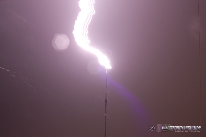
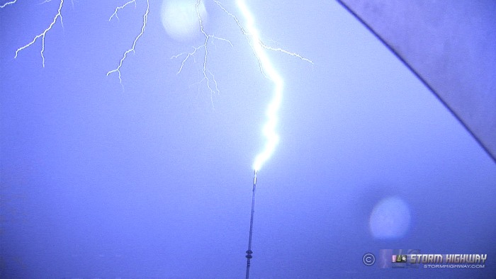
The WVAH TV tower rarely ever disappointed when it came to upward lightning, and tonight was no exception with at least 8 hits to the tower. In fact, the discharges tonight were some of the most powerful, loud and return-stroke plentiful of any of the more than 50 that I've documented at this location during the years I lived here. Absolutely incredible to witness at close range like this! Unfortunately due to the persistent wind and rain, I only managed to capture four discharges on camera - stills of two and video of two others:
This is a single discharge consisting of at least 10 return strokes:
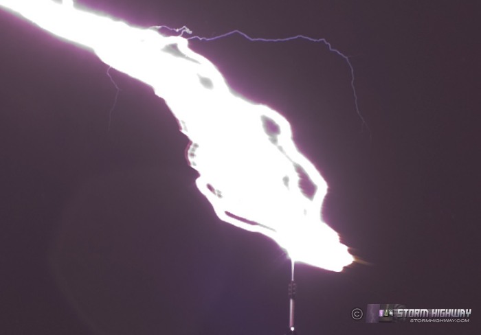
Exposure-compensated crop:
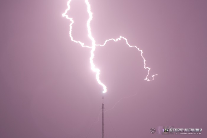
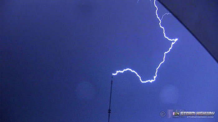
Anvil crawler that failed to initiate an upward leader:
Video still frames:
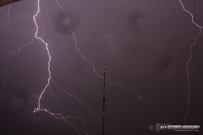
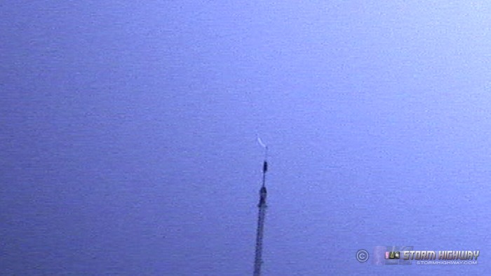
Upward leader initiation:
Southwesterly winds at the top of the tower were quite strong, audibly whistling and howling through the tower structure and guy wires. This wind also caused the lightning channels to drift significant distances as they discharged (see the video for a close-up and slow-motion replay). In the first image, the last return stroke was a newly-created path via stepped leader, evidenced by the short segment of downward branching. Nighttime still photography of upward lightning at close range like this is somewhat problematic, as the drifting 'continuing current' channels will 'smear' across the exposure (as you can see in the first image) and numerous return strokes will 'blend' together as a abnormally wide channel.
After the electrified precip shield moved off to the east, I immediately noticed on radar that storms on the eastern edge of the complex were beginning to intensify and rotate, apparrently finally tapping the enhanced CAPE to the east of the mountains. I knew right away that these were players, and that I needed to get there quickly! The problem was that I was two hours away from an intercept, exacerbated by being 20 miles west of Charleston at the tower site. All evening, I had been reading reports coming in of the magnitude of this outbreak and how efficient the storms were at tornadoing. So despite the midnight hour, the target being Allegany Summit deep in the highest parts of the Appalachian mountains in WV/VA, and moderate/heavy rain the entire way south on the curvy WV Turnpike, I decided to give it a go.
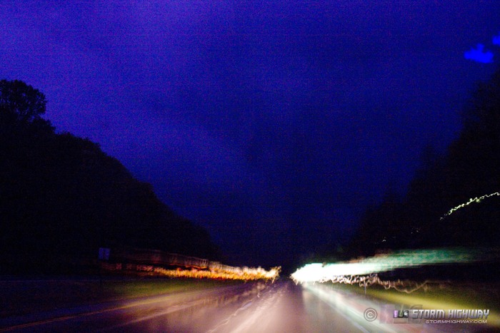
The drive south was agonizingly slow. I could not safely go faster than 55mph in most stretches of the waterlogged turnpike. Supercells near Beckley were a lost cause, racing off to the northeast. I initially planned on a White Sulphur Springs/Lewisburg intercept of the next cell in the line, but it too appeared to be smoking me to its I-64 crossing point. Seeing the lost cause of trying to beat it to Lewisburg, I chose the next cell in line down west of Wytheville, plotting an intercept course near Pearisburg, VA east of Princeton, WV along Highway 460.
The rain finally began slowing near Princeton, allowing me to resume 70mph speeds. However, by the time I turned east on 460, the storm's circulation was already due south of me. Radar markers consistently showed the storm's estimated speed at near 60mph, but I believe it was likely in excess of 70mph as I was not gaining any east-west longitudinal separation with the storm.
I entered the storm's northern flank precip at Narrows, and reached the radar-indicated circulation's road crossing point east of Pembroke. Unfortunately, after the valiant 2-hour battle to reach that spot, I could not make out any storm structure at all. I turned around and slowly inspected the area where any tornado would have crossed, but found no damage. I then began the long trek home.
As I approached Glen Lyn westbound, a new storm fired up to my west and began rotating immediately before crossing Highway 460 directly in front of me. One lightning flash revealed a low-level cloud feature over the road, but there was no way to positively identify it:
A few seconds later, the wall of precip swept over - ending any chance of chasing any supercell features with the storm, and effectively ending my chase prospects for the night.
It was closing in on 3AM as I turned north on I-77 at Princeton. I made it back to Charleston around 5AM, using my much-appreciated morning off to recover the lost night's sleep.
|


