| Home | Blog Index | Blog Archives | Christianity & Faith Essays | Storm Chasing Essays
Severe weather event & chase in IL/KY - Monday, November 14
A pretty decent fall season severe weather event took place today, better than I had originally expected after looking at data last night. As I've mentioned before, a few good October-to-February opportunities in the Midwest are not unexpected, and this was one of them. I got a late start on the chase leaving New Baden, initially behind the line of storms that went up about 50 miles to my east. I pushed east on I-64, caught up to the heavy rain at Mount Vernon, then south on Highway 45 to finally get ahead of a potent cell at Norris City right at dusk. This storm put on quite a show of CGs, but I couldn't get out of the rain long enough to fire off any shots. I dropped further south across the Ohio River bridge at Shawneetown to position in front of the next big cell in the line passing over Paducah. I caught it just north of Marion, KY. The storms here were already outrunning the tiny instability axis and fading fast, though the lightning wasn't quite done.
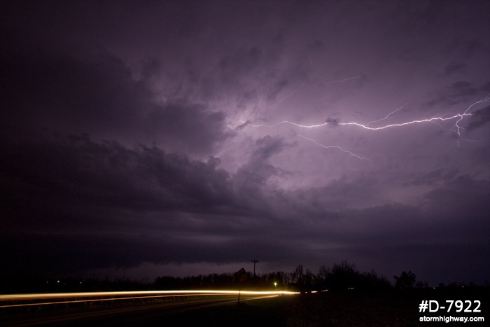
click to enlarge
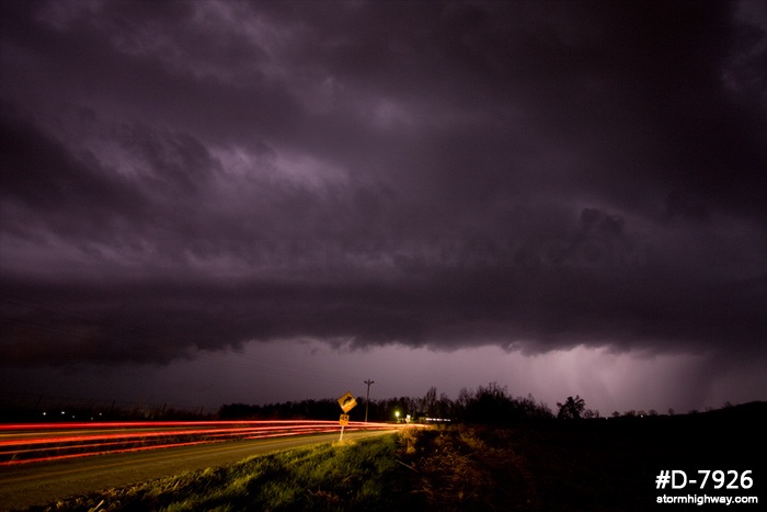
click to enlarge
I positioned in front of the hail markers about a mile to the north of where I had stopped to shoot photos, but didn't see or hear any hail. The rain was heavy enough to create a white-out that I could only inch along through, with the air full of leaves picked up by the 30 to 40mph winds. I made it back home just before 10PM.
Nice images!
- Posted by Bill Hark | | |
Thanks Bill!
- Posted by Dan R. from New Baden, IL | | |
Good job on managing to get something from this event from down your way, I really like the second image, had not seen it till now.
- Posted by Paul | | |
Thanks! Was really hoping for a CG to round out that last shot, but I'll take it.
- Posted by Dan R. from New Baden, IL | | |
|


