| Home | Blog Index | Blog Archives | Christianity & Faith Essays | Storm Chasing Essays
December 3 chase; lightning observations from Thanksgiving
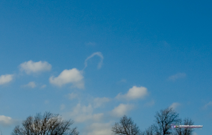
Monday's lightning chase was a bust. We just couldn't maintain the instability needed to make it happen, thanks to a delayed frontal passage allowing post-sunset CAPE values to plummet prior to the precip onset. I initially targeted Jacksonville, IL, then later moved down to Valley Park, MO. Despite my WxWorx display indicating a few lightning strikes just to the west, I didn't see a single flash. The catch of the day was this nice horseshoe funnel near Jerseyville, IL:
Click images for larger versions
Lightning from this system was confined to extreme southern Missouri, eastern Oklahoma and northern Arkansas, well out of my range for a lightning chase. I'm still optimistic about Thursday night/Friday morning and the big storm on Sunday/Monday producing lightning chances here within the home chase area, though it's appearing increasingly likely I'll need to drive an hour or two south for both of them.
observations from November 22 (Thanksgiving) lightning
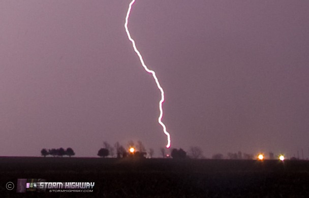
I made discoveries of items I somehow originally missed from the November 22 storm that I wanted to mention. The first is that one of the lightning channels connected to the short cell tower at Billhartz Road and I-64. This appears to be an upward flash, due to lack of branching. However, I was not able to 100% confirm this since there was no leader propagation either way visible on frame-by-frame video analysis. I don't know exactly how tall this tower is, but similar towers range from 130 to 160 feet high (here's a Google Street View image of the tower). If this was an upward flash, it will be the least-tall structure I've ever personally chased initiating one. I have seen photos of other lower-height objects initiating upward lightning, just not personally. It may be that this being a cool season thunderstorm, the charge centers of the storms may have been at lower altitudes, allowing for easier leader initiation from ground-based objects.
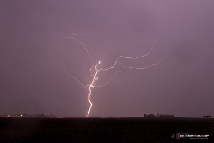
The second item of note is this lightning flash where bi-directional leader propagation is evident, allowing nearly the entire discharge structure to be visible. Notice the downward branching in the lower portion and upward branching in the upper portion. All cloud-to-ground lightning flashes exhibit this behavior, but it's rare we see the upper half of the upward-branching 'feeder' channels since they are typically enshrouded up in the clouds. Again, a lower-altitude charge structure of this cool-season storm could explain why the upper section of this flash is visible to a ground-based chaser instead of being hidden up in the clouds.
|


