| Home | Blog Index | Blog Archives | Christianity & Faith Essays | Storm Chasing Essays
May 31 Kentucky/Indiana chase
I had been watching Thursday's setup for several days prior. In simple terms, an incoming shortwave would spin up a surface low near St. Louis and send it eastward in the general vicinity of the Ohio River. When it comes to Midwestern surface lows in the spring, as a rule they are never things to ignore if they happen to entrain instability near their centers. The wind profiles near the warm front extending east from the low were great for supercells and tornadoes if a strong storm could become surface-based and rooted on the front. While I was concerned about meager instability with this event, nonetheless I felt it was a day that warranted taking a vacation day to chase.
My morning target for the day was my living room (always nice when that happens). I simply had to wait to see where the low and warm front were setting up, then once storms were imminent, hit the road. Just after noon, it became clear that I-64 was going to be the road of choice, with the first storm intercept somewhere in the Evansville, Indiana vicinity. Storms initially were unimpressive approaching Evansville, but they began intensifying rapidly upon encountering stronger instability to the east. This first picture is of the storm in Indiana just north of Owensboro, Kentucky.
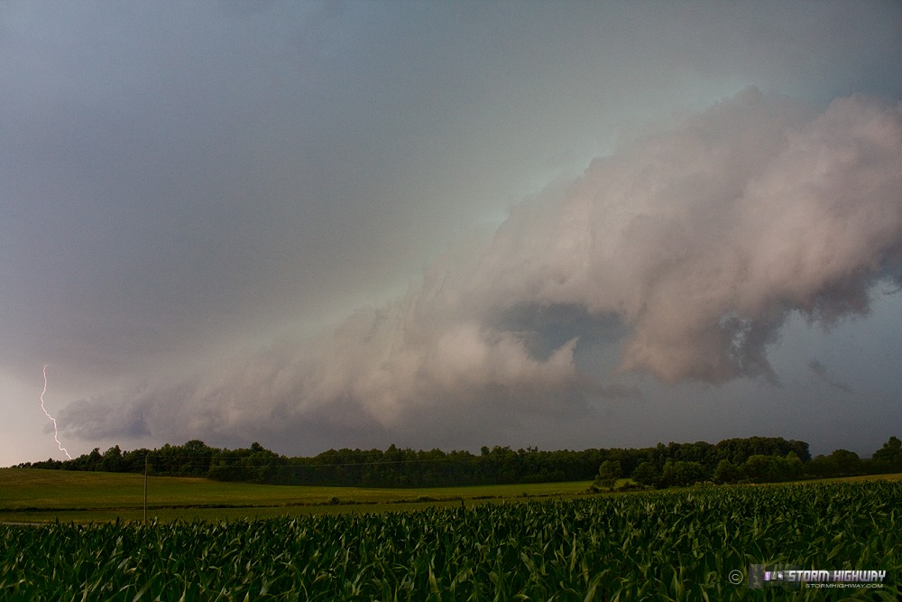
Click for larger view
The storm apparently began interacting with the warm front just east of Owensboro, as it turned right from a northeasterly direction at 40mph and began moving due east at a slower pace, about 25mph. However, the storm was severely undercut by its own outflow and never displayed a tornado 'look' nor any radar-indicated circulation. I stayed about 10 miles ahead of the storm, eventually crossing the river into Kentucky at Tell City/Hawesville. After the storm appeared to begin losing its intensity on radar (apparently crossing the warm front or outrunning a small instability max), I let it approach at Hardinsburg for a few structure shots.
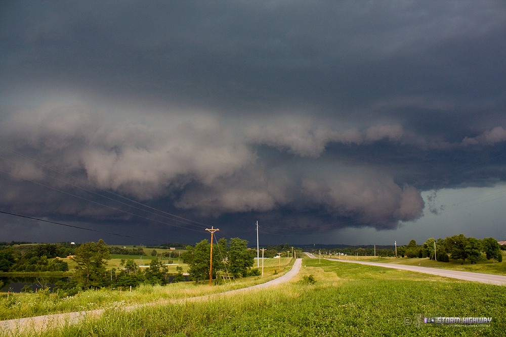
Click for larger view
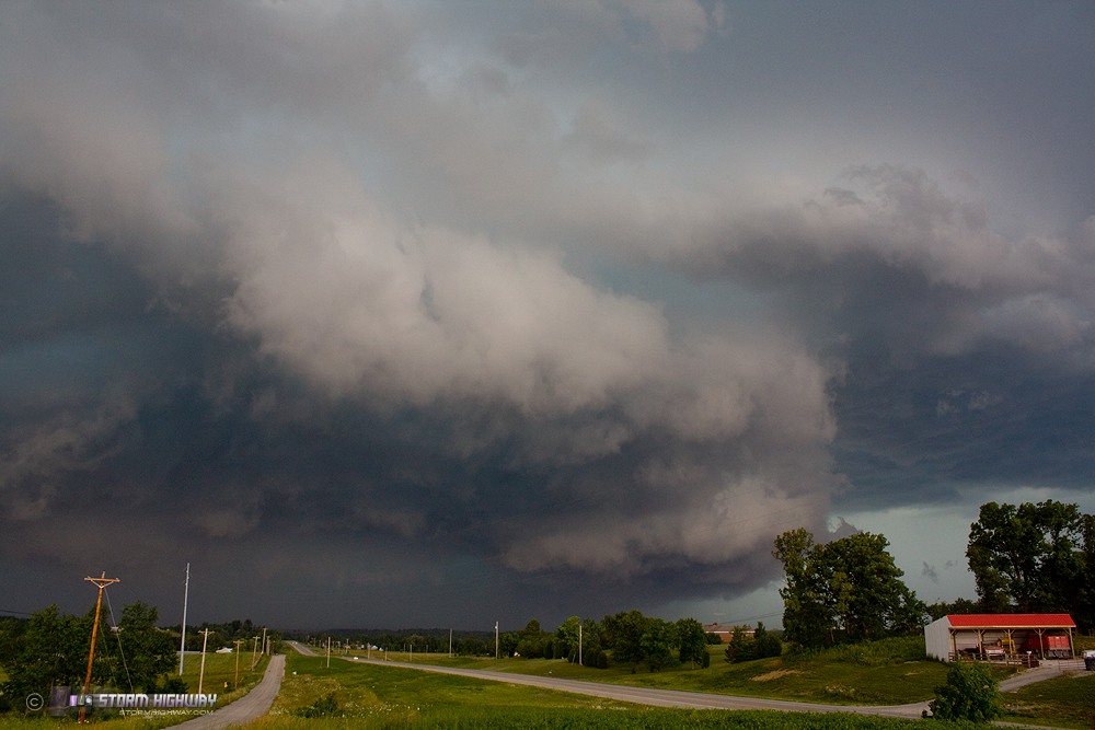
Click for larger view
After this, I headed northeast into a nice area of high VILs on radar at Irvington, but only encountered pea-sized hail. With the storm becoming increasingly linear, I didn't feel it was worth it to continue following it into the worsening roads and terrain. I headed back to I-64 at Corydon to head home.
Aside from some northwest flow MCS/lightning opportunities here in the Midwest, I don't see a whole lot in the way of tornado/supercell setups in the long ranges aside from in the *far* northern Plains. With that, I'll likely be wrapping up my watching of the Plains for spring storm chase expeditions until next year. I'll need a few more days of model runs to make that 'official'.
Cracking images Dan !!!
- Posted by Mick from UK | | |
Thanks Mick!
- Posted by Dan R. from New Baden, IL | | |
|


