| Home | Blog Index | Blog Archives | Christianity & Faith Essays | Storm Chasing Essays
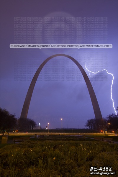
April 16 predawn St. Louis lightning
The saga continues! I really can't complain about my terrible-so-far April 2013 storm season, especially when remembering all of the past successes (like last September 25, to name one) puts things in perspective. This is just a bump in the road. This morning's resumption of the ritual of getting soaked to the core shooting lightning in downtown St. Louis was another series of frustrations now typical for this month so far. I decided to set up facing east this morning, expecting the winds to shift out of the west as the storms passed overhead, as is typical with most convective complexes. Instead, the winds shifted out of the east just prior to the storms' arrival and actually *increased* as the precip started, hopelessley and relentlessly pummelling my lenses with raindrops. Wiping them off was a fruitless endeavor, as they were instantly covered again.
Finally, after the main cores of the storms were east of downtown, the wind shifted around to the west - followed almost immediately by a very low stratus deck (scraping the top of the Arch) that blocked all of the lightning in the sky from view. I did manage to capture one bolt from this vantage point, so I can't call this shoot a total disaster. Things could certainly have been much worse!
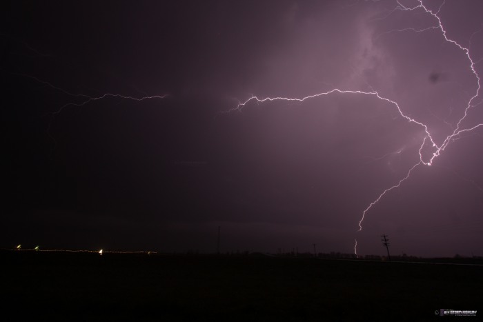
There were a few vivid bolts around I-64 as I made my way back home. I stopped for about 5 minutes south of town to take a few shots just before the low stratus deck arrived.
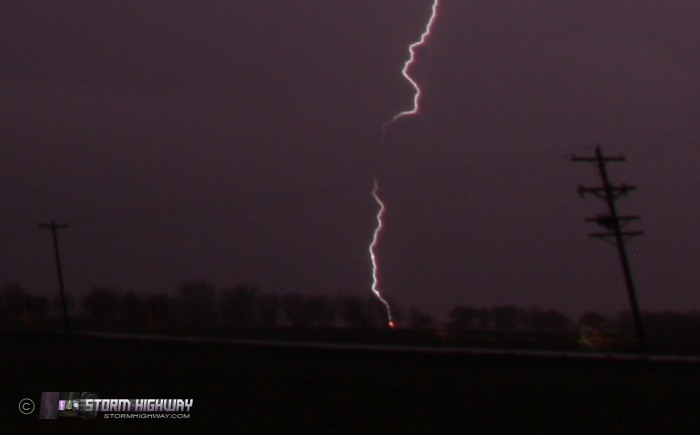
Close-up crop of the above shows this bolt lighting up a tree (or some other unfortunate object) with an orange glow:
Dan,
Could you, sometime soon, please devote a blog entry describing your general methodology for determining the timing of upcoming severe convective events in the great plains. And since I'm sure that the Internet serves as your primary source of information, could you be specific about what websites are your favorites. Thanks.
- Posted by JM from BC Canada | | |
JM, All of the data links I use are at my data bookmarks page. The link is in the right hand column of this page under "Weather Data". Some of the past Plains blog posts also talk in detail about what I look at. If you go to the Blog Archives page and look through the posts marked with the little tornado icon, you should be able to find a few of those. Your idea is a good one, I may one day put something together all in one post.
- Posted by Dan R. from New Baden, IL | | |
|


