| Home | Blog Index | Blog Archives | Christianity & Faith Essays | Storm Chasing Essays
April 17 central Missouri supercells
A better day today! My target for Wednesday ended up panning out, though it fell short of a tornado. I had my eye on the warm front that was forecast by all models to lift through Missouri during the day, progged to end up somewhere between I-70 and the Iowa border by storm time (late afternoon). As today's event drew closer, it was evident models were too far north with their placement of the front. Ongoing convection in northern Missouri impeded the boundary's northward progress, and it essentially stalled more or less right along Interstate 70 by the time I departed home just after noon. My target was in the Boonville-Columbia area, where I expected a storm would approach and (hopefully) latch onto the boundary. By the time I arrived in Columbia, the main negative with the setup emerged: the front was now actually sinking southward as a weak cold front. This meant that storms would have difficulty taking advantage of the the boundary environment before getting undercut.
The first storm to work with the boundary was this one at Sedalia. The storm wound up quite nicely for about 10 minutes, presenting this well-defined wall cloud to the south of town (click for full screen version):
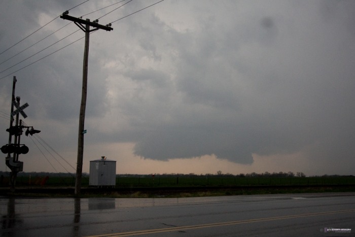
This quickly fell apart, leaving the next storm in the line as the new play. The second storm, being 'tail end Charlie', was able to maintain intensity much more than the first. This was my initial view of the rain-free base south of Tipton (west of Jefferson City), with a wall cloud trying to condense. 1.5" hail was falling on me at the time of this image (click for full screen version).
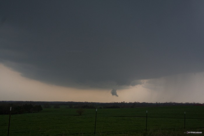
I had bad road options at this point, having to break off from the storm here and go all the way east to Jefferson City to cross the Missouri River. Just before I did this, the storm exhibited its best structure of the day as it became tornado warned. This is looking north at California, MO along Highway 50 (click for full screen versions):
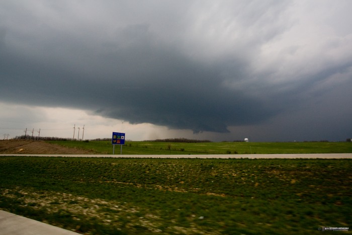
Despite my long detour through Jefferson City, I maintained a low-contrast visual on the storm. It did not appear to ever be close to producing a tornado. It crossed the frontal zone without 'grabbing' it, probably partically due to the front moving against the storms' motion and minimizing the time it had to work the boundary zone.
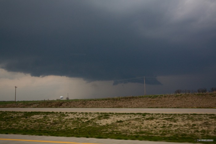
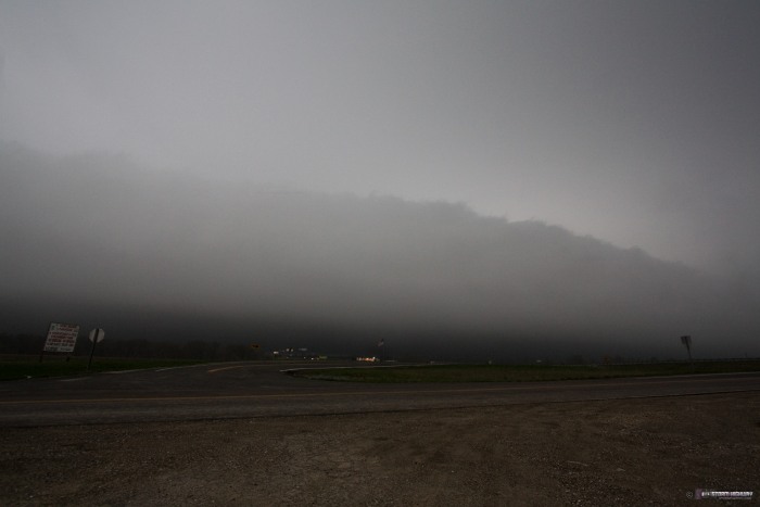
By the time I made it to I-70, the storm was now well north of the front and sending a blast of cold outflow south and east. The massive low arcus cloud that this created was pretty impressive, presenting as a ominous dark wall facing westbound drivers. Completely harmless, however. This is the view looking west near Millersburg along I-70 (click for full screen versions):
I made it home at 9PM, capping another nice Midwestern storm chase day. Now it's just a matter of awaiting the main squall line to arrive sometime on Thursday.
Hope you get a good day on Thursday Dan !
Mick
- Posted by Mick from UK | | |
|


