
|
||||||||||||||
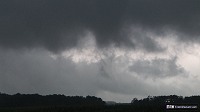
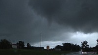
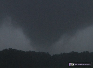
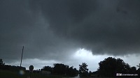
BELLMONT, IL - I observed three (possibly five) tornadoes in Lawrence and Wabash Counties in extreme eastern Illinois between Interstate 64 and Highway 50 on Monday, July 1, 2013. I believe that many tornadoes in the Midwest go competely undocumented and unchased by storm chasers (and even the general public) during unconventional atmospheric setups for tornadoes similar to July 1. Based on this event, it is my opinion that many 'cold air funnel' events actually produce true tornadoes capable of damage. GPS LOG: Click to view the GPS track for this chase Around noon on July 1, I pulled up the VWX (Evansville) radar image and noted three distinct MCVs spinning around the broad cool upper low in place over the lower Midwest. One MCV was in south-central Illinois near Mount Vernon, moving southwestward at a good pace toward Carbondale and Cape Girardeau, MO. The second was east of Evansville tracking slowly almost due west, and a third MCV was down in western Kentucky. MCVs are rich in vorticity, and are tornado threats if instability is realized near their centers. As such, I believed all three of this day's MCVs had some tornado potential. The Mount Vernon one was moving into more unstable air in southeast Missouri, and the Kentucky one was deep into a region of good instability (1000 j/kg SBCAPE or better) with several strong storms already ongoing in its vicinity. I favored the Kentucky MCV for tornadoes due to its access to better low-level CAPE, but it was simply too far of a drive for me to make in time. I was also hesitant to make the 3-hour drive to Cape Girardeau for the Mount Vernon MCV's target area. The Evansville MCV was headed generally toward my home location, and storms were beginning to go up and stay established near its center. Thanks to clearing skies near the core of the MCV and to the east and southeast, storms in this region would have steady access to a reservior of at least 500 j/kg SBCAPE. I arrived on the first storm of the day in Saint Francisville, and almost immediately began chasing funnels under the updraft. The updrafts were on the northwest side of the storms today, as the ambient surface flow (and therefore storm inflow) was northerly. Rising motion was rapid and impressive on this and all other bases I observed. Brief funnels formed and dissipated every 2 to 3 minutes, not reaching very far below cloud base. Finally the storm spun down this funnel close to the ground just west of the town of Saint Francisville:
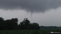  I could not confirm ground circulation due to trees, so I am not counting this as a tornado (though it may have been). I followed the storm westward, where it produced a funnel 2/3rd of the way to the ground under a stout wall cloud just west of the town of Saint Francisville. The funnel had lifted by the time I could get the camera switched on. Again, I could not confirm ground contact with this due to the tall corn, so I am hesitating to count it as a tornado, though it is probable that it was.
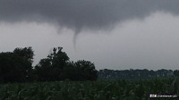
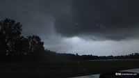
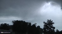
 I followed the area of rotation and rising motion west on Sand Barrens Lane. About a mile west of Highway 1 on Sand Barrens Lane, the storm produced a very weak and brief tornado just south of the road. During these storms, there were many fog tendrils reaching from ground to cloud base, producing tornado look-alikes everywhere. Therefore, motion was the key in identifying tornadoes, which fortunately is easy when rapidly rotating tendrils reach downward accompanied by rapid rising motion in the column, which was the case here. I was able to visually confirm brief tendrils of condensation at the ground with this, making it a legit - but very weak - tornado.
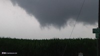
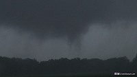
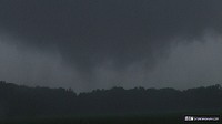
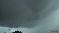
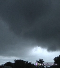
  Rapid rising motion continued in this area as I followed it slowly westward. Just as I stopped at the intersection of Sand Barrens Lane (150N) and East Harmony Road (900E), several fog tendrils appeared beneath very rapid rising motion at cloud base, connected to ground. This appeared at first to be fog being drawn into the updraft, which at first it may have been (developing due to lowering pressure in the tornado cyclone).
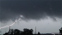
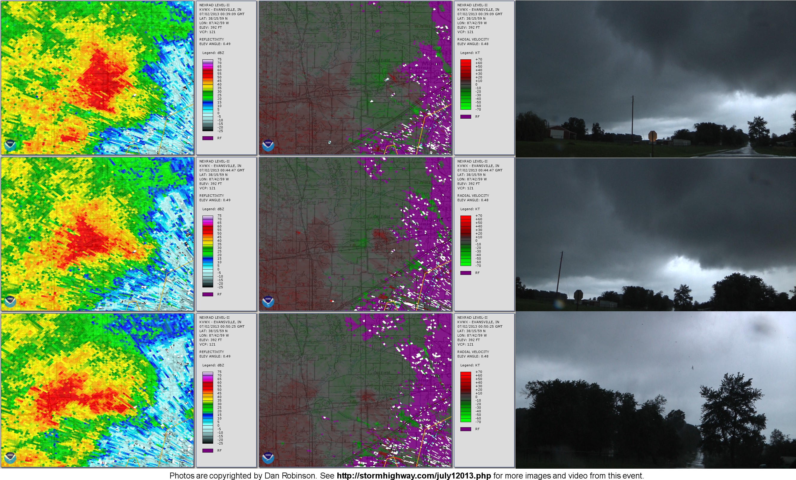
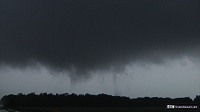 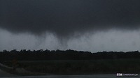 However, soon it was evident that this was not fog - the tendrils began widening, spinning and moving faster, gradually becoming the strongest tornado of the day. If there is any question about this feature, the video linked above is conclusive. The view here is looking south-southeast at the tornado. A hook echo is evident on VWX (Evansville) radar at this time, with the hook on the north side of the storm!
  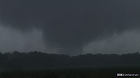
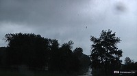
I reported this tornado via 911, as I did not have direct numbers for either NWS PAH or ILX (and I was unsure of the responsible CWA). I identified myself as an experienced storm chaser and that this was not a "cold air funnel" (I expected that the NWS would be suspicuous of tornado reports, given the environment for "cold air funnels"). After the tornado lifted, rapid rotation continued with brief funnels:
 Here are more details about this tornado that I submitted to the National Weather Service: Saint Francisville/ Sand Barrens, Illinois tornado - July 1, 2013
Lawrence County, Illinois Tornado nearly stationary approximately .5 to .75 miles south-southwest of the intersection of Sand Barrens Lane (150N) and East Harmony Road (900E).
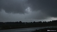
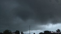
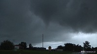
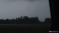
Tornado start time: Zulu 22:24:11 (5:24:11 PM CDT) Viewing location Lat/Lon: 38.5904483000000 -87.740931700000 As heavy rain obscured my view, I attempted to follow this storm southwest, but could not due to flooded roads. The storm produced several well-defined funnels while I had fleeting glimpses in between trees. I believe this storm may have produced additional tornadoes during this time, as inflow bands feeding into the storm were moving very fast, with rapid rising motion at cloud base in the brief times I had visual through trees. Cloud bases were very low, making it difficult to see base features. Radar then showed this storm expanding into a large area of rain and weakening, so I moved back east to Mount Carmel to catch the next storm in the complex. The storm's updraft moved right through the city, with rapid rising motion and, at times, rapid rotation in scud tags at cloud base. The rotation was tracking almost right along Highway 15. The power had just gone out in the area of Highway 15 and Oak Street on the west side of Mount Carmel. It is entirely probable that a brief tornado had been produced here, as I had poor visibility of the storm base while passing through the town. Just west of Mount Carmel, cloud base rotation increased dramatically and a blocky, rotating lowering was produced that made it appear a tornado was imminent. This area of rotation persisted for the next 10-15 minutes as I followed it west on Highway 15. CG lightning activity was slow but fairly constant through this entire event, with a flash every minute or two.
  A rounded 'mothership' structure could be seen around the area of rotation. I did not have time to grab a wide-angle still image of this, and it would not fit in the video camera's frame.
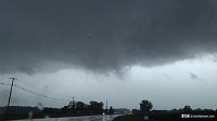
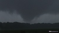
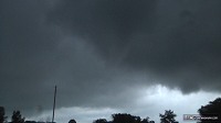
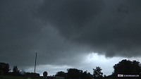
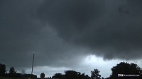
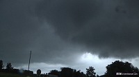
 Finally, I stopped at East 500th Road and Highway 15 to chase the storm, and a tornado quickly developed just to the south. The following images show the progression of the tornado and the debris cloud on the ground. The tornado produced a loud whooshing sound as it impacted a grove of trees, with the loud sounds of trees snapping and popping. Branches were lofted vertically. This can be seen and heard on the video clip linked above. The tornado narrowly missed several houses (I discovered this when I went back to look at the damage).
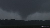
Again, I called in this tornado via 911, speaking to the same operator as before. The tornado continued moving almost due west, and began approaching its Highway 15 crossing. I approached this crossing point and chased the tornado, now very weak, moving through a line of trees next to the road and out into the field next to the road. This can be seen in the video clip linked above. Several small vortices danced in the field as they approached the road, and finally one small vortex crossed the road, just missing an eastbound car (I had tried to warn the driver by flashing my lights). This sequence is in the video above, but the small vortex crossing the road is not easy to see due to the low light.
  Trees at a residence on the north side of the road shook as the now very weak tornado struck them. After this, I could not see any further evidence of the tornado, either via cloud base rotation/funnel or ground effects. I followed the storm west for another 2 miles as it displayed a wall cloud with rising motion. After this, heavy rain filled in around this feature, obscuring it. Here are more details about this tornado that I submitted to the National Weather Service: Bellmont, Illinois tornado - July 1, 2013
I moved back west to Mount Carmel to chase the next storm crossing the river from Indiana, but darkness prevented any visual discernment of base details. I could see a similar structure as the previous storms, and again, it is very probable that this third storm produced additional tornadoes given the identical environment.
Wabash County, Illinois Tornado track start: Approximately 500 feet south of N 1220th Boulevard and 1/2 mile west of Co Rd 550E. Time: Zulu 00:40:51 (7:40:51 PM CDT) Tornado crossed E 500 Road approximately 500 feet south of N 1220th Boulevard. Time: Zulu 00:41:47 (7:41:47 PM CDT) Tornado crossed Highway 15 approximately 500 feet southwest of N 1220th Boulevard. Time: Zulu 00:43:48 (7:43:48 PM CDT) Tornado track end: 500 feet east of Highway 15 and 200 feet south of N 1220 Boulevard. Time: Zulu 00:44:01 (7:44:01 PM CDT)
Tornado start time: Zulu 00:40:51 (7:40:51 PM CDT) Viewing location during tornado start through its E500th road crossing: Lat/Lon: 38.4005600000000 -87.893180000000
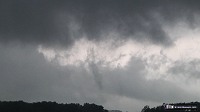
Radar imagery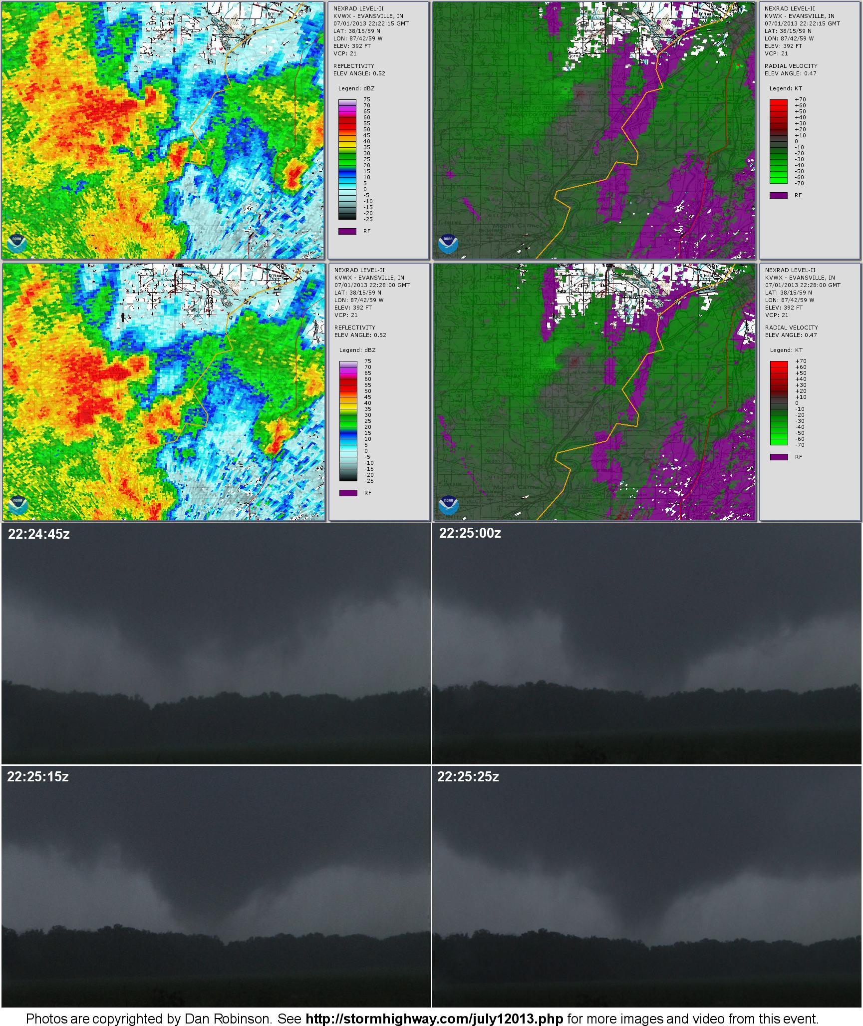
|
||||||||||||||


Web Site Design and Internet Marketing by CIS Internet