| Home | Blog Index | Blog Archives | Christianity & Faith Essays | Storm Chasing Essays
DAY 10: Oklahoma hail and lightning day
A long chase today. I began in Salina, heading southwest toward my target along the dryline in southwestern Kansas. As the day progressed, rain and messy disorganized storms developed just to the east of the dryline in Kansas. This was going to leave a rather narrow uncontaminated instability axis for any storms that did fire on the dryline, so I headed south into the Texas panhandle, where storms in progress would have untainted atmosphere to work with as they moved east. A lone supercell in the area of best parameters was heading toward Follet, so it was my play. However, this storm's updraft rapidly dried up, followed by all of the Texas panhandle storms quickly going strongly outflow dominant.
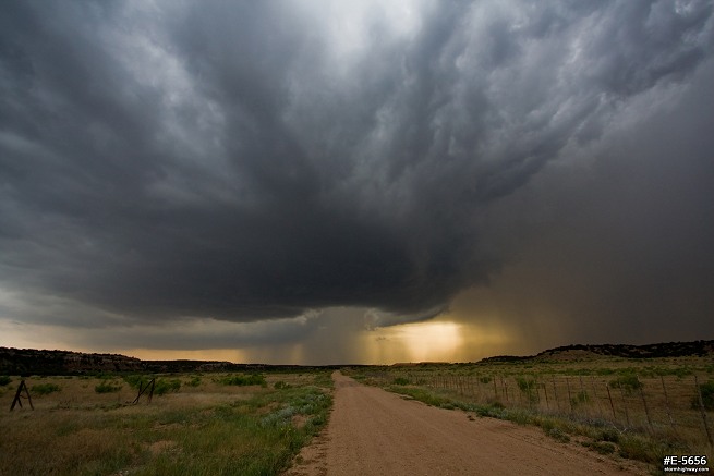
I saw no other option but to keep going south to the tail end storms near Wellington, Texas moving toward Oklahoma south of I-40. These storms were high based, but worth staying with and watching. This was the appeareance of a storm along Highway 30 about 8 miles south of Erick, OK as it crossed the border from Texas:
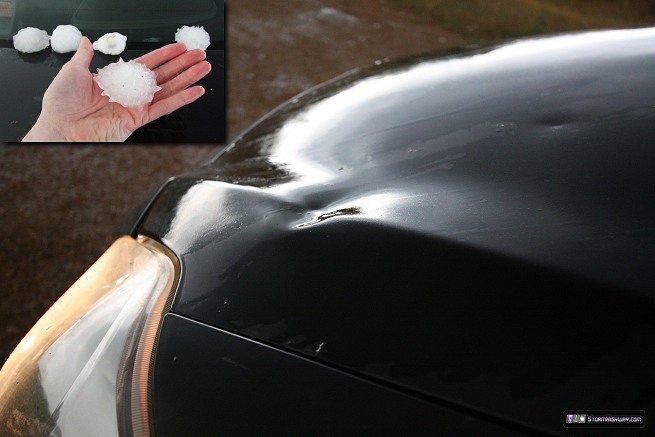
I drove north to sample the core of this storm, which radar algorithms estimated at 2". I found hail that size and slightly larger, which gave me my car's first dents:
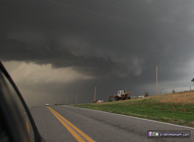
As the next storm to the southwest approached, it started winding up, producing baseballs that began bouncing on and next to the road. I quickly bailed south to exit the hail (and thanfully taking no further impacts), looking back to see a well-defined RFD clear slot just to the north:
The storm looked quite good on radar and the RFD cut was certainly ominous, but the storm was still very high based. There were now no good road options east to keep up with this storm. I had to either go back north on Highway 30 and then I-40 east (through the hail core again), or I could go down to Highway 9 and take the long way around to Highway 283/34. I chose the southern route, which would take me a long way from the storm before I could re-intercept. I managed to catch the now tornado-warned storm on Highway 34 south of Elk City. The storm was visually outflow dominant, however, and I couldn't make out any suspicious areas in the mess. No longer impressed with the storm, I ended the chase and headed up to I-40 to move east and look for a hotel room.
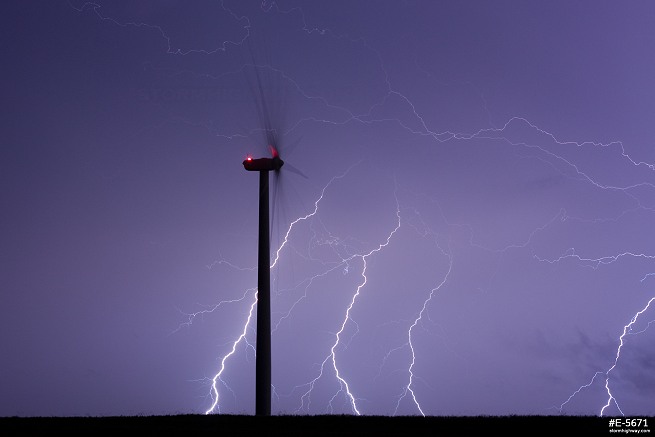
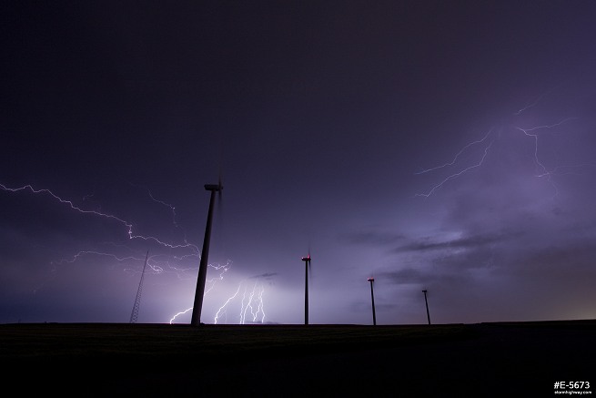
The CG lightning in the now MCS was frequent, so I stopped briefly in Weatherford to shoot some photos at the wind farm:
All of the hotels on I-40 were booked, from Elk City all the way into Oklahoma City. I don't know if this was due to the Moore tornado, or due to the booming oil and gas industry in the region. I finally found a room north of Will Rogers Airport for the night.
NEXT PLAINS CHASE: Oklahoma supercells, May 30 >
|


