| Home | Blog Index | Blog Archives | Christianity & Faith Essays | Storm Chasing Essays
Cold-core storms in southern Illinois - May 3
I had been watching this setup depicted by models several days in advance. At the midlevels, an unseasonably cold upper low would begin cutting off and stalling over Missouri by Friday. At the surface, a cold front would slowly stall out, and by Friday would allow stronger upper flow and colder midlevel temperatures to catch up to the warmer and more unstable air to the east of the boundary. This was not a classic cold-core tornado setup, but the juxtaposition of parameters along and east of the frontal boundary: backed surface winds, instability, cold midlevel temperatures (good low level lapse rates) and decent upper flow (+30 knots at 500mb) made it a definite storm chase day, particularly with it being right in my backyard.
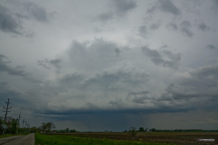
With cold-core days typically being very early-initiation events, I left at 9:30AM to head east to Mount Vernon to await the start of convection east of the frontal boundary. I slowly drifted north and east through morning and into the afternoon, ending up at Flora, IL as the first real convection began developing just to the east. This activity consolidated into a strong cell moving north-northwest, and I stayed with it into Effingham. It was very strange to intercept a storm moving in this direction! This was the view of the storm just south of Effingham:
This storm still had a long way to go to reach the surface front to the northwest, and it never made it before fizzling out. The available instability was just too weak, thanks to widespread cloud cover. A second cell coming up from the southeast suffered the same fate, losing its intensity just south of Effingham.
Seeing nothing further upstream, I decided to head over to the surface boundary in the Vandalia area along I-70. Storms were beginning to fire up along the boundary from there down to Mount Vernon. It appeared that the boundary was moving east and would threaten to undercut any storm that managed to get going along it. This is pretty much what occured from what I saw.
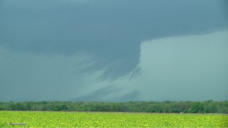
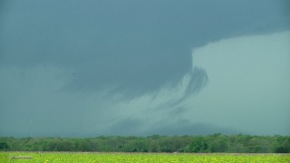
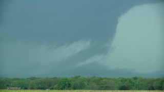
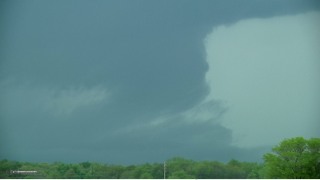
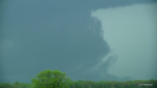
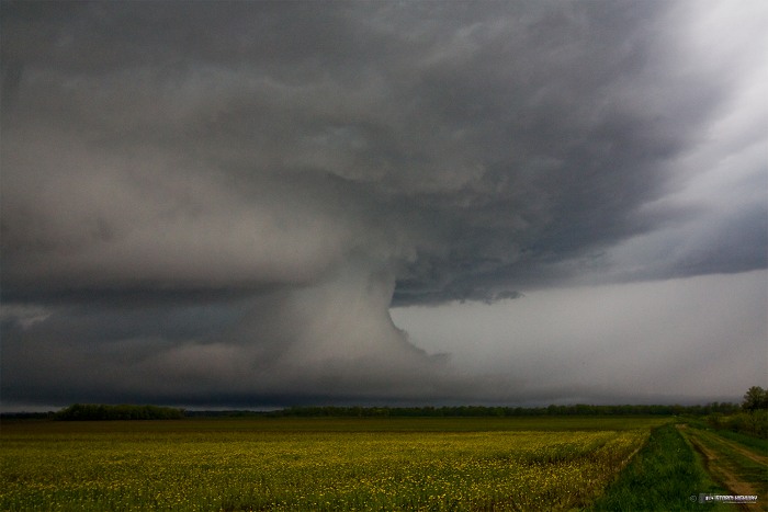
Nonetheless, the first storm I met coming up toward Vandalia exhibited one of the most interesting boundary/cold air interactions I've seen. The features it produced made for some spectacular storm structure, though all benign (no rotation, strong winds or even hail was evident with this storm). I'm not sure exactly what was taking place, though after reviewing video, it appears that once the storm made it across the front, the updraft began ingesting the shallow layer of cool, saturated air on the west side of the boundary. The cloud features here were slowly rising into the storm's base, increasing in density. Eventually, a solid mass of clouds connected the updraft to near the ground. I hesitate to call this a true wall cloud, but technically it could be called one (at least early in its evolution). Weak upward motion persisted on the right edge of this, while a gust front rapidly propagated northward to the left (exhibiting a typical outflow-generated shelf cloud). While all of this was occuring, lightning activity increased dramatically in the storm.
The following images show the evolution of this feature over the course of 5 minutes (video grabs):
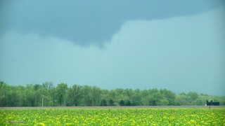     
This was the view to the west after I drove to within a couple of miles of the storm:
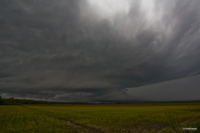
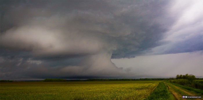
Here's a panorama of the above scene made from two frames:
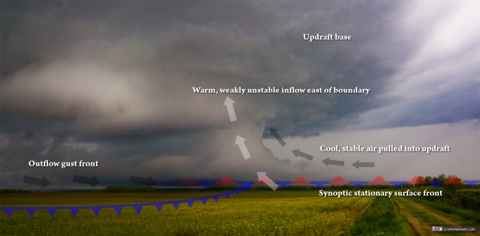
And an overlay of the atmospheric phenomena producing the structure:
I stayed close to Vandalia to watch another two storms approach, but they were both well to the west of the boundary in the cold air. I called it a day and made it home around 7:30PM.
|


