| Home | Blog Index | Blog Archives | Christianity & Faith Essays | Storm Chasing Essays
Storm chasing forecast update for April 23 - May 7
We finally have some model agreement and consistency for the system coming in this weekend, and it's (at least for now) very good news for storm chasers. A classic potent tornado setup is shown for Saturday in Kansas and Oklahoma as a strong trough moves out into the Plains, and this overtop of deep moisture, strong instability, backed surface winds and a classic veering-with-height vertical wind profile.
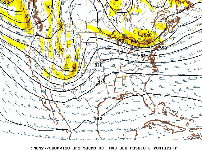
Due to the vast improvement in the models' handling of this system, I have a much greater level of confidence in 2014 Plains trip #1 happening this weekend. The departure date will be Friday afternoon if the current forecast holds in upcoming days' data. As always, there is still time for a 'model meltdown' where this setup 'tanks' - which is the reason why I'm not going past 75% on trip probabilities. Since we are now within 5 days of the event, that will get less likely with each passing run, though it's still something to keep in mind.
This system will produce at least one more day of tornado potential in the Plains and/or the Midwest as it moves east, possibly into Tuesday. After this, there is good agreement in a deep, persistent eastern troughing pattern entrenching itself. That will shut down severe weather/tornado potential for at least a week or more following this weekend's events.
As for tomorrow's (Wednesday's) system, it appears to be a fun storm chase day in western Kansas and Oklahoma, but on the low end for tornado potential thanks to insufficient moisture and instability. Again, these types of marginal days can still produce tornadoes. That said, I get my fill of those types of days right here at home throughout the year, so I tend to opt to not spend the money to go see one in the Plains. Waiting for the high-potential Plains setups like we may see this weekend is simply how I have to operate due to limited funding.
The following table charts the probability of a Great Plains storm chase expedition happening for several indicated date ranges in the near future:
| 2014 Plains Storm Expeditions - Probabilities as of April 22 |
| April 23-24 | 0% | |
| April 25-28 | 75% | |
| April 29-May 7 | 15% | |
|
Finally, severe weather! Unfortunately I won't be able to chase this weekend as I'm way too busy with other things, but once finals are over in a couple weeks I'll maybe do some lightning photography in the stl metro. Be careful out there. Let's just hope folks in the southern plains haven't become complacent with the lack of tornadoes.
- Posted by Tim | | |
There should be a lot happening in the STL metro Sunday night-Wednesday, so being here isn't all that bad.
- Posted by Dan R. from New Baden, IL | | |
|


