|
Home | Blog Index | Blog Archives | Christianity & Faith Essays | Storm Chasing Essays
More late summer storms in the St. Louis metro
Tuesday the 9th brought yet another barrage of close lightning over downtown St. Louis, but no strikes to the Arch. There was one hit at the west end of the Eads Bridge (or possibly to one of the buildings at Laclede's Landing) very close to where I was shooting video, with instantaneous thunder. I had the camera set up on my typical close framing of the Arch, so didn't capture it. This was the only lightning image I captured from this event - the bolt is passing behind the Arch here (not hitting it):
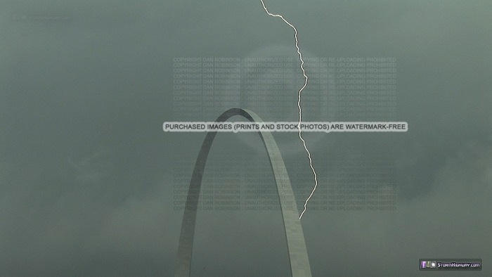
Click to view larger version
That image, by the way, is courtesy of my old video camera. I was finally able to get it working after having the necessary part overnight-shipped (in case you were wondering after the last chase account).
Wednesday brought the 'main event' as the cold front finally swept through. The pre-frontal environment was slightly conducive for supercells. A few storms north of the metro area in Illinois briefly attained minimal supercell structures. These phases were very transient and too short-lived to purposely intercept, but I managed to be at the right place at the right time to capture one such interval near Hamel. This outflowish storm rapidly transitioned with a quickly-lowering updraft base, strong inflow and rapidly rising scud tags into a developing wall cloud. The storm displayed a hook structure on radar at this time.
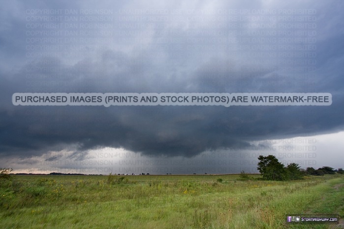
Click to view larger version
As with the others, this phase was short-lived - the storm went back to being completely outflow-dominant after only 5 minutes. I then left this scene to get back downtown for the final round of storms on the cold front. These were generally weak and disorganized as they passed over the city:
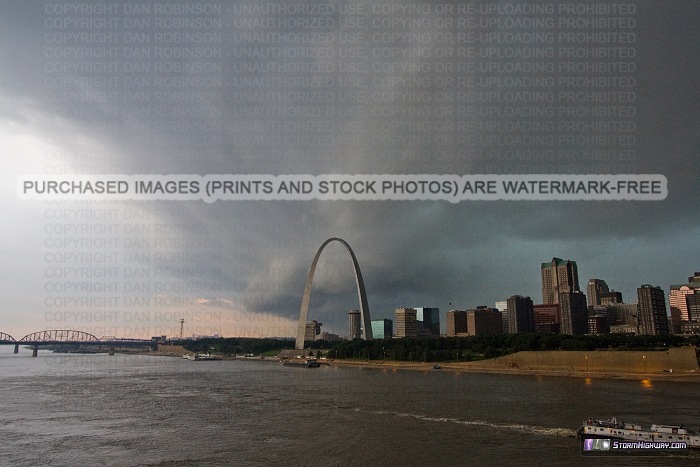
Click to view larger version
|


