|
Home | Blog Index | Blog Archives | Christianity & Faith Essays | Storm Chasing Essays
Additional images from the June 28 St. Louis tornadic supercell
ORIGINAL CHASE ACCOUNT: June 28 supercell and tornadoes through St. Louis
EXPEDITION VIDEO 1: Tornadoes at Eolia, MO
EXPEDITION VIDEO 2: Tornadoes at Eolia, MO and supercells (extended footage)
A quality storm chase day like June 28 always yields additional imagery once I have time to go back through everything and examine it closely. In this case, that re-examination revealed that I did capture the St. Peters, MO tornado (albeit a low-contrast view), and several additional stackable/stitchable still image sequences.
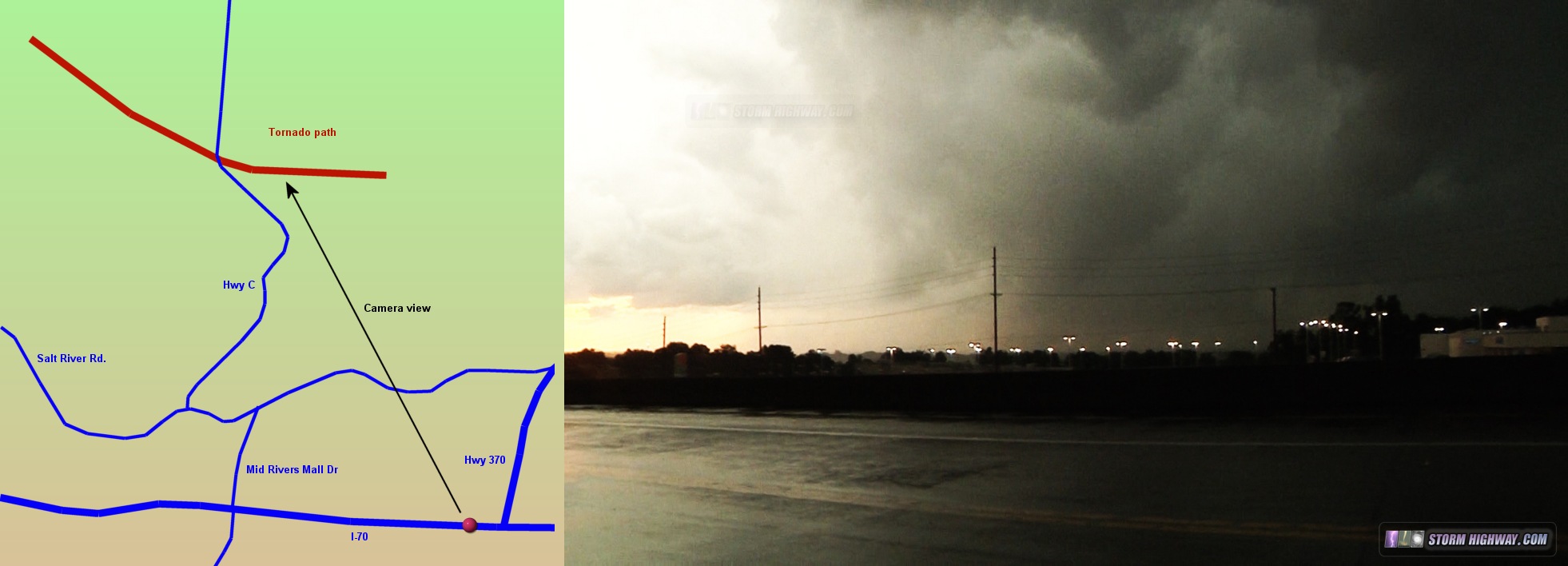
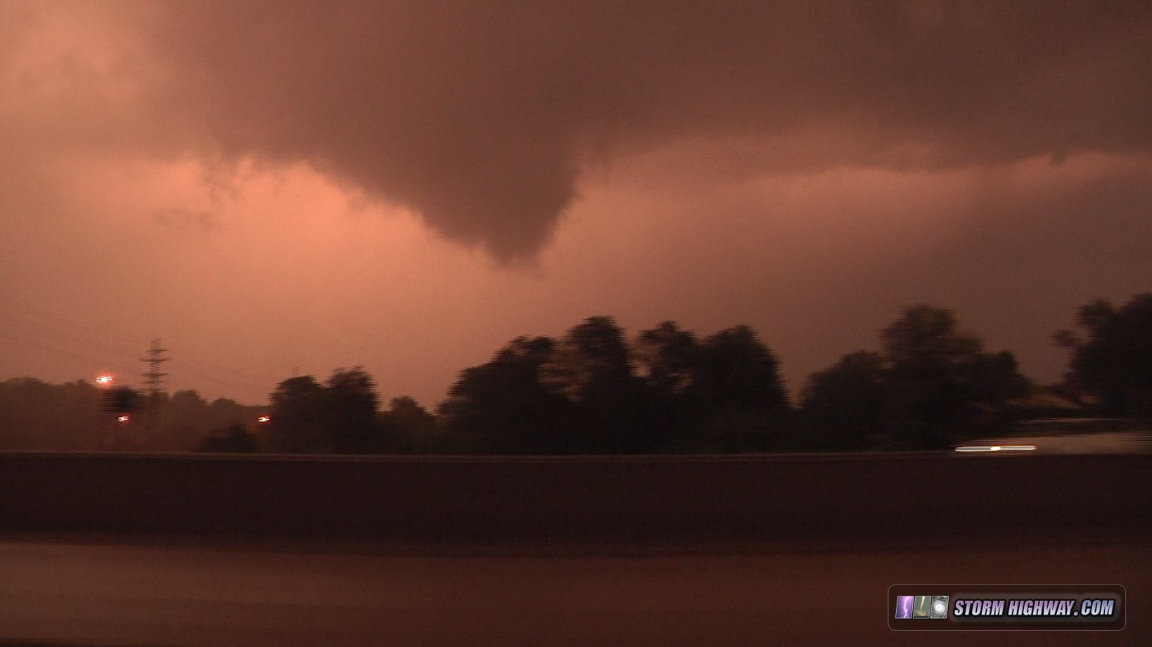
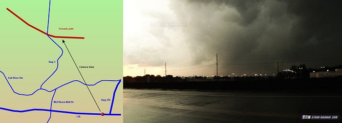
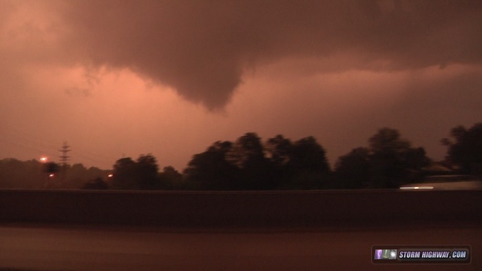
I'll start with the St. Peters tornado. I was parked on the west side of the I-70/Highway 370 interchange in St. Peters (on the south frontage road), just east of Mid Rivers Mall, looking northwest. At the time, I saw what looked like swirling debris under a truncated cone funnel. The contrast was so poor that I could not be sure of what I was seeing at the time, though I believed a tornado was in progress based purely on radar signatures. I pointed the camera at this feature in the hopes I'd be able to see something later when I was able to contrast-enhance the video. This is the result (click for a larger picture):
After this, my chase path through the city was I-70 east through St. Charles, then I-270 south to Creve Coeur, I-64 east to downtown, I-55 south to Mehlville, I-255 east across the river to Columbia and finally Illinois Highway 3 south to Waterloo. I bisected the hook of the storm at Creve Coeur, yielding this brief view of what appears to be a funnel just east of I-270, though rotation/motion in this was weak:
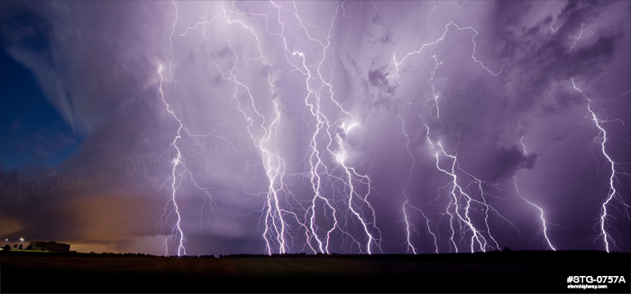
Now for the stills. My favorite of these is the stackable sequence from the storm at Columbia, just after it crossed the river. The lightning at this point was flat-out incredible, easily the best I've seen since moving here - with tall, vivid cloud-to-ground bolts in the storm's vault and forward flank precip region roughly every 5 to 15 seconds. I could have stacked 4 more frames into this, but I felt that this 5-frame merge looked the best.
These are both two-frame panorama stiches of the storm over Highway 61 at Wentzville and at O'Fallon, MO prior to the St. Peters tornado.
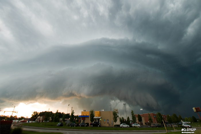
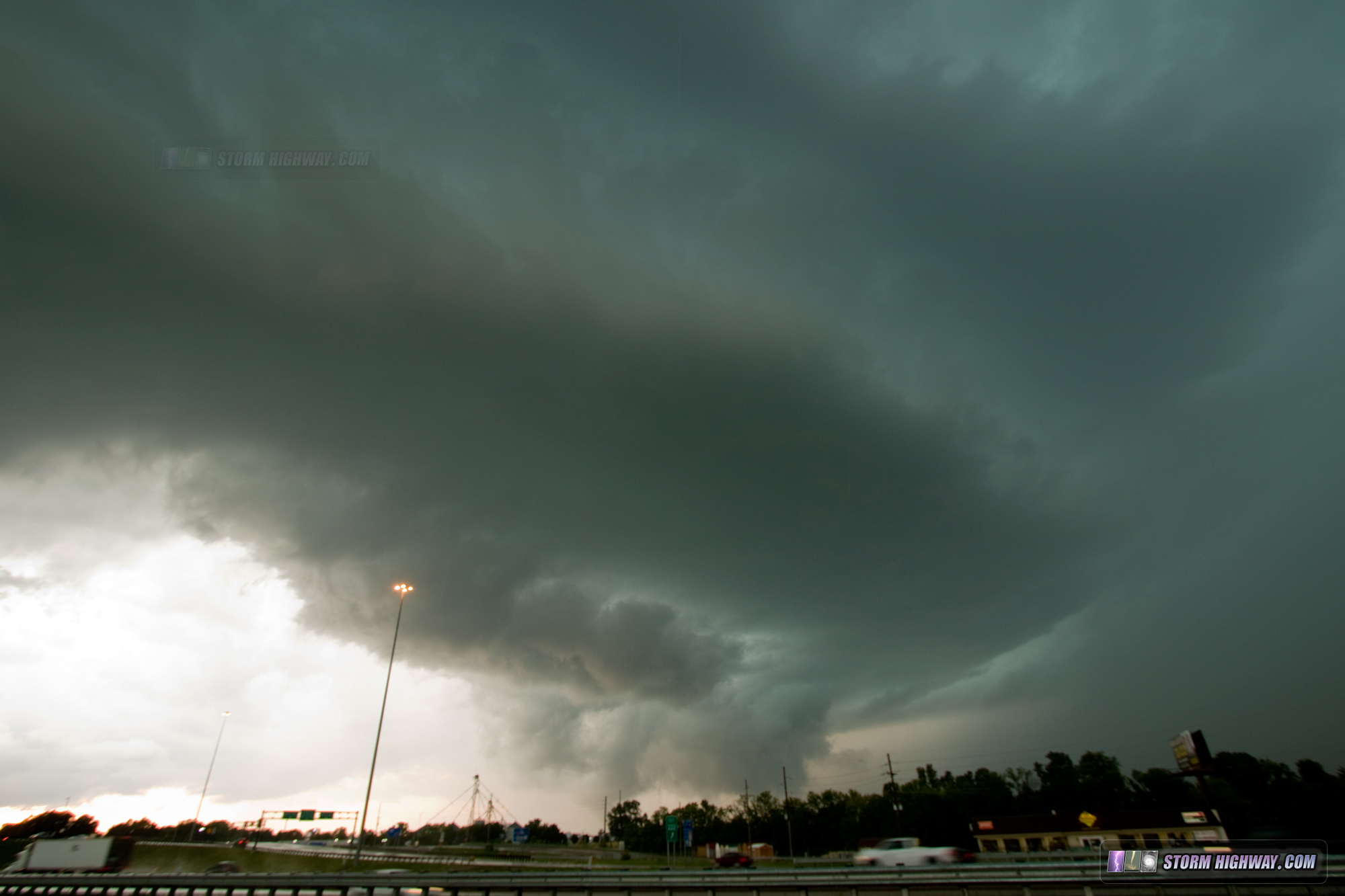
This is the St. Peters storm minutes before the tornado, viewed from Mid Rivers Mall along I-70.
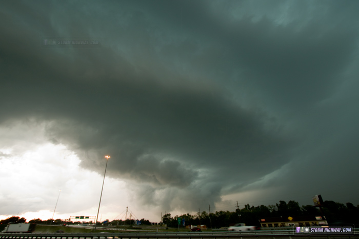
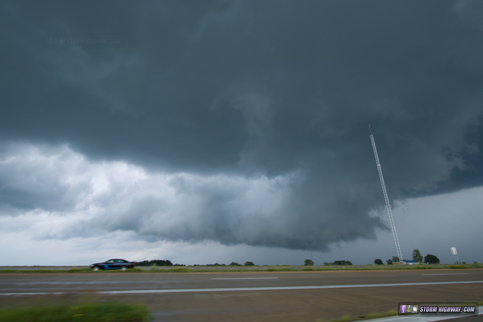
Immediately after the St. Peters tornado, the occluded mesocyclone was visible on the west side of the storm. At this point, a new meso and hook was developing to the south.
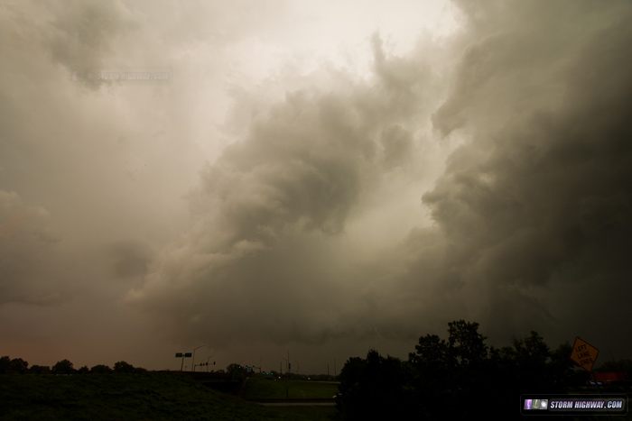
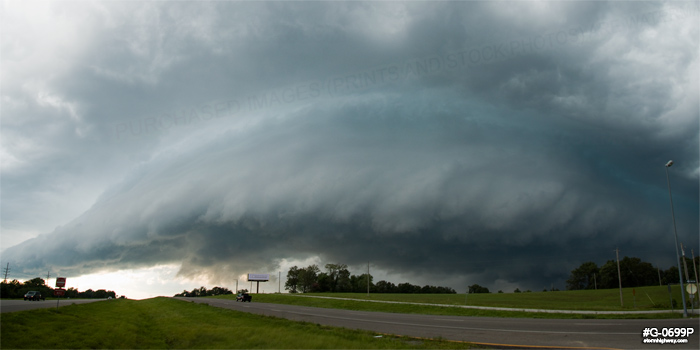
The first storm at Hannibal, MO presented this well-defined RFD clear slot and wall cloud:

|