|
Home | Blog Index | Blog Archives | Christianity & Faith Essays | Storm Chasing Essays
Tornadic supercell south of St. Louis - July 8
Our tornado season here never ends, but it's somewhat rare to get a nice warm frontal setup this far south in July. The forecast for this day was pretty clear-cut: be on the storm that went up closest to the surface low along the warm front. The problem was that this was likely to happen just west of the Mississippi River in eastern Missouri southwest of St. Louis, south of I-44 and west of I-55. If you're familiar with this area, you know it's pretty abysmal for storm chasing, with hills, trees and winding roads. Compounding the situation is that the only available Mississippi river crossings close by are on I-255 on the south side of St. Louis, and at Perryville/Chester - a 70-mile distance between the two!
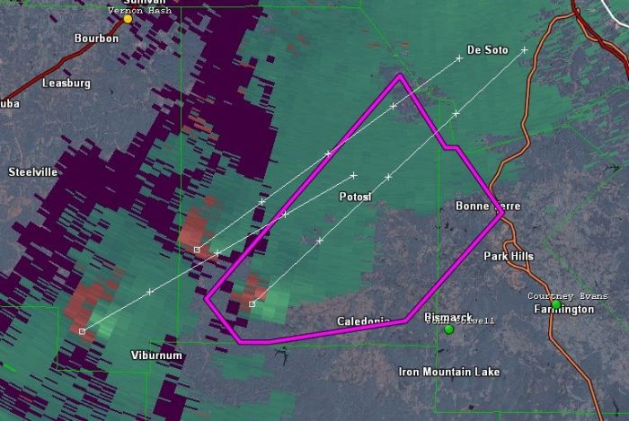
I started in Perryville on the warm front, then moved north into Illinois as the front lifted in response to the gusty south winds in place. The storm of the day fired west of Potosi in Missouri and quickly produced a tornado near Caledonia, not long after I grabbed this screen capture of three updrafts spinning up mesos (the left-most one here produced the tornado).

In this type of situation with storms forming not far west of the Mississippi River and far from either available bridge, it is almost always better to wait for the storms in Illinois. This can be agonizing, especially when strong circulations are presenting on radar and tornado warnings are issued. The problem, again, with intercepting in Missouri is that the terrain/road network is really bad for storm chasing, and plus, you lose the storm once it crosses the river. The only real place with visibility/terrain to intercept in this part of Missouri anyway is along I-55 and the river bottom to the east. If you do that, you better hope the storm produces in that narrow strip, otherwise you're done once the storm crosses the river. You have a LONG way around to get to a bridge in this area. Doable, of course, but you'll lose the storm for *at least* 90 minutes.
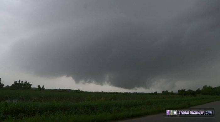
So, that's why I chose to sit between Fults and Prairie du Rocher in Illinois and wait for the storm to come to me. Once I had the storm there, I would have good terrain and a nice road network to keep up with it the rest of the evening. Unfortunately, the storm was done producing tornadoes before it crossed the river, with the only interesting feature being this wall cloud as it closed in at Fults.

I followed the storm to Hecker, with the road I was on keeping me right under the RFD clear slot. I had a great view of the wall cloud and updraft as it slowly shriveled and separated from the rest of the core, itself weakening and moving off to the east. By 8:00PM the storm was gone, with nothing but shredded cloud debris evaporating away. At this point it was game over for everything close to home, with the only play being storms down near Cape Girardeau. I wouldn't make those before dark, and with the warm front still lingering up north, I didn't think they'd be worth the drive even if I had more daylight.
I wasn't too upset about missing the tornadoes in Missouri, considering I'd have never targeted there to begin with unless the setup was much farther west.
|