|
Home | Blog Index | Blog Archives | Christianity & Faith Essays | Storm Chasing Essays
Midwest components of Plains tornado events
It is common for tornado events in the Great Plains to have lesser-known components in the Midwest region. In nearly half of big Plains tornado days, there were simultaneous tornadic supercells in the Midwest. For the purposes of this study, I'm defining the Midwest region as Iowa, Missouri, Illinois, Indiana, Kentucky, Arkansas and Tennessee (in essence, everything east of the Great Plains states of Oklahoma, Kansas and Nebraska).
Characteristics of Midwest tornado events during Plains setups
- One major ingredient was present in nearly all cases: a sharp synoptic warm/stationary front extending east from the triple point in the Plains. Aside from one or two outflow boundary/open warm sector cases, all Midwestern tornadic supercells during these events occurred along this primary surface boundary. Warm/stationary fronts are rich in low-level shear and can enhance tornado potential if an organized thunderstorm interacts with one, particularly if the storm tracks along the boundary.
- Upper flow (greater than 35 knots at 500mb) associated with the synoptic system to the west was present overtop of this surface boundary in most (but not all) of the cases, providing large-scale ascent to help initiate thunderstorms and deep-layer shear for storm organization.
Great Plains tornado events with no Midwestern component tended to have one or more of these characteristics:
- A negatively-tilted shortwave trough or a trough with meridionally-oriented flow over the Plains. These patterns tend to confine all upper-level support far to the west in the Great Plains, leaving the Midwest region without large-scale ascent and deep-layer shear.
- A narrow warm sector in the Great Plains. In these cases, the Midwest region is completely outside of the synoptic warm sector.
- Despite the boundary, surface-based instability and upper support being present, in some cases no thunderstorms initiated along the surface boundary in the Midwest to take advantage of an otherwise favorable environment.
CASES: Great Plains events with Midwest tornadoes
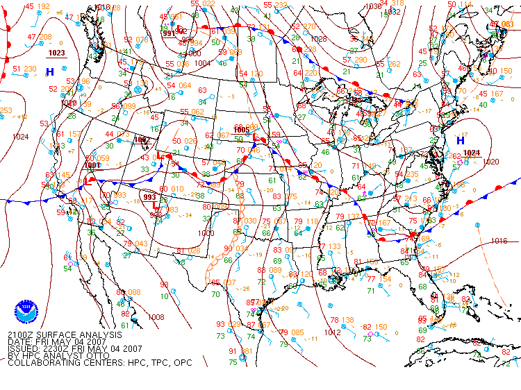
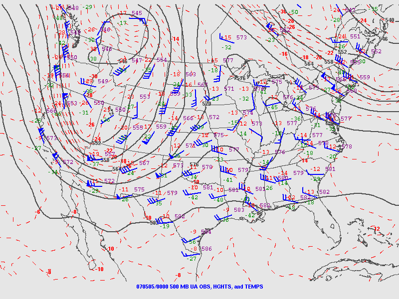
(This is not an all-inclusive list, many more could be added.) In this secton, I'm including SPC storm reports, the HPC surface chart and 500mb charts for each event (where available). You can click on each to view in full size.
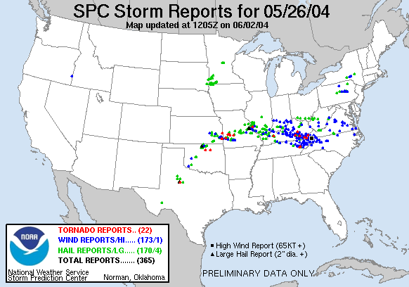
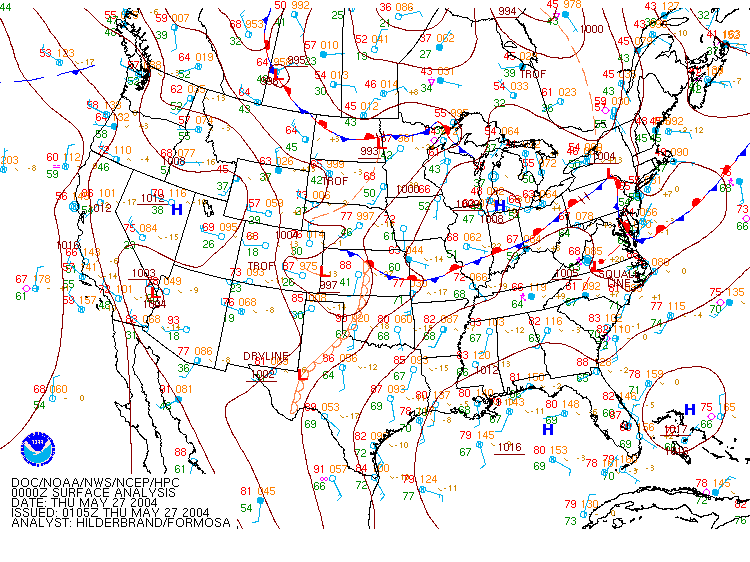
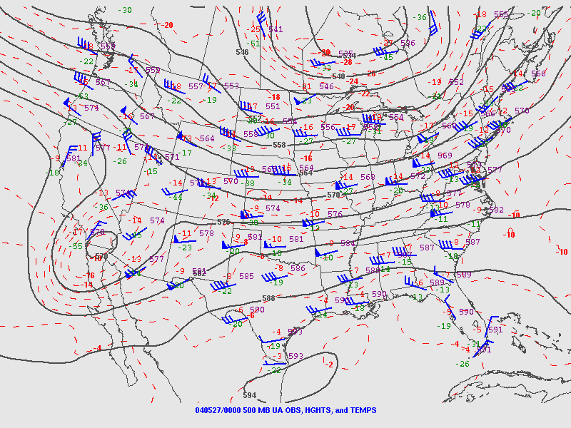
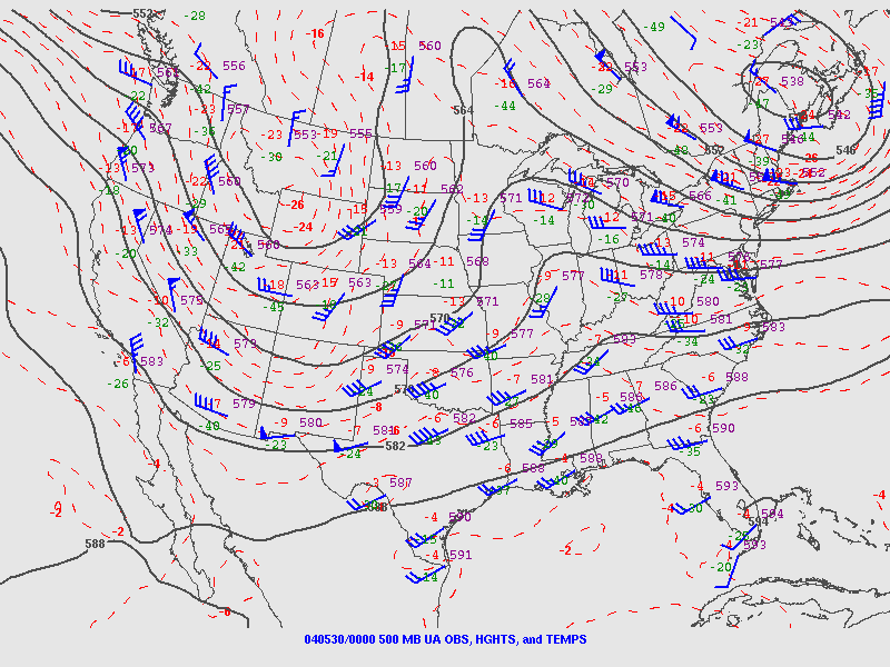
May 26, 2004:
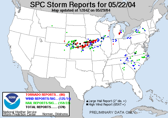
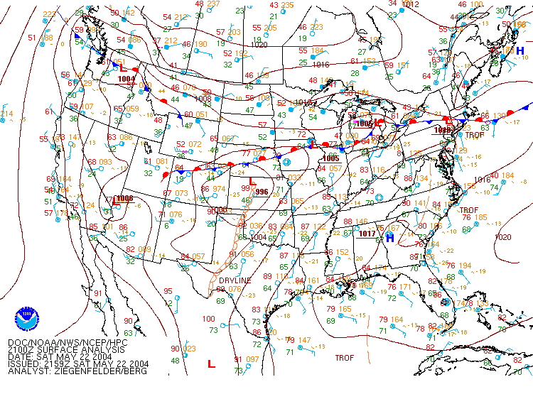
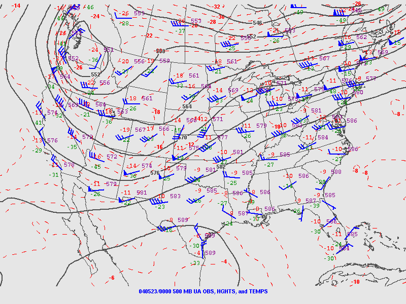
May 22, 2004:
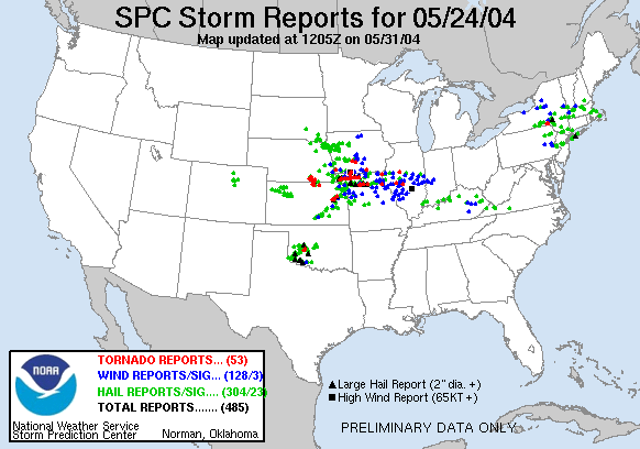
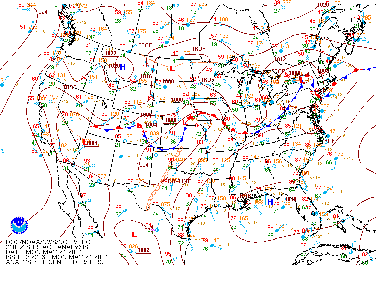
May 24, 2004:
  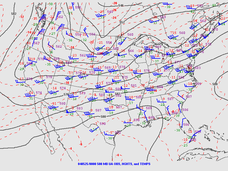
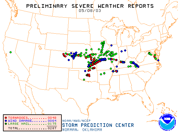
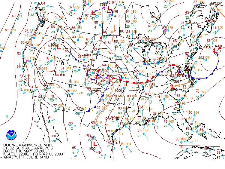
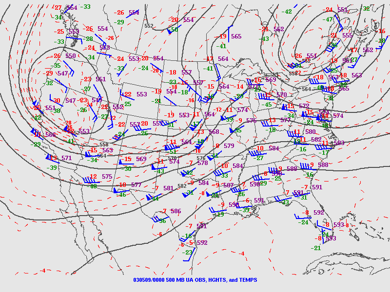
May 8, 2003:
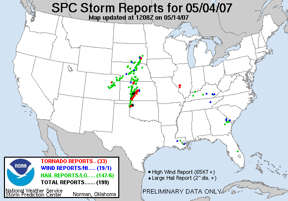
May 4, 2007: Tornadoes occured near St. Louis where a convective MCV interacted with the surface boundary.
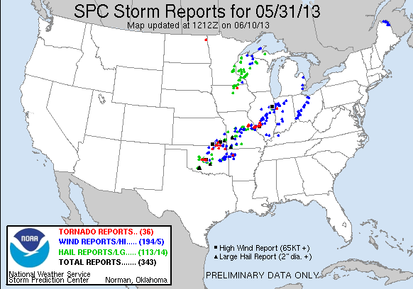
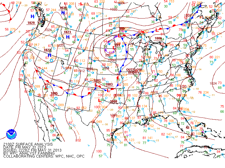
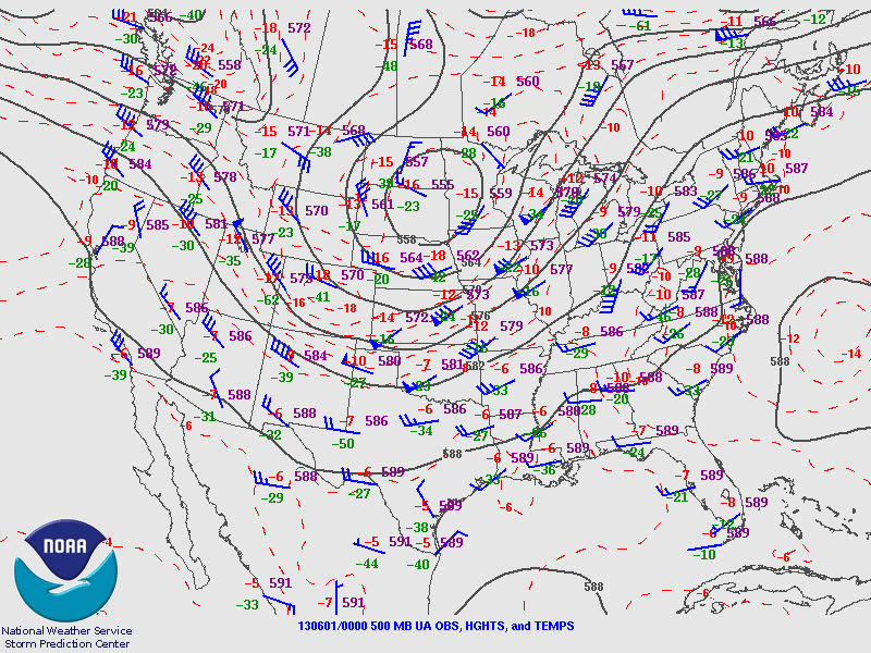
May 31, 2013: No synoptic surface boundary was present, but the St. Louis area tornadoes occurred as a result of a squall line entraining an outflow boundary from morning storms.
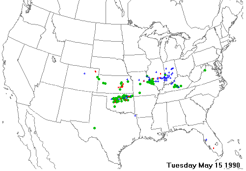
May 15, 1990:
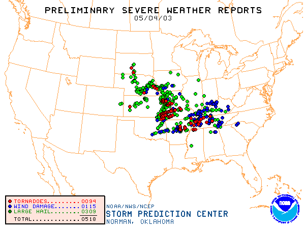
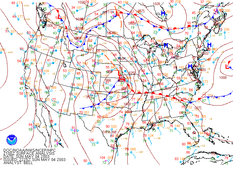
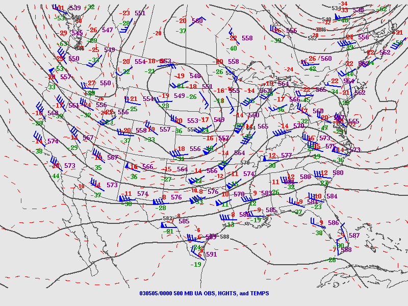
May 4, 2003:
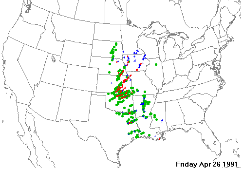
April 26, 1991:
 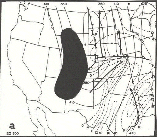 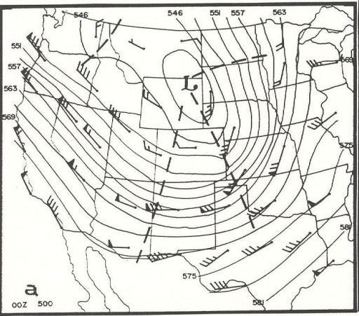
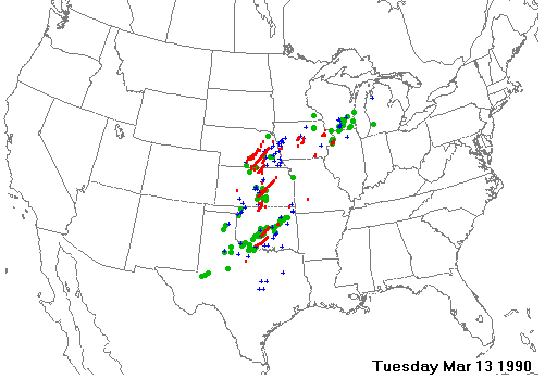
March 13, 1990:
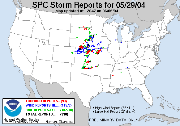
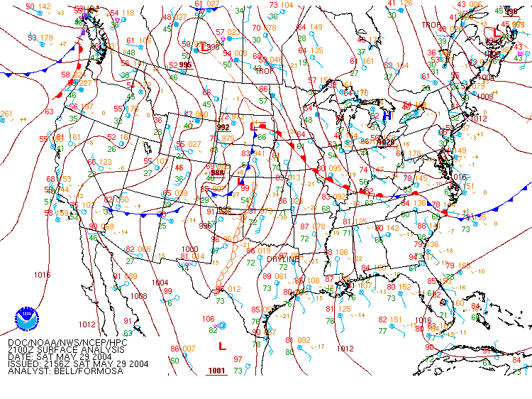
May 29, 2004: Open warm sector supercell in Missouri near Kansas City.
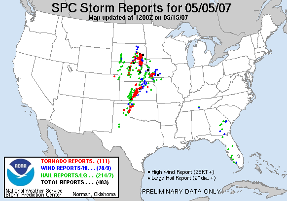
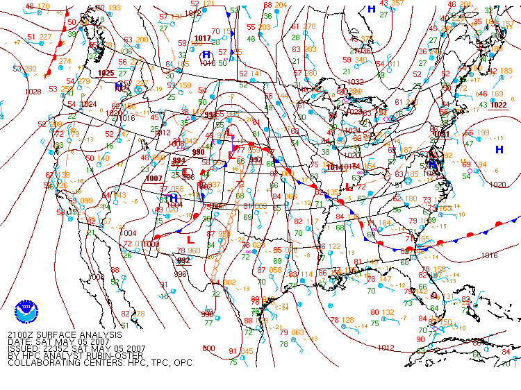
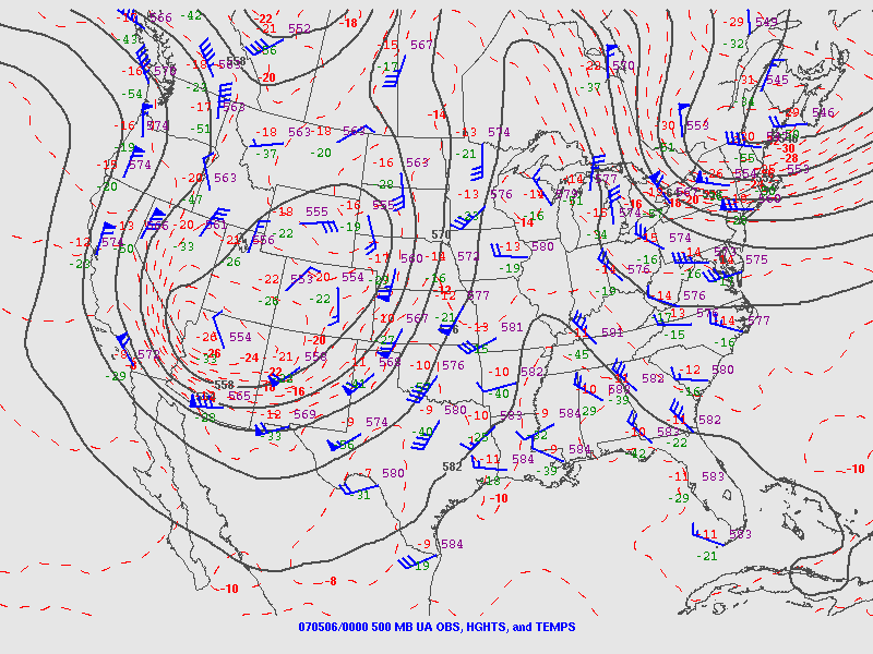
May 5, 2007:
CASES: Great Plains events with no Midwest tornadoes
There are many more examples that could be placed into this category, but I'm showing two to illustrate the comparison.
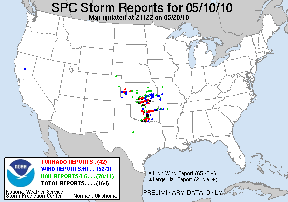
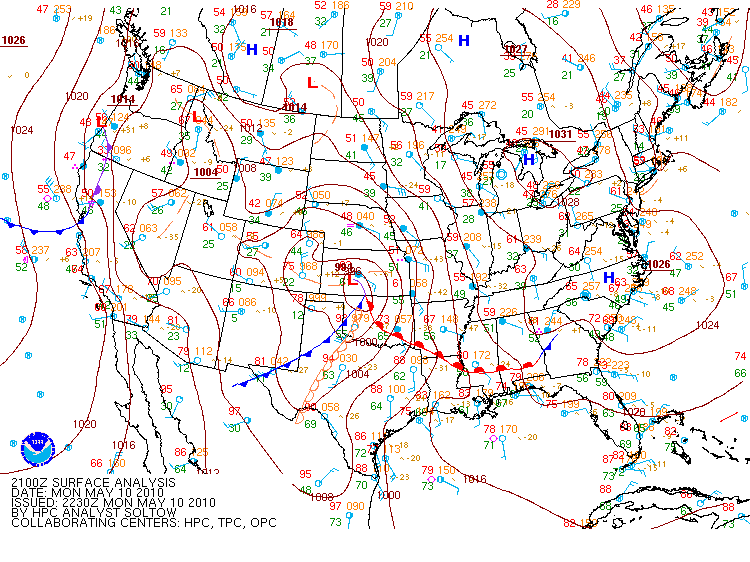
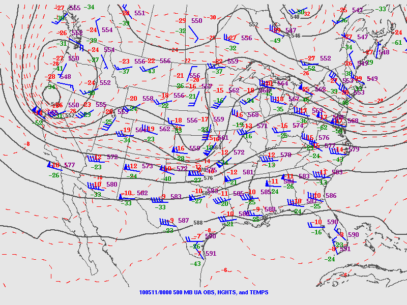
May 10, 2010: Narrow warm sector.
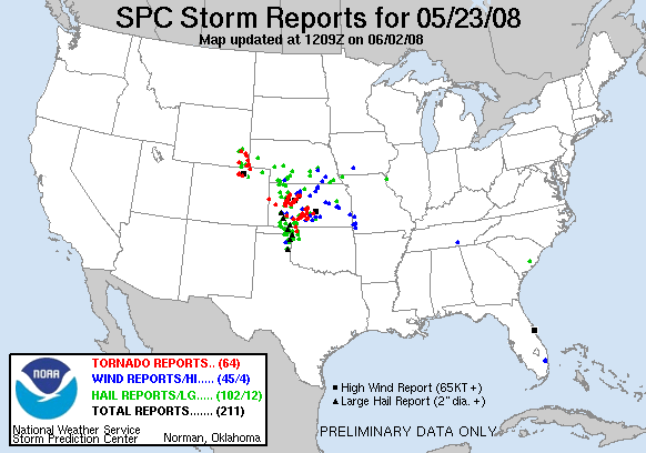
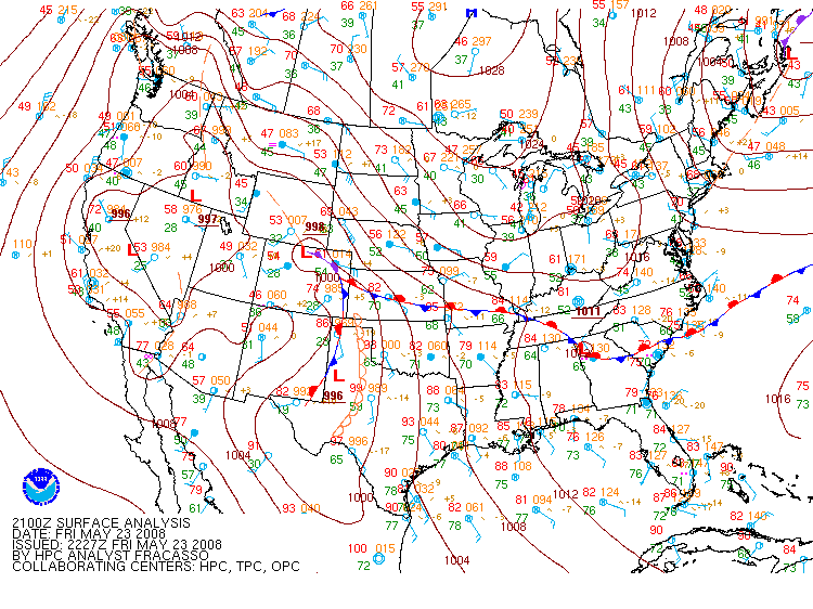
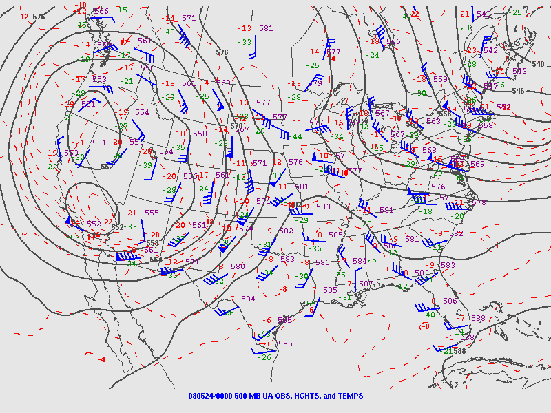
May 23, 2008: Surface boundary existed in the Midwest, but meridional flow was in place over the Plains with little upper support to the east.
Forecasting implications for storm chasers
storm chasers interested in secondary targets during a big Plains event might want to consider looking at the Midwest region. Factors to evaluate:
- Does a sharp synoptic surface boundary extend into the Midwest?
- Will upper support from the ejecting shortwave overspread the boundary that far east?
- Is daytime/evening convection expected in the vicinity of this boundary?
If all three of those conditions exist, the surface boundary in the Midwest might provide an intriguing secondary storm chasing target.
Good post, Dan. I enjoy reading your blog and exploring your website.
- Posted by Mary Beth from St. Louis, MO | | |
|


