|
Home | Blog Index | Blog Archives | Christianity & Faith Essays | Storm Chasing Essays
Plains storm forecast update No. 3: for April 6; March 31 storms
Another brief update to give mention to a trend the long-range models have been indicating for the past couple of days. Some multi-model, run-to-run consistency has been shown for a deep western-US upper trough pattern to develop toward the end of next week, which could mean the 2016 spring season's first big potential storm chase day(s) in the Great Plains. As I've said many times before, the date ranges we're looking at are beyond the typically-reasonable window for reliable long-term storm forecasting, but when more than one model shows the same thing again and again, it's worth taking a look at.
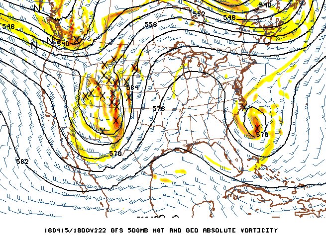
GFS model 500mb winds forecast for April 15
While the upper pattern looks good on these maps, so far the low-level moisture / instability aspect of the system has been showing as a potential problem. A significant west-to-east branch of the jet has been indicated lingering over the Gulf coast, a feature which threatens a frontal boundary and thunderstorms to exist from south Texas eastward. This could possibly block a more substantial northward moisture transport ahead of the big western trough. For the system to really be chase-worthy, we'd need this southern feature to somehow vanish/weaken from the model output (and hopefully, ultimate reality). Nonetheless, late next week certainly has my attention, and I'll be posting about it one way or another as the possible event approaches.
The following table charts the probability of a Great Plains storm chase expedition happening during several indicated date ranges in the near future:
| 2016 Plains Storm Expeditions - Probabilities as of April 6 |
| April 6-12 | 1% | |
| April 13-19 | 20% | |
|
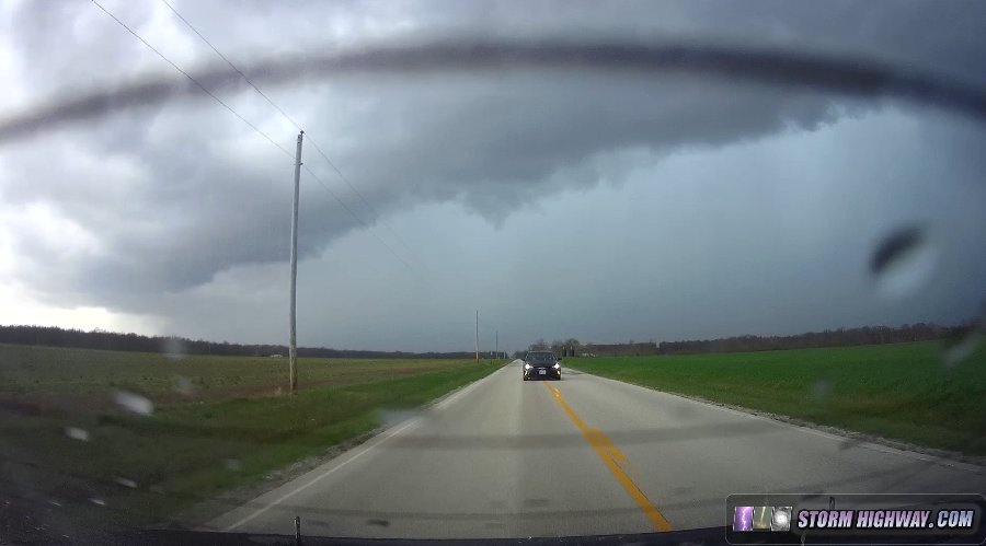
March 31 southern Illinois severe storms
My parents were visiting me this weekend, and ended up accompanying me on this outing from Greenville to Salem on some briefly-severe storms that produced one-inch hail west of I-57.
|


