|
Home | Blog Index | Blog Archives | Christianity & Faith Essays | Storm Chasing Essays
April 5 chase log; Plains forecast update for April 9
What appeared to be shaping up as a classic Midwest tornado event on Wednesday the 5th ended up tanking at the last minute, as overnight moisture return failed to bring the 60-degree dewpoint line up north to the warm front. Nonetheless, wind profiles were more than supportive of supercells, and the warm frontal zone held some promise for tornadoes if the clouds cleared out early. It was good enough - and close enough - to take the day off from work to chase.
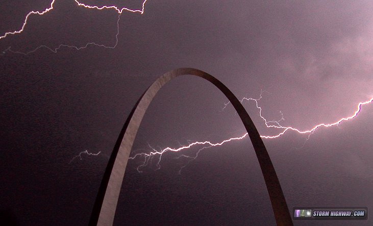
In the overnight hours prior to this event, thunderstorms moved through the St. Louis metro. I went to my usual spots downtown for this (click for video):
By mid-morning, my target was the warm front as close to the surface low as clearing/heating would allow. I-64 between Mount Vernon, IL and Evansville, IN seemed to be where this was setting up, with the warm frontal zone more or less right along I-64. I incrementally moved east with each new storm moving up from the south, starting at Belle Rive and ending at Burnt Prairie. The Burnt Prairie storm had the best chance to produce, with no upstream storms to foul its inflow. As it approached, an RFD clear slot rapidly cut in. A lowered area that looked very much like a tornado was visible, right where one would expect - but it was not clear enough to confirm, and motion did not appear to be very strong:
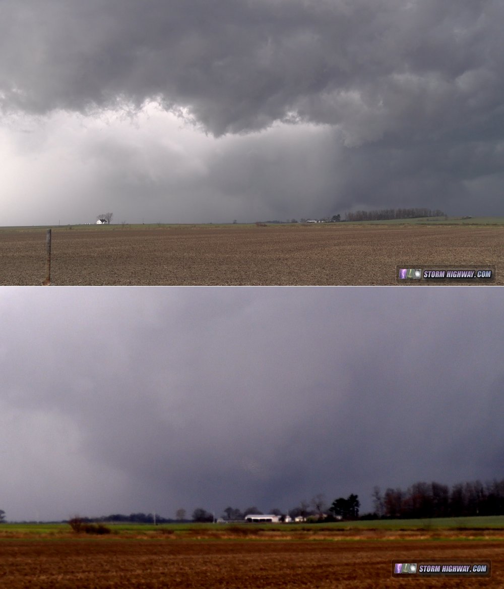
The RFD filled with precip and surged across I-64 as a strong low-level circulation appeared to be 30 seconds from producing, with tightly-rotating cloud tags and a brief rope funnel visible. I paralleled this feature on the only county road just north of I-64, but lost it as the RFD precip overtook me. A cylindrical updraft was visible above the rain as the strong RFD carved around it.
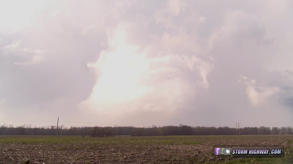
I caught up to this feature again just south of Albion. The RFD winds imploded a small grain bin next to the road. Creeping north through the RFD precip, I finally broke through, but the storm quickly vanished to nothing right as it reached Albion. With all other storms either out of reach to the northeast or behind the outflow from the Albion storm, I was out of plays, and headed home.
Plains forecast update for April 9
The upper jet pattern in the USA remains active and progressive, with the parade of shortwave troughs set to continue for the foreseeable future. Despite this, surface moisture depth and instability appear to be struggling through the period, essentially letting most of the upper waves go to waste. The best days in the "forecastable" future (within 7-10 days) appear to be around next Sunday-Monday, when a large western USA trough begins spreading broad southwest flow aloft over the Plains with what looks like decent moisture in place at the surface. A couple of well-timed ripples in this flow might yield a dryline/warm front setup or two in the central Plains, which is definitely something to watch. A pattern that yields multiple storm chase days in a row is preferred for me, as you tend to get more 'bang for your buck' on one trip out and back.
I will be watching next Sunday and beyond closely, but being 7+ days out, it's too early to start raising confidence levels very high for a trip.
The following table charts the probabilities for a Plains storm chase expedition taking place for the date ranges shown:
| 2017 Plains Storm Expeditions - Probabilities as of April 9 |
| April 9-15 | 2% | |
| April 16-19 | 45% | |
|
GO: Home | Storm Chase Logs | Photography | Extreme Weather Library | Stock Footage | Blog
Featured Weather Library Article:
|


