|
Home | Blog Index | Blog Archives | Christianity & Faith Essays | Storm Chasing Essays
Traffic tips and strategies for viewing the 2017 total solar eclipse in the St. Louis area
As we're past the one-month mark to Eclipse Day, people are making their final plans for traveling to the path of totality. The two main concerns for eclipse viewers are last-minute clouds and traffic jams, the latter being the biggest logistical factor for witnessing the event.
Historic traffic levels are predicted for some areas before, during and after the event, particularly near the coasts. Oregon is expecting more than a million people to travel to the state, and is taking measures such as shutting down all construction zones and placing emergency personnel at rest stops in case of gridlock. A similar situation could play out in South Carolina, where large numbers of people from New York City, Boston, Miami and Washington, DC funnel down I-95 and its parallel roads to converge on the narrow path of totality.
While the coastal crowds will be exacerbated by their inability to spread out in both directions, here in the St. Louis area, traffic densities *should* be much lower. However, with big cities such as Chicago, Springfield, IL, Memphis and New Orleans all inside "drivesheds" to the eclipse (most direct route to the totality path) that lead to the St. Louis area, traffic jams in some places are very likely. So, for those traveling to Missouri and Illinois to watch the eclipse, here are some facts and tips to consider:
- Half of the St. Louis metro (the southwest side) is inside the path of totality, which may result in the city being a hotspot for traffic jams. The city's roads and highways could be clogged as large numbers of people on the northeast side of the metro try to get south and west. It may be best to avoid traveling through the STL metro to get to the path of totality.
- Mississippi River, Ohio River and Missouri River crossings are limited and widely spaced, and these bridges will likely be major bottlenecks in the event of a massive traffic event. For example, the first bridge south of the STL metro is 70 miles away in Chester, Illinois! It will probably be beneficial to choose river crossings as far from the path of totality as possible, even if it means a more circuitous route.
- Avoid Interstates and main highways, as these will be the most likely places to experience high traffic and crowds. This is the Midwest, which means there are an abundance of county roads available both to get to the path of totality and stop and view it safely - particularly on the Illinois side (I'll get to that in the next item).
- The Illinois side of the Mississippi River is more preferable for eclipse travel and viewing than the Missouri side for a number of reasons. Illinois has flatter terrain and an abundance of secondary county roads that offer a multitude of available routes, allowing traffic and people to spread out more.
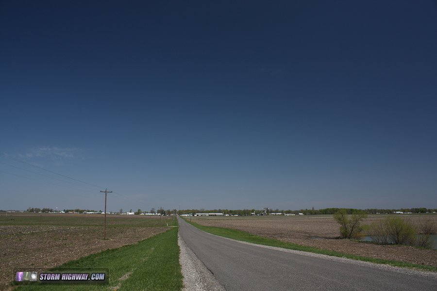
ABOVE: The sky view along a typical Illinois county road
The Illinois county roads are also mostly straight, and are wide enough for easy roadside parking. The Missouri side, by contrast, is more forested and hilly, has fewer secondary roads and more curving/winding highways with little to no shoulders for pulling over safely. Take a look at this Google Street View image showing a typical eastern Missouri road within the path of totality.
The only bottlenecks on the Illinois side are at the Kaskaskia River bridges south of I-64, but the abundance of county roads south of the river should allow any jams to fan out quickly.
- The Google Maps traffic feature will be helpful in tracking realtime traffic jams and shifting your travel route as needed.
- If you are planning to stay at a hotel outside of the totality path, leave very early on eclipse day to ensure you can get inside the path! I am planning on leaving my place in New Baden as early as 4 or 5 AM, depending on actual traffic levels, to travel the 50 miles south to my planned viewing location.
Right now, unfortunately we just don't know how bad the eclipse traffic will be. However, planning for the worst-case scenarios will reduce the chances of ending up in the nightmare of being stuck in a traffic jam all day and missing totality!
GO: Home | Storm Chase Logs | Photography | Extreme Weather Library | Stock Footage | Blog
Featured Weather Library Article:
|


