|
Home | Blog Index | Blog Archives | Christianity & Faith Essays | Storm Chasing Essays
Plains forecast update for May 13: Trip 1 likely
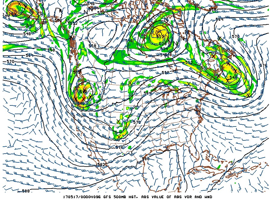
It looks like we may finally have setups worthy of the first Plains trip of the 2017 season, thanks to a couple of shortwaves embedded in a broad-scale western US trough set to move over the Great Plains next week. With deep moisture shown along the dryline and a southwesterly jet aloft, the ingredients for supercells and tornadoes should be present in sufficient quantities.

GFS forecast for May 16
Right now, two events from this system are standing out: Tuesday in Kansas and Thursday from Nebraska to Oklahoma. Both have "outbreak" potential (numerous tornadic supercells up and down the dryline), but there are some caveats that could temper or even bust either or both events. One is bad timing of at least one the shortwaves (the little 'mini troughs' that move within the broader flow). The second is some mixing out of the moisture along the dryline during the afternoons that the GFS has been fairly persistent on. Even with those potential negatives, it appears that Tim Marshall's famous words of wisdom "when it's May, you chase" certainly apply here, as the setups appear to be of the caliber to provide a good chance of a nice show. I'm about 70% on Plains trip #1 happening next week, with the time blocked off from work and a tentative departure on Monday afternoon/evening. Trip #1, if the conditions warrant, may last through Friday.
The following table charts the probabilities for a Plains storm chase expedition taking place for the date ranges shown:
| 2017 Plains Storm Expeditions - Probabilities as of May 13 |
| May 13-14 | 0% | |
| May 15-19 | 70% | |
| May 20-25 | 30% | |
|
| View 1,609 storm chases: |
| by year: |
|
| by type: |
|
|
|
GO: Home | Storm Chase Logs | Photography | Extreme Weather Library | Stock Footage | Blog
Featured Weather Library Article:
|