|
Home | Blog Index | Blog Archives | Christianity & Faith Essays | Storm Chasing Essays
Plains forecast update for May 15
Each model run as this week's system approaches has turned worse and worse, introducing numerous problems into the fray for storm prospects. None of the setups have very much going for them in the quality tornado/supercell department: veered 850mb winds, a southwest-to-northeast oriented dryline with surface flow struggling to back, and sputtering moisture return off of the Gulf with at best high-60s dewpoints prone to vertical mixing. The surface observations over Texas show the story with the upstream moisture situation:
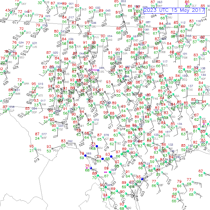
Surface obs on Monday afternoon
I have seriously lost my enthusiasm for this week's prospects in the Plains. Additionally, a conditional threat for supercells and possibly tornadoes may exist on Wednesday and Thursday in northern Missouri, though admittedly several degrees less than the dryline out west will offer. However, with the former only half a day's drive from here, I'm more inclined to stay and see what the warm front closer to home can do. It's possible even that may not be worth a drive - resulting in a no-chase week for me.
Those already out on the Plains this week shouldn't lose hope, as I think there may be a couple of needle-in-the-haystack tornadoes that might redeem the setups - but one is really going to need to play their cards right to see it. As for me, I'm not sold yet on spending my money and PTO. I'm deferring a decision to head west until the last possible minute, which - for me - is early tomorrow morning. My confidence level is less than 45% that I'll see anything in the morning data that will compel me to start the trip westbound.
Looking into the medium-long range, a northwest flow/ridging pattern is shown settling over the Plains after this week. This may usher us into another extended downtime that could last through the end of the month - which, if this week busts, would result in one of the more "duds" of a May in chasing history.
The following table charts the probabilities for a Plains storm chase expedition taking place for the date ranges shown:
| 2017 Plains Storm Expeditions - Probabilities as of May 15 |
| May 15-19 | 45% | |
| May 20-25 | 10% | |
|
GO: Home | Storm Chase Logs | Photography | Extreme Weather Library | Stock Footage | Blog
Featured Weather Library Article:
|


