|
Home | Blog Index | Blog Archives | Christianity & Faith Essays | Storm Chasing Essays
Plains forecast update #9: for May 28: Season over?
Most seasons, if by June 1st, a major western trough or at least modest westerly-southwest flow over the Great Plains isn't showing up in the medium-to-long range models, it's a sign that the peak severe weather season (for classic dryline supercells) may have come and gone.
While it's a little too early to declare the season officially over, the GFS and Euro models don't paint a favorable picture for storm chasing during the next week or so. Both show the shortwave troughs that do develop tracking far to the north across the Dakotas and Canada, with the annual summer ridge looking like it is staking its final claim over the southern and central Plains. A few last gasps of flow are shown trying to battle the ridge and cross the Plains around next weekend, but nothing looks very "chase worthy".
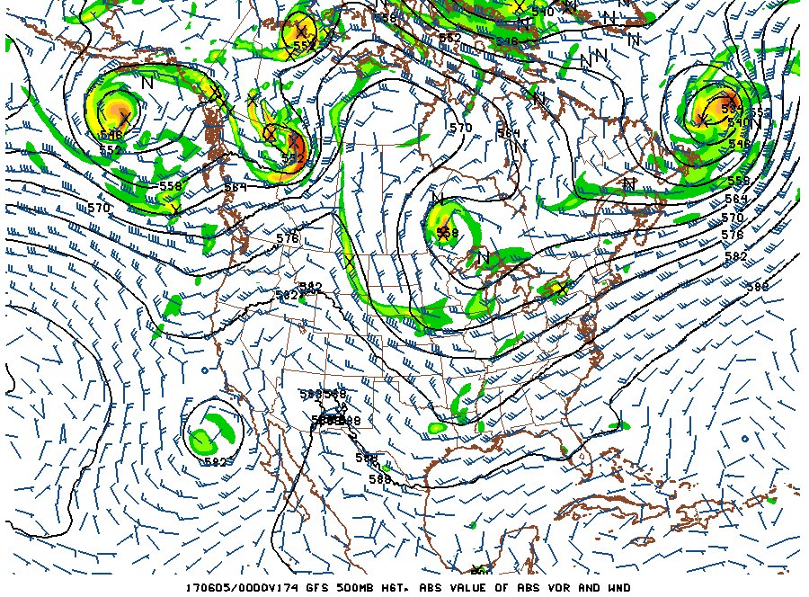
GFS forecast for June 4
There shouldn't be a total shutout for chase vacationers who are out right now. As always, there will be sporadic 2% and even 5% tornado days in the Colorado and Wyoming high plains as well as the Dakotas and Canada, any of which could produce a surprise quality storm chase day. But let's be real: more often than not, they don't. They are not something I consider as worthy of spending chase funds, PTO and vehicle wear and tear on.
Unless the long range models are way off and we start seeing signs of good upper support configurations in a couple of weeks, I don't have high hopes for Plains trip #2 for the year happening. Right now, the little bit of hope I do have is tied only to that possibility that the models could be wrong. As we all know, in the long ranges, they have a tendency to be - exactly how wrong is essentially what the 2017 storm season hinges on.
The following table charts the probabilities for a Plains storm chase expedition taking place for the date ranges shown:
| 2017 Plains Storm Expeditions - Probabilities as of May 28 |
| May 29-31 | 5% | |
| June 1-5 | 20% | |
| June 6-10 | 25% | |
|
GO: Home | Storm Chase Logs | Photography | Extreme Weather Library | Stock Footage | Blog
Featured Weather Library Article:
|


