
|
||||||||||||||||||||||||||||||||||||
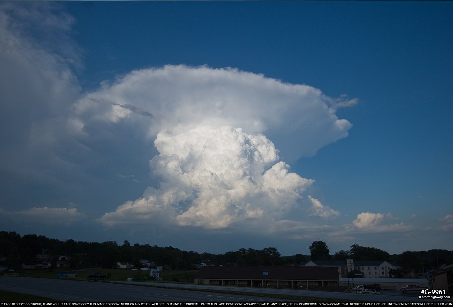
4K VIDEO: Storms put on a show from Hannibal, MO to St. Louis - May 26 MONROE CITY, MO - The severe weather setup on May 26 was marginal - but with 20 knots of northwesterly flow, decent surface-based instability and it being a 90-minute drive from St. Louis on a Saturday, I felt it was worth taking a look at. I drove up to Jacksonville, IL as storms began firing farther to the north near Augusta. I met these near Mt. Sterling, but found them to be outflow dominant. The abundant instability to the west in Missouri meant the storms were starting to propagate in that direction. I headed over to Hannibal to see if an isolated cell could get going over on the Missouri side of the river. As I did this, an explosive new updraft went up back to the east in Illinois. This was all behind the outflow, so I knew it would likely not have any real tornado potential. Instead of rushing back to it, I stopped in Hannibal to shoot some timelapse video of the storm for about 25 minutes:
 click to view full screen
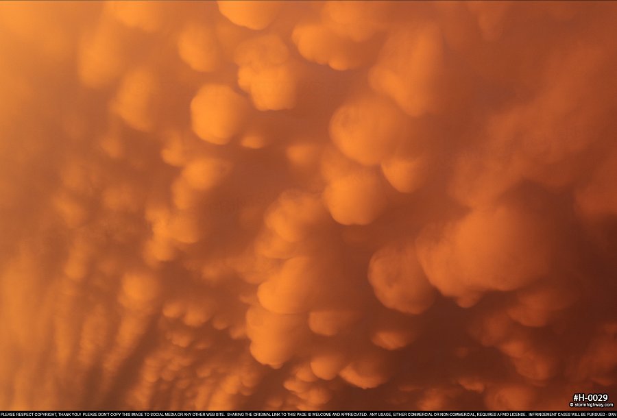
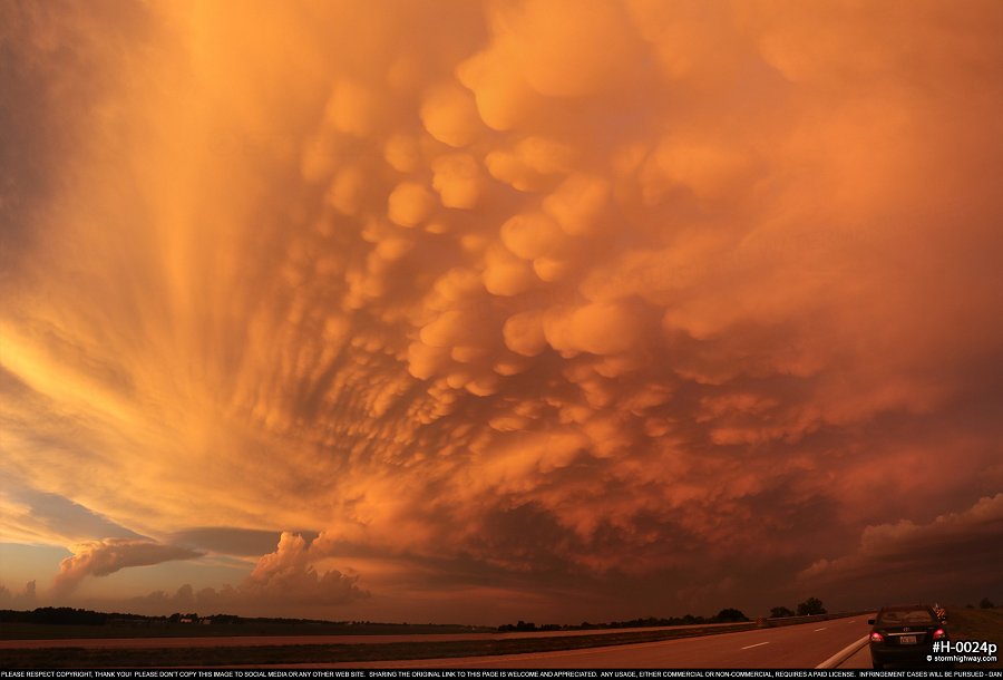
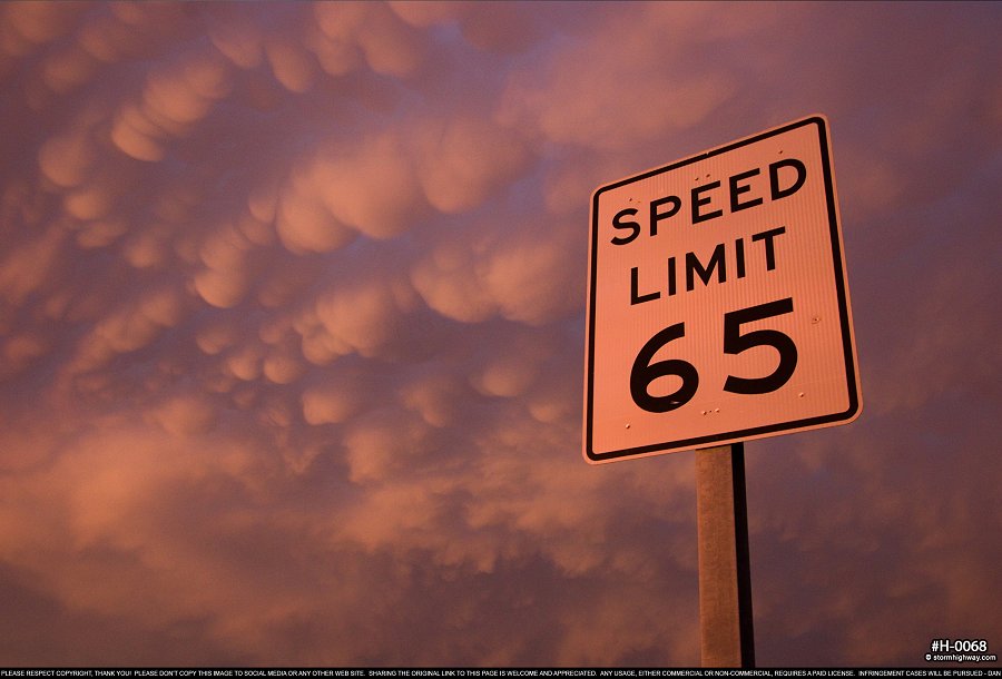
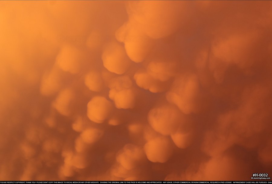
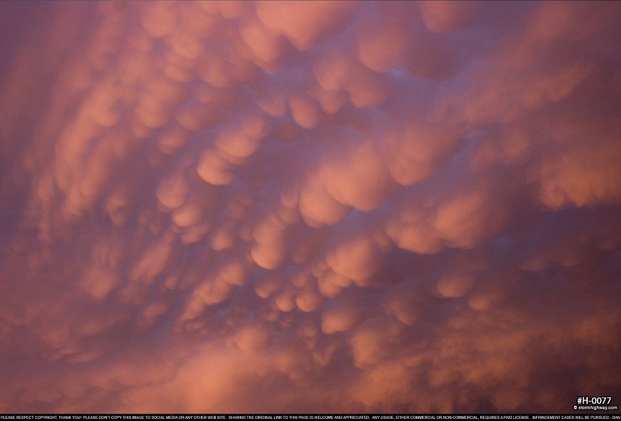
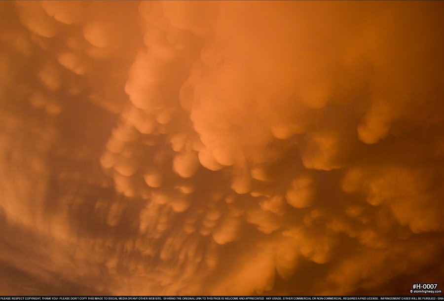
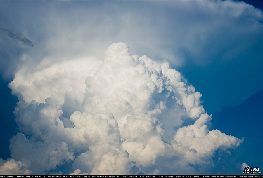 click to view full screen As expected, more updrafts were exploding to the west and going severe-warned at West Quincy. I went northwest to Palmyra to chase these, but they too were already pushing outflow far ahead. One last updraft went up even farther to the west at Philadelphia, appearing to be briefly supercellular on radar. I found one-inch hail in the core of this storm at Philadelphia, but it quickly dissipated. I headed back south to Monroe City. Just after turning east onto Highway 36, the eastern sky exploded in color as the setting sun illuminated a well-defined mammatus field of rare quality, ranking in the top 5 of such events that I've seen. This was worth several long stops to capture imagery:
 click to view full screen
 click to view full screen
 click to view full screen
 click to view full screen
 click to view full screen
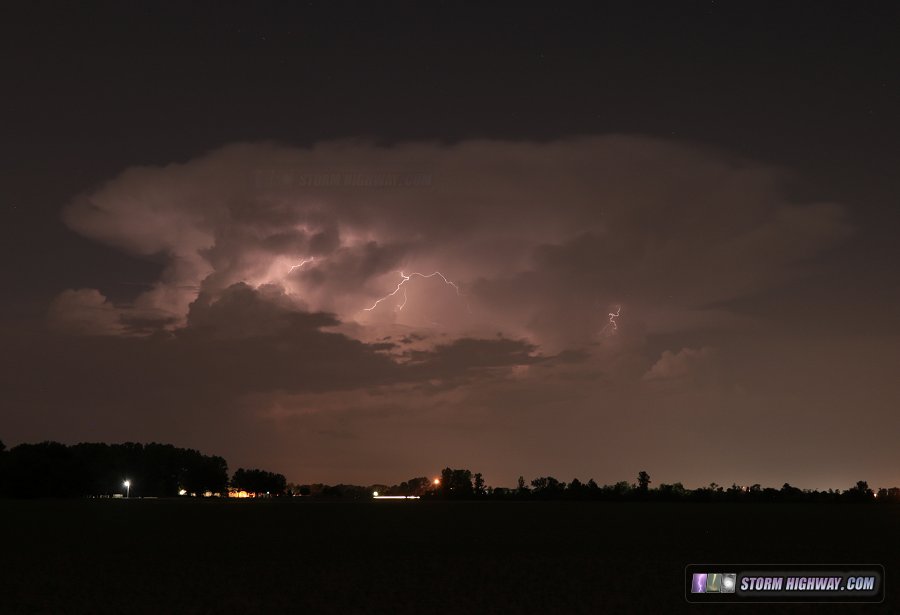
 click to view full screen With the loss of sunlight, the entire cluster of storms I'd been covering was rapidly vanishing. I began heading back south toward home, keeping an eye out for possible redevelopment after dark that some of the models had been showing thanks to the nocturnal low-level jet. And sure enough, right after I passed through downtown St. Louis, the northern sky began flickering with the first flashes of lightning from a new storm at Jerseyville, IL that had gone up on the outflow from the ones earlier in the evening. I stopped near Horseshoe Lake to get a few shots of this. Surprisingly, there was very little in the way of cloud-to-ground activity with this new convection, which was barely moving.
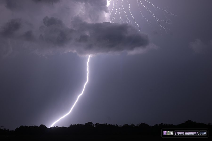
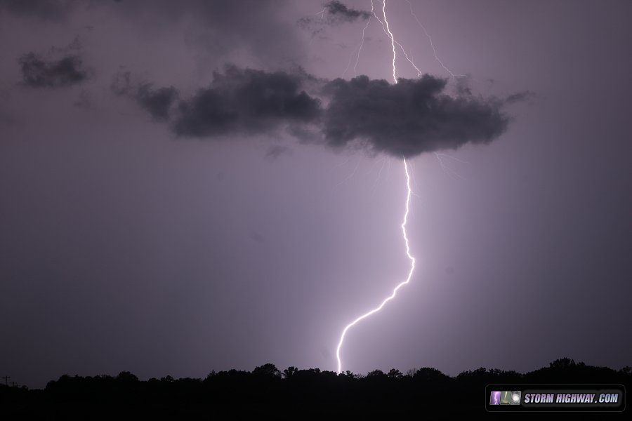
 After low clouds began obscuring the view of the new storms, I drove up to north of Alton to see if I could get a visual on more lightning. These repeated positive cloud-to-ground bolts started raining down as the storms began pushing more to the south along their own outflow.
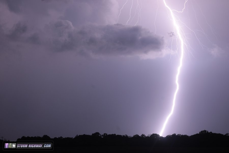 The storms eventually turned even more to the right, heading straight for St. Louis. I made it there in plenty of time, but the storms ended up passing completely west of downtown before dissipating completely.
GO: Home | Storm Chase Logs | Photography | Extreme Weather Library | Stock Footage | Blog
Featured Weather Library Article:
|
||||||||||||||||||||||||||||||||||||


Web Site Design and Internet Marketing by CIS Internet