
|
||||||||||||||||||||||||||||||||||||
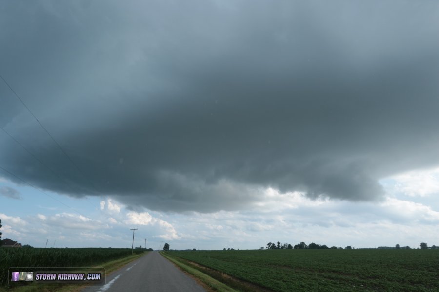
A warm front draped northwest to southest through the heart of the St. Louis metro area, strong instability and an upper-level jet made Monday a potentially big storm chase day for the region. I started with this weak storm at Red Bud that, despite looking paltry on radar, still maintained a respectable updraft base with strong rising motion, RFD clear slot and partial wall cloud:
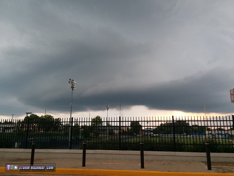
 This storm had all the looks of producing if it could just gain a few notches in intensity, which I expected could happen once the low level jet started picking up near sunset. However, I noted a second storm firing in the St. Louis city limits that would be threatening downtown - so despite the good look of the Red Bud storm, I rushed to get back into the city so as to not miss something potentially photogenic over the skyline. After fighting rush-hour traffic gridlock, I arrived at the updraft of the St. Louis storm at I-64 and I-170 at Brentwood. Strong descending motion indicated a solid RFD trying to cut in, but the updraft itself was struggling. Furthermore, a new storm at Arnold was cutting off its low-level inflow. This was the view at Big Bend and Manchester:
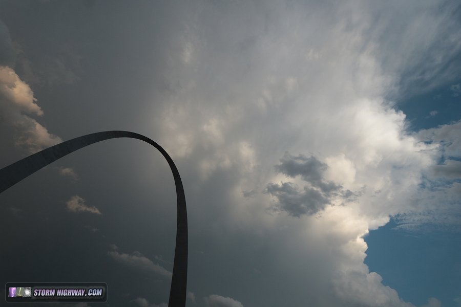
 I went downtown to see if the sun could peek through for a rainbow or other sunset colors, which didn't happen. The southern storm, now at Columbia, was flickering with lightning to the south, but not visible enough to capture with "reaction based" stills. Here is the view of the back edge and anvil of the Columbia storm with the Arch:
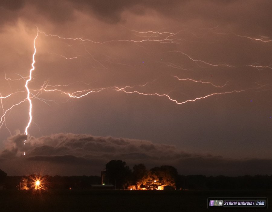
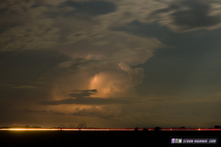
 I returned home, then ventured back out at 10pm for lightning with the departing cluster of storms to the east:
 A new short-lived updraft on the southern end of this activity went up in the moonlight, anvilling out before dissipating:
GO: Home | Storm Chase Logs | Photography | Extreme Weather Library | Stock Footage | Blog
Featured Weather Library Article:
|
||||||||||||||||||||||||||||||||||||


Web Site Design and Internet Marketing by CIS Internet