
|
|||||||||||||||||||||||||||||||||||||
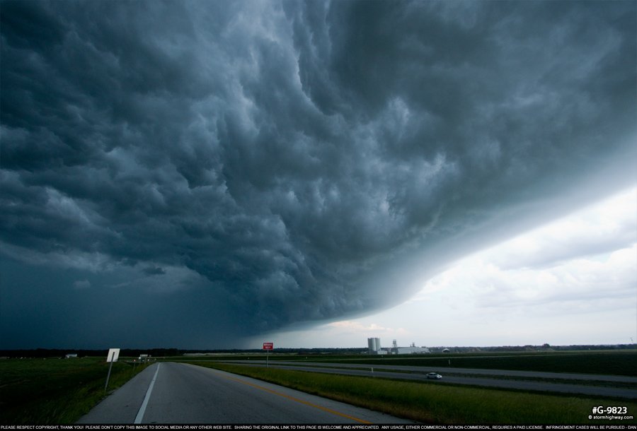
4K VIDEO: 4-way dashcam timelapse of the chase PARSONS, KS - Saturday, May 19 was the single day (out and back the same day) comprising my second Great Plains trip for 2018, and overall Day 3 since the start of the season. The setup for this event was initially promising for tornadic supercells, as backed winds and adequate upper level support made the warm front in northeast Kansas through northwest Missouri the primary target. I departed St. Louis during the early morning hours, arriving in Kansas City just before noon. GPS LOG: May 19, 2018 trip path Upon stopping in Kansas City and doing a final forecast after noon, the surface chart was not encouraging. Overnight/morning storms had pushed an outflow boundary down to the Oklahoma border, with cooler temperatures and upper 50s dewpoints across eastern Kansas and the original warm front target. Furthermore, the frontal boundary in northern Kansas was actually sinking southward as a cold front, all but ruling out the original target area as a viable play. The only positive for the northern area was clear skies, which would allow for some destabilization by late afternoon. Other than that, the only other viable play appeared to be the outflow boundary to the south, which was getting full sun as storms were already firing along I-35 to the west. I made my way south-southeast toward this activity, arriving just ahead of new storms going up at Parsons. The Parsons storms were high based and already hopelessly outflow dominant as I arrived on them. Nonetheless, I stayed ahead of them eastbound as occasional QLCS circulations would threaten to spin something up. Each time, the outflow was simply pushing too hard to allow any surface inflow to make it in. Just across the Missouri state line, I had decided that the chase was done, and started heading for I-44 toward home. The first jaunt south allowed the gust front to overtake me, with a large whale's mouth pushing east:
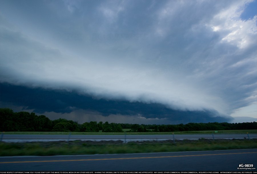
 I managed to get back ahead of this before arriving at Springfield for a short gas and food stop. The gust front was hot on my heels, nearly catching up again as I returned to the highway:
 I stayed ahead of the storms all the way to St. Louis, where new storms developed just ahead of me over downtown. These ended up to be of no consequence, and I arrived home before 10PM. NEXT PLAINS CHASE: Day 4: Sunset storms in Missouri >
GO: Home | Storm Chase Logs | Photography | Extreme Weather Library | Stock Footage | Blog
Featured Weather Library Article:
|
|||||||||||||||||||||||||||||||||||||


 Severe storms from Parsons, KS to Springfield, MO - May 19, 2018


Web Site Design and Internet Marketing by CIS Internet