|
Home | Blog Index | Blog Archives | Christianity & Faith Essays | Storm Chasing Essays
Storm Chasing & Photography roundup for March 1 - April 15
It's time for another quick roundup of storm chases and weather events covered over the past month and a half.
 March 3: St. Louis snow March 3: St. Louis snow
A relatively mundane winter storm and a big miss of what would have been a career shot. I ended up along I-55 at Carondelet shooting the northbound bridge when vehicles began losing control on a patch of plowed snow. A large sign was in the way of the action, so I picked up my tripoded camera to move 20 feet to the right. At that very instant, a tractor-trailer jackknifed and hit the divider wall no more than 100 feet away from me. I missed it all. My dashcams captured it from my car parked nearby, but what a shot on the 4K camera it would have been.
 March 9: Storm from Jonesburg, MO to Hillsboro, IL March 9: Storm from Jonesburg, MO to Hillsboro, IL
I again chose the area closer to the surface low to track a storm from central Missouri into Illinois at Hillsboro, Illinois. No photos or video captured.
A strange setup with missed tornadoes near Paducah at 9AM and transient supercells in central IL. Full chase log >  March 16: Meteor fireball March 16: Meteor fireball
My driver's side dashcam captured a meteor fireball in the western sky over St. Louis. Earlier that evening, another separate fireball event was seen over the Chicago area.
A trip to the Texas Panhandle and Oklahoma for high-speed lightning video. Full chase logs >
 March 28: St. Louis storms March 28: St. Louis storms
Another trip downtown for storms. No photos or videos captured.
April 7: STL metro storms
Another practice run shooting lightning with the high speed camera around the metro. I started near Union, MO and followed storms back home. The lightning wasn't bad, but I didn't capture anything worthy enough to publish.
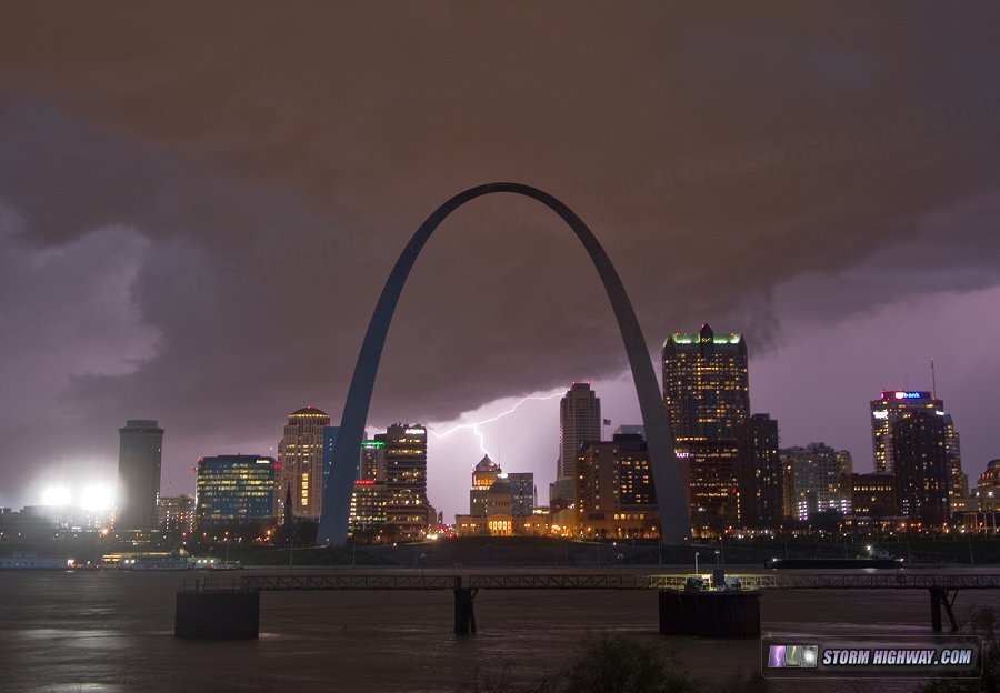
 April 11: STL metro storms April 11: STL metro storms
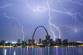
Another lightning outing in the metro from downtown to near Hamel, IL, with mostly uncooperative storms. I did manage to catch one still photo of lightning over downtown.
 April 13: Lousiana/Mississippi lightning chase April 13: Lousiana/Mississippi lightning chase
The lack of a good spring storm season so far in the Midwest prompted me to make this trip for a setup I would normally not think of storm chasing. My main goal for this trip was not tornadoes, but lightning. I had finally figured out a way to deal with the difficult focusing of the high-speed cam and wanted to finally get a "real" storm to shoot. I expected such cloud-to-ground lightning to be in plentiful supply as it typically is with these types of systems in the South. I chose to intercept storms as they moved into better visibility/terrain along and west of the Mississippi River, as the trees and terrain west of the river bottom is virtually unchaseable. The first two elevated storms I encountered north of Tallulah, LA were virtually visible-lightning-free. I drove through the small town of Forest, LA in this area, encountering fresh damage that appeared tornadic (large trees uprooted with trees falling northward in town and southward west of town) from one of these supposedly elevated storms.
I found the lightning I was looking for with the tornadic storm moving through Vicksburg. I tried to catch a glimpse of the tornadic circulation crossing I-20, carefully inching eastward monitoring the wind direction to discern what was ahead. I could not see anything. After getting head of the storm east of Vicksburg, I got my opportunity to shoot a high-quality lightning barrage with brilliant stepped leaders captured on high-speed video with several cloud-to-ground strokes. I re-intercepted the storm on I-55 north of Jackson, catching a couple more bolts before the storm swept over the road. There were no good roads available to get ahead of the storms again, so I called it a chase at dusk and headed home.
I shot the lightning near Vicksburg at 3,800 frames per second and north of Jackson at 5,900fps.
| View 1,609 storm chases: |
| by year: |
|
| by type: |
|
|
|
GO: Home | Storm Chase Logs | Photography | Extreme Weather Library | Stock Footage | Blog
Featured Weather Library Article:
|
 March 28: St. Louis storms
 April 11: STL metro storms
 April 13: Lousiana/Mississippi lightning chase


