|
Home | Blog Index | Blog Archives | Christianity & Faith Essays | Storm Chasing Essays
March 22, 2019 chase log: Texas Panhandle tornado, hail & lightning
I started the day in Shamrock, making my way west toward clearing skies. A warm front/boundary was draped north of I-40 southeast through Amarillo, so the plan was to catch storms as they interacted with it. The main problem with the area northwest of AMA is that there is a massive area with no roads, essentially nothing north of I-40 from the New Mexico border to Highway 385. I had a choice to either intercept on the south side of this or the north. I chose the former.
The first storm organized as it approached Adrian. There is a gravel road that extends a couple of miles north into the "no man's land" before it dead-ends at a private ranch. I was able to follow the storm to this point, but it passed about 5 miles north of the end of the road. From this location I watched the storm's base lower with RFD carving a nice meso. Rotation at the apex of the RFD was strong, and a few weak funnels descended periodically.
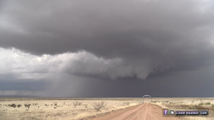
RFD clear slot north of Adrian
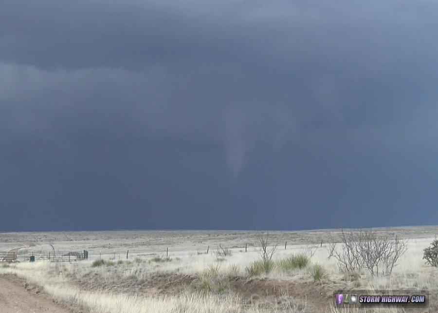
Funnel north of Adrian
I dropped back to I-40 for the next storm, a QLCS structure that developed a strong kink/circulation moving over Vega. I saw a well-defined funnel buried in the rain on the east side of Vega that the Amarillo NWS office later confirmed as a tornado (making it my first one captured in March).
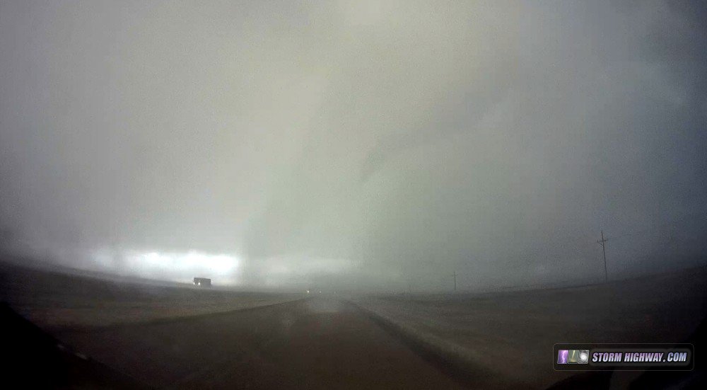
Funnel near Vega
After this storm moved north of the interstate, I went east to Bushland for the next cell which developed more classic supercell structure, though very high based and with little in the way of visible rotation. I stayed ahead of this storm as it moved through Amarillo, allowing it to pass over me north of town. Hail covered the road a couple of inches deep.
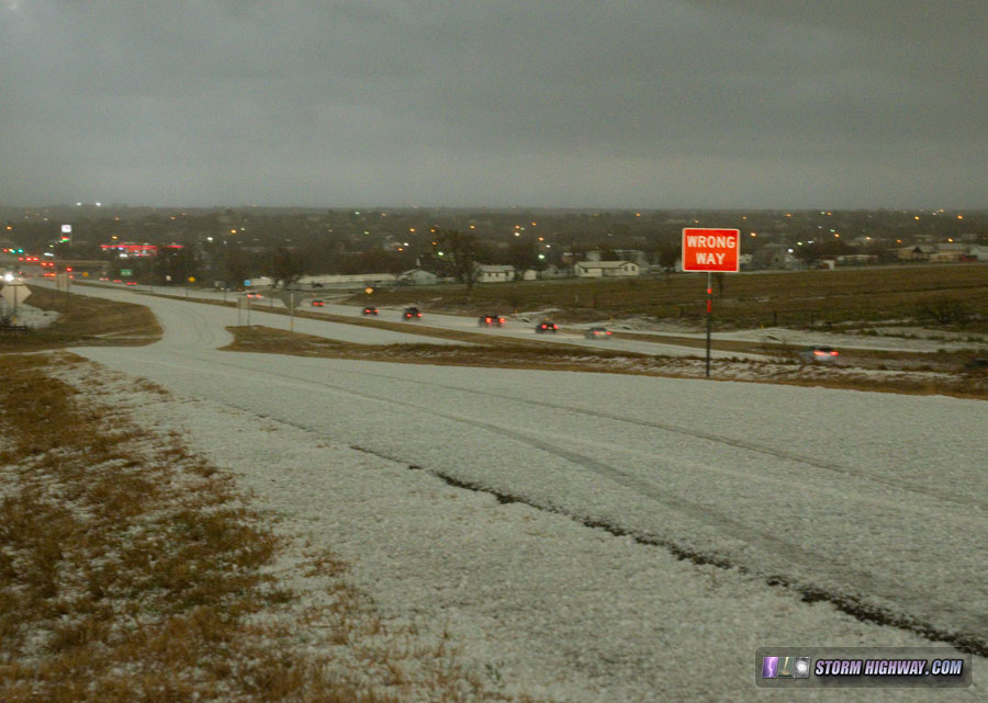
Amarillo hail
The largest hail I found was golfball-sized:
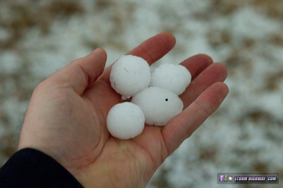
Amarillo hail
With everything mostly congealed into a long QLCS line, I let the storms pass to the east, expecting some dramatic light from the setting sun as well as possibly a couple of upward lightning flashes to the towers on the north side of Amarillo. Both didn't disappoint. A vivid double rainbow appeared for 15 minutes, followed by three quality upward lightning discharges after sunset.
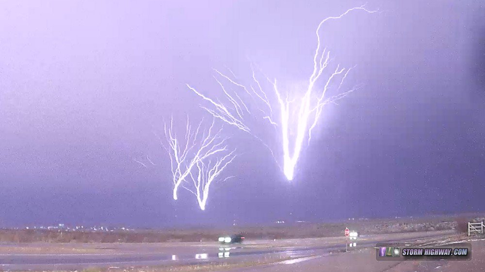
Amarillo upward lightning
Here is a sampling of the high-speed video frames from the second upward lightning flash. The flash lasted 0.52 seconds, covering 796 video frames at 1,500 fps.
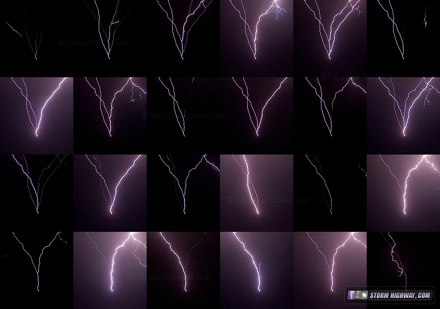
High-speed video frames of Amarillo upward lightning
This Youtube video includes some of the shots from this day, including the high-speed lightning captures:
< Back to 2019 Great Plains trip #1 summary
GO: Home | Storm Chase Logs | Photography | Extreme Weather Library | Stock Footage | Blog
Featured Weather Library Article:
|


